
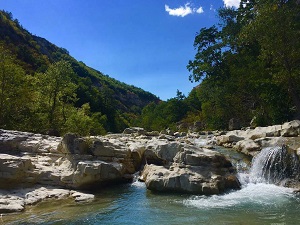
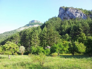
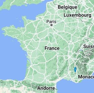
Starting in Veynes, this journey through the heart of the Buëch region beautifully reveals a transitional land where the majestic Alps gently meet Provence. The trail stretches south towards Savournon and Laragne-Montéglin, crossing vibrant orchards and rolling hills highly fragrant with lavender, before plunging dramatically into the spectacular Gorges de la Méouge, truly a jewel of aquatic biodiversity. Rich heritage is revealed in Orpierre, a well-preserved medieval village famously known for its exceptional climbing cliffs, and in Serres, whose narrow, winding streets cling proudly to the rock high above the river. Heading steadily north through Sigottier and Montbrand, the landscape quickly becomes more mountainous, strongly marked by deep Scots pine forests and wild, rugged limestone ridges. The route eventually reaches Lus-la-Croix-Haute, acting as a natural gateway to the Drôme department, offering a striking, memorable contrast with the stark mineral peaks of the formidable Dévoluy massif that continually dominate the horizon.
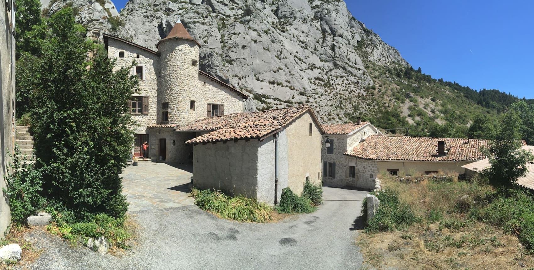
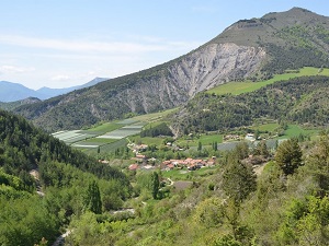
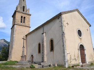
Positioned beautifully at the crossroads of the Alps and Provence, the Buëch region proudly boasts a highly unique identity where bright Mediterranean light intensely illuminates mountain landscapes deeply sculpted by centuries of erosion. This fascinating territory, gracefully shared between the Hautes-Alpes and Drôme departments, is clearly characterized by a wonderfully wild landscape composed of striking blue marl and spectacular limestone ridges. Its history is permanently etched in its many perched villages, such as Serres—a medieval town snugly nestled against its rocky outcrop—and in the enduring rural heritage of historic sundials creatively adorning ancient stone facades. The landscapes alternate flawlessly between intensely fragrant, open lavender fields and the cool, turquoise waters found within the Méouge Gorges, a highly protected site of truly exceptional beauty. The region's biodiversity is also remarkable, seamlessly sheltering hardy alpine fauna and gentle southern influences directly within the protected heart of the Baronnies Provençales Regional Natural Park.
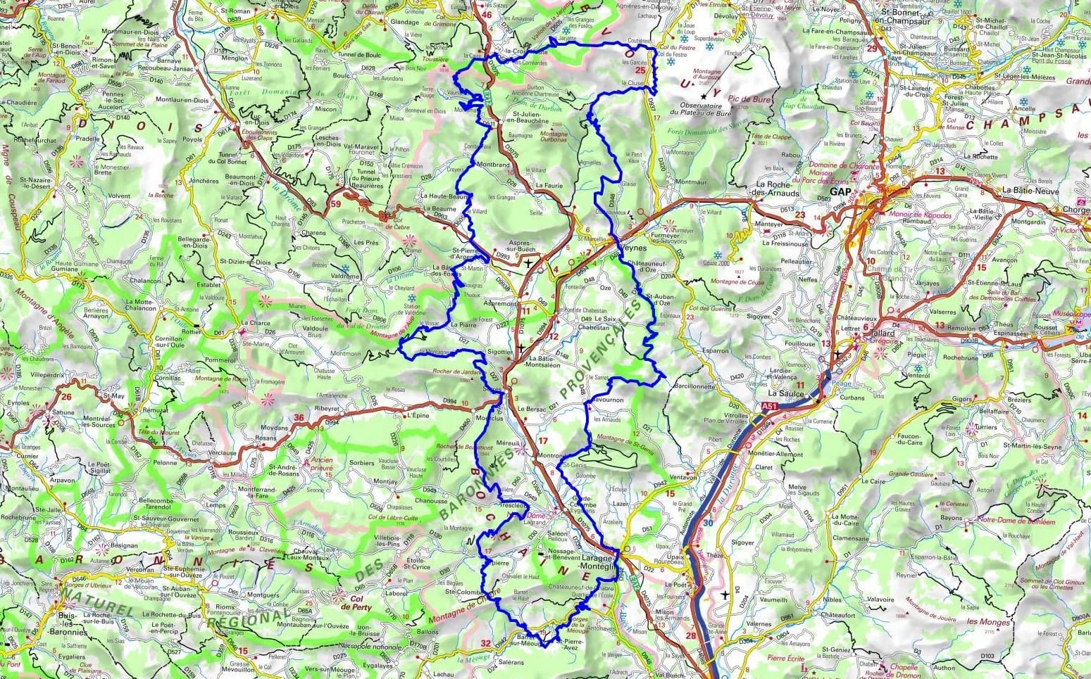
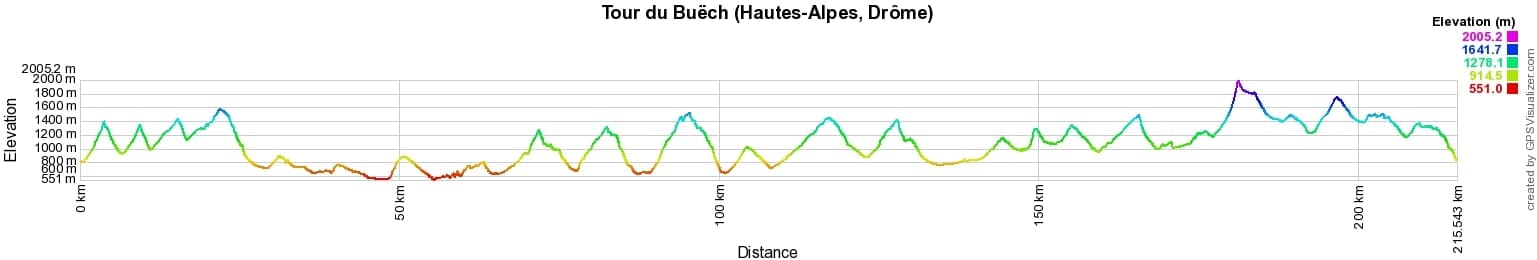
 Distance: 219km, Elevation maximum: 2005m, Elevation minimum: 551m, Elevation gain uphill: 10984m
IGN Maps: 3338OT - SERRES VEYNES HAUT BUËCH BOCHAINE. 3339OT - SISTERON LARAGNE-MONTEGLIN MONTAGNE DE CHABRE. 3237OT - GLANDASSE COL DE LA CROIX-HAUTE PNR DU VERCORS. 3238OT - LUC-EN-DIOIS VALDRÔME COL DE CABRE. 3239OT - ROSANS ORPIERRE BARONNIES ORIENTALES. 3337OT - DÉVOLUY OBIOU PIC DE BURE. 3337OTR - DÉVOLUY RESISTANTE OBIOU PIC DE BURE.
Nearby paths:
![]() It is advisable to follow the beacons all along your hike and to bring the FFRandonnée topo-guide. You will also find information on MonGR.fr.
It is advisable to follow the beacons all along your hike and to bring the FFRandonnée topo-guide. You will also find information on MonGR.fr.
GR®, PR®, GRP® and the corresponding markings are trademarks of the French Federation of Hiking. They may not be reproduced without permission. The French Federation of Hiking, state-approved, includes organizations that maintain hiking routes. It publishes guides for these routes. With your donations, support the actions of the thousands of volunteer markers of the FFRandonnée.
GR-Infos.com is an editorial partner of MonGR.fr.
| Return |

Former holiday hotel with a garden along the Allier, L'Etoile Guest House is located in La Bastide-Puylaurent between Lozere, Ardeche, and the Cevennes in the mountains of Southern France. At the crossroads of GR®7, GR®70 Stevenson Path, GR®72, GR®700 Regordane Way, GR®470 Allier River springs and gorges, GRP® Cevenol, Ardechoise Mountains, Margeride. Numerous loop trails for hiking and one-day biking excursions. Ideal for a relaxing and hiking getaway.
Copyright©gr-infos.com (Authorization for private use only)
To help us maintain and improve GR-Infos.com, a contribution of 2€ is desired via Wero or bank transfer. Thank you!