
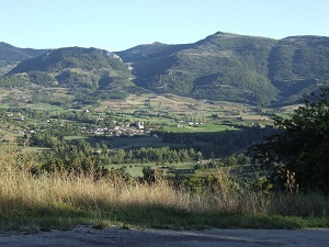
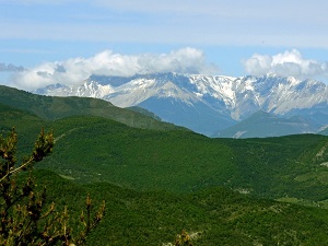
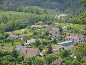
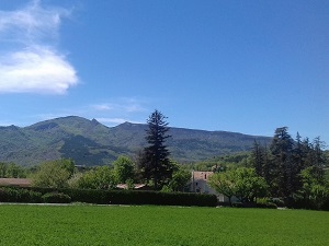
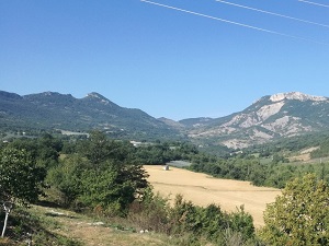
Starting in Lachau, this captivating journey through the heart of the Provençal Baronnies and the Buëch Valley reveals a remarkably wild landscape. The trail first winds its way beautifully towards Eygalayes, before plunging dramatically into the spectacular gorges of Barret-sur-Méouge, where the deep turquoise waters of the waterfalls offer a striking, vivid contrast to the steep, rugged cliffs. As you steadily climb towards Saint-Pierre-Avez, hikers will discover a deeply authentic rural heritage, proudly marked by ancient perched villages with glowing facades of golden stone. The trek continues onward towards Val Buëch-Méouge, a fascinating transition zone where the high Alps meet the warmth of Provence, and where fruitful orchards naturally lie alongside dense Scots pine forests. The journey culminates in Eourres, a highly atypical and eco-friendly village nestled quietly at the foot of the Mare mountain, serving as a bright symbol of rural renewal and passionate biodiversity preservation. Spanning from fine lavender fields to sweeping, windswept peaks, this route wonderfully celebrates the enduring harmony between a rugged, ancient geology and a deeply resilient mountain culture.
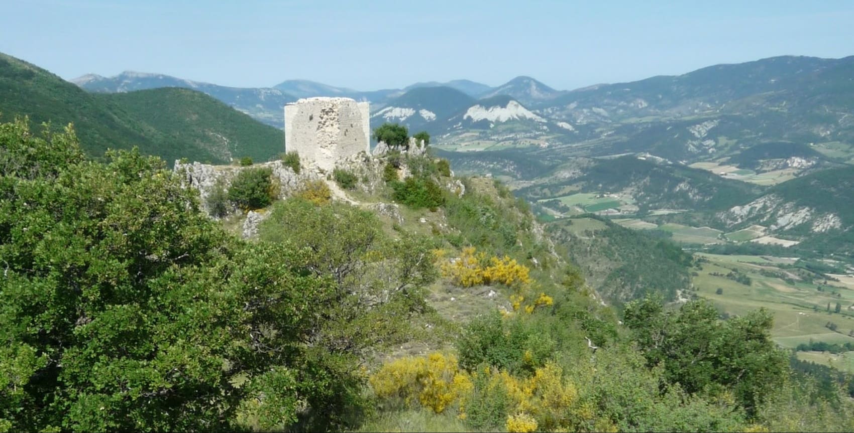
Situated gracefully on the border between the Drôme and Hautes-Alpes departments, the deeply sculpted landscapes of the Buëch and Méouge valleys offer a truly luminous transition between the sharp peaks of the Alps and the rolling hills of Provence. This unique mid-mountain region is clearly distinguished by its expansive blue marl and steep limestone ridges, creating a space where the brisk mountain climate meets the inviting, mild Mediterranean air. The undisputed natural gem of the area remains the spectacular Méouge Gorges, whose cool, turquoise waters peacefully meander beneath a historic, three-arched medieval bridge. The rich historical heritage is continually revealed through charming perched villages like Serres—a fascinating medieval town tightly clinging to the bare rock—or the venerable Clausonne Abbey, which stands as a quiet testament to an isolated, devout monastic life. Furthermore, it is a renowned land of adventure for both hikers and paragliders, who eagerly take advantage of the highly exceptional thermals found at the Laragne-Montéglin site. Beautifully alternating between fragrant lavender fields, rich apple orchards, and sweeping pine forests, the local biodiversity absolutely abounds, providing a safe shelter for magnificent golden eagles and nimble chamois.
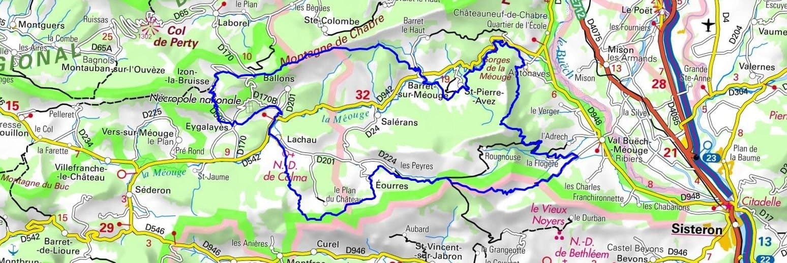
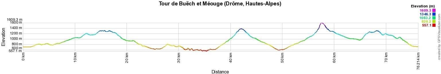
 Distance: 76km, Elevation maximum: 1609m, Elevation minimum: 557m, Elevation gain uphill: 3593m
IGN Maps: 3240OT - BANON SAULT PLATEAU DE SAINT-CHRISTOL. 3239OT - ROSANS ORPIERRE BARONNIES ORIENTALES. 3339OT - SISTERON LARAGNE-MONTEGLIN MONTAGNE DE CHABRE.
Nearby paths:
![]() It is advisable to follow the beacons all along your hike and to bring the FFRandonnée topo-guide. You will also find information on MonGR.fr.
It is advisable to follow the beacons all along your hike and to bring the FFRandonnée topo-guide. You will also find information on MonGR.fr.
GR®, PR®, GRP® and the corresponding markings are trademarks of the French Federation of Hiking. They may not be reproduced without permission. The French Federation of Hiking, state-approved, includes organizations that maintain hiking routes. It publishes guides for these routes. With your donations, support the actions of the thousands of volunteer markers of the FFRandonnée.
GR-Infos.com is an editorial partner of MonGR.fr.
| Return |

Former holiday hotel with a garden along the Allier, L'Etoile Guest House is located in La Bastide-Puylaurent between Lozere, Ardeche, and the Cevennes in the mountains of Southern France. At the crossroads of GR®7, GR®70 Stevenson Path, GR®72, GR®700 Regordane Way, GR®470 Allier River springs and gorges, GRP® Cevenol, Ardechoise Mountains, Margeride. Numerous loop trails for hiking and one-day biking excursions. Ideal for a relaxing and hiking getaway.
Copyright©gr-infos.com (Authorization for private use only)
To help us maintain and improve GR-Infos.com, a contribution of 2€ is desired via Wero or bank transfer. Thank you!