
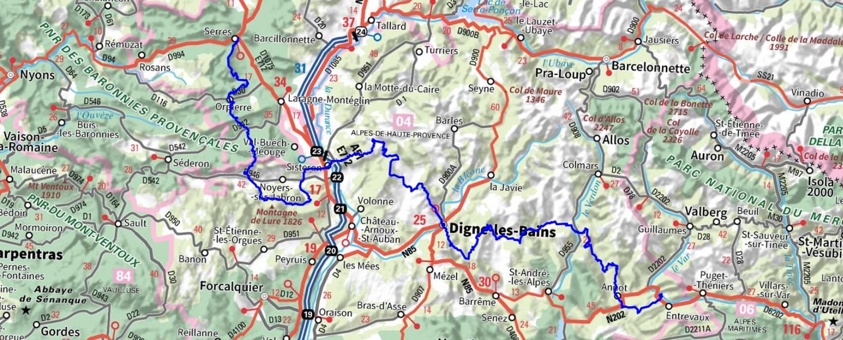
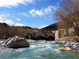
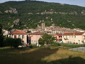
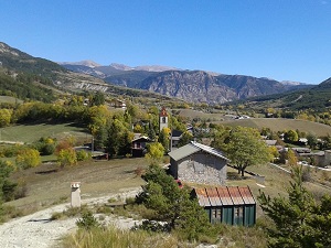
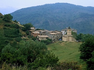
The Great Pre-Alps Crossing (GTPA), Baronnies and Mercantour, begins in Serres, a medieval town in the Hautes-Alpes. The trail climbs towards the cliffs of Orpierre, before crossing the ridge of the Montagne de Lure to reach Sisteron, the "Pearl of Provence," and its citadel overlooking the Durance River. Through the Haute-Provence Geological Reserve, the route reaches Digne-les-Bains, the lavender capital, nestled in valleys of black marl. The journey continues towards the source of the Verdon River via Thorame-Basse and Thorame-Haute, where larch forests and high-altitude pastures bear witness to a pastoral way of life. The heritage is further showcased by the passage through Annot, famous for its sandstone boulder fields and chestnut groves. The journey ends majestically at Entrevaux, a fortified town designed by Vauban, whose drawbridge and cobbled streets mark the gateway to the Maritime Alps.
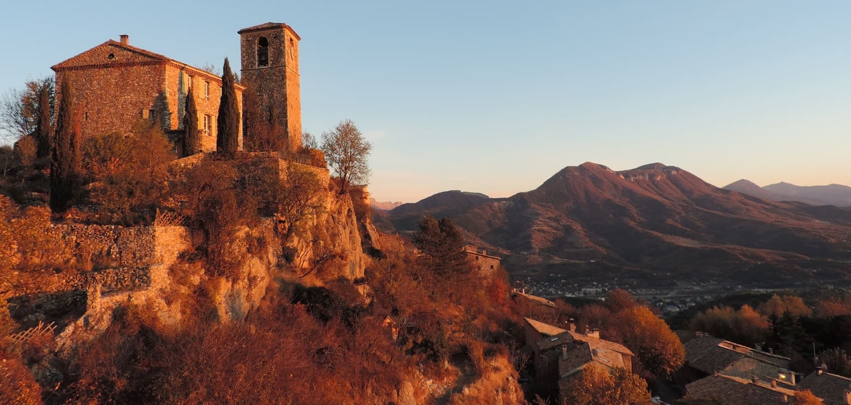
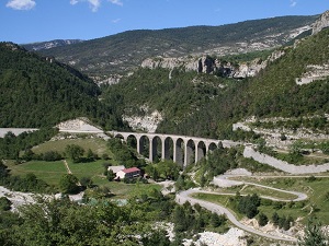
The Great Pre-Alps Crossing offers varied panoramas, ranging from lush valleys to steep ridges. Hikers traverse diverse landscapes, such as the Verdon gorges, limestone plateaus, and pine forests, showcasing the region's geological richness. The flora is particularly abundant, featuring endemic species like thyme, rosemary, and various flower types. Hikers may spot chamois, golden eagles, and a variety of migratory birds that inhabit the mountains. Entrevaux is a fortified medieval village that bears witness to a rich historical past. The narrow streets, the stone houses, and the citadel overlooking the valley create a charming atmosphere. Digne-les-Bains is known for its thermal baths and its role in the history of lavender, while Sisteron is famous for its imposing citadel that watches over the Durance valley. Historical remains, ancient chapels, and local markets where olives and cheeses can be found, including the famous lavender, enrich the cultural landscape.
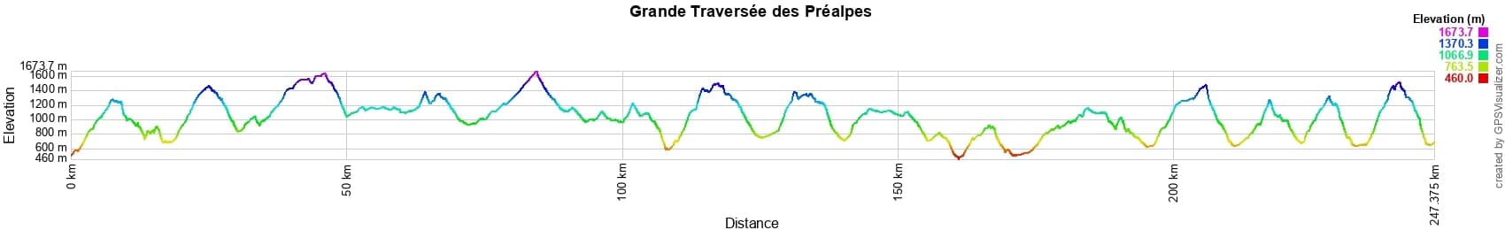
 Distance: 256km, Elevation maximum: 1678m, Elevation minimum: 460m, Elevation gain uphill: 11808m
IGN Maps: 3340ET - DIGNE-LES-BAINS SISTERON LES MÉES. 3440ET - DIGNE-LES-BAINS LA JAVIE VALLÉE DE LA BLÉONE. 3441OT - BARRÊME VALLÉE DE L'ASSE PNR DU VERDON. 3442OT - GORGES DU VERDON MOUSTIERS-SAINTE-MARIE LAC DE SAINTE-CROIX PNR DU VERDON. 3442OTR - GORGES DU VERDON RESISTANTE MOUSTIERS STE-MARIE LAC DE SAINTE-CROIX PNR DU VERDON. 3540ET - HAUTE VALLÉE DU VAR GORGES DE DALUIS PARC NATIONAL DU MERCANTOUR. 3540OT - BARCELONNETTE PRA-LOUP LE SAUZE ALLOS PARC NATIONAL DU MERCANTOUR. 3540OTR - BARCELONNETTE RÉSISTANTE PRA LOUP LE SAUZE ALLOS PARC NATIONAL DU MERCANTOUR. 3541OT - ANNOT SAINT-ANDRÉ-LES-ALPES PNR DU VERDON. 3542OT - CASTELLANE LAC DE CASTILLON PNR DU VERDON. 3239OT - ROSANS ORPIERRE BARONNIES ORIENTALES. 3339ET - LA MOTTE-DU-CAIRE VALLEE DU SASSE. 3339OT - SISTERON LARAGNE-MONTEGLIN MONTAGNE DE CHABRE. 3341OT - MONTAGNE DE LURE LES MÉES CHÂTEAU-ARNOUX-SAINT-AUBAN. 3338OT - SERRES VEYNES HAUT BUËCH BOCHAINE.
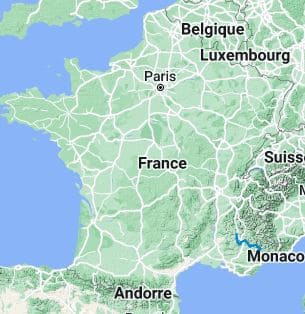
Nearby paths:
![]() It is advisable to follow the beacons all along your hike and to bring the FFRandonnée topo-guide. You will also find information on MonGR.fr.
It is advisable to follow the beacons all along your hike and to bring the FFRandonnée topo-guide. You will also find information on MonGR.fr.
GR®, PR®, GRP® and the corresponding markings are trademarks of the French Federation of Hiking. They may not be reproduced without permission. The French Federation of Hiking, state-approved, includes organizations that maintain hiking routes. It publishes guides for these routes. With your donations, support the actions of the thousands of volunteer markers of the FFRandonnée.
GR-Infos.com is an editorial partner of MonGR.fr.
| Return |

Former holiday hotel with a garden along the Allier, L'Etoile Guest House is located in La Bastide-Puylaurent between Lozere, Ardeche, and the Cevennes in the mountains of Southern France. At the crossroads of GR®7, GR®70 Stevenson Path, GR®72, GR®700 Regordane Way, GR®470 Allier River springs and gorges, GRP® Cevenol, Ardechoise Mountains, Margeride. Numerous loop trails for hiking and one-day biking excursions. Ideal for a relaxing and hiking getaway.
Copyright©gr-infos.com (Authorization for private use only)
To help us maintain and improve GR-Infos.com, a contribution of 2€ is desired via Wero or bank transfer. Thank you!