
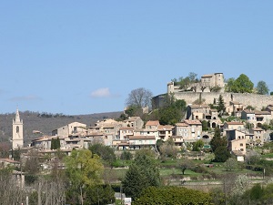
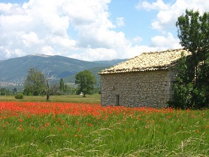
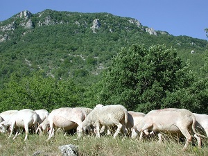
Starting from the medieval town of Forcalquier, the trail climbs gently towards Limans and Lardiers, winding through plateaus of lavender and truffle oaks where the air is fragrant with wild thyme. The ascent to the Lure mountain, Mont Ventoux's little sister, marks the high point of the journey: a desert of white stones offering a breathtaking view, from the Vercors mountains to the Mediterranean. Descending via Cruis, a charming village at the foot of the mountain, the heritage unfolds through ancient abbeys and dry-stone sheepfolds, testaments to a long pastoral tradition. Nature here is wild, sheltering rare biodiversity, from chamois to endemic high-altitude flora. Between the beech forests of the north-facing slopes and the sun-baked south-facing slopes, the return via Montlaux and Fontienne completes the celebration of the soul of this Provence so dear to Jean Giono.
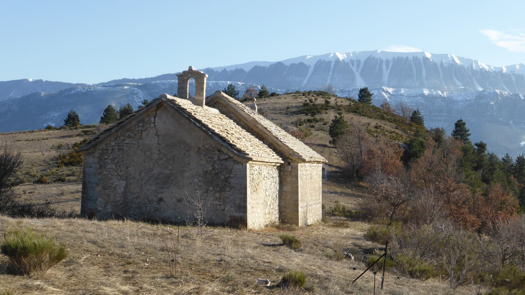
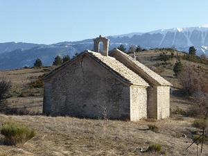
The wild sister of Mont Ventoux, the Lure mountain rises to over 1,800 meters, its limestone silhouette a striking sight. This giant of Provence boasts exceptional biodiversity, where high-altitude beech forests mingle with meadows of fine lavender and medicinal plants. Historically, this landscape was a refuge for shepherds and herbalists of Lure, who gathered rare essences here for apothecaries throughout Europe. The built heritage is discreet yet captivating, marked by dry-stone huts (or "bories") and isolated chapels like Notre-Dame de Lure, nestled in a valley of ancient cedars. A former playground of the writer Jean Giono, the ridge offers a breathtaking panorama, stretching from the snow-capped peaks of the Écrins massif to the Mediterranean Sea on a clear day. Nature has remained untouched there, far from the hustle and bustle, preserving a night sky of rare purity that now attracts astronomers to the Saint-Michel observatory.
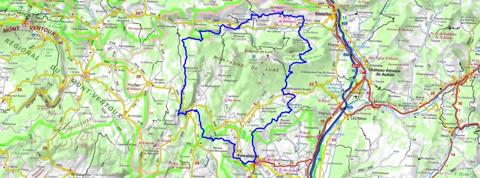
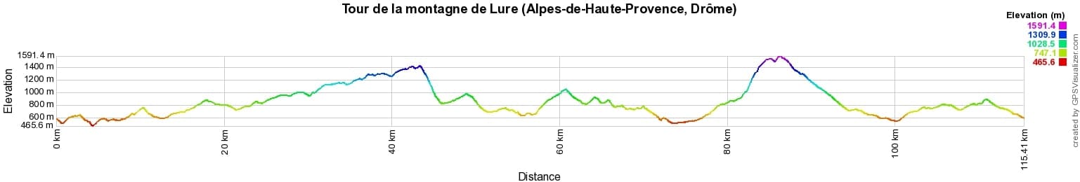
 Distance: 96km, Elevation maximum: 1819m, Elevation minimum: 466m, Elevation gain uphill: 3622m
IGN Maps: 3342OT - MANOSQUE FORCALQUIER PNR DU LUBERON. 3341OT - MONTAGNE DE LURE LES MÉES CHATEAU-ARNOUX-SAINT-AUBAN. 3240OT - BANON SAULT PLATEAU DE SAINT-CHRISTOL. 3339OT - SISTERON LARAGNE-MONTEGLIN MONTAGNE DE CHABRE.
Nearby paths:
![]() It is advisable to follow the beacons all along your hike and to bring the FFRandonnée topo-guide. You will also find information on MonGR.fr.
It is advisable to follow the beacons all along your hike and to bring the FFRandonnée topo-guide. You will also find information on MonGR.fr.
GR®, PR®, GRP® and the corresponding markings are trademarks of the French Federation of Hiking. They may not be reproduced without permission. The French Federation of Hiking, state-approved, includes organizations that maintain hiking routes. It publishes guides for these routes. With your donations, support the actions of the thousands of volunteer markers of the FFRandonnée.
GR-Infos.com is an editorial partner of MonGR.fr.
| Return |

Former holiday hotel with a garden along the Allier, L'Etoile Guest House is located in La Bastide-Puylaurent between Lozere, Ardeche, and the Cevennes in the mountains of Southern France. At the crossroads of GR®7, GR®70 Stevenson Path, GR®72, GR®700 Regordane Way, GR®470 Allier River springs and gorges, GRP® Cevenol, Ardechoise Mountains, Margeride. Numerous loop trails for hiking and one-day biking excursions. Ideal for a relaxing and hiking getaway.
Copyright©gr-infos.com (Authorization for private use only)
To help us maintain and improve GR-Infos.com, a contribution of 2€ is desired via Wero or bank transfer. Thank you!