
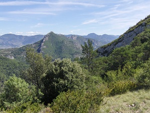
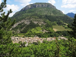
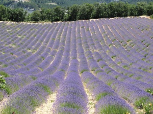
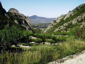
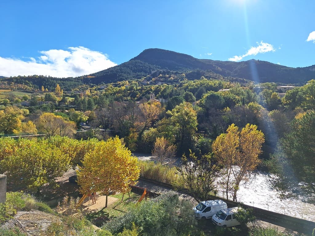
Starting from Buis-les-Baronnies, this grand loop in the heart of the Baronnies Provençales Regional Natural Park offers a truly immersive experience where the Alps gracefully meet Provence. The trail passes through charming villages like Sainte-Jalle and Sahune, where silvery olive groves naturally give way to the towering limestone cliffs of Rémuzat, a vital sanctuary for griffon vultures. Heading towards Rosans and Serres, the region's rich medieval heritage unfolds through narrow, winding streets and ancient Saracen towers that overlook fragrant valleys of lavender and thyme. The route becomes significantly wilder towards Orpierre, a renowned climbing destination, and Saint-Auban-sur-l'Ouvèze, nestled perfectly within a pristine mountain cirque. Nature expresses itself powerfully here, between the dense pine forests of Laborel and the breathtaking, expansive panoramas of Le Poët-en-Percip. The return journey then begins through the upper Ouvèze valley, passing through Brantes, a spectacular hilltop village that directly faces the imposing north face of Mont Ventoux.
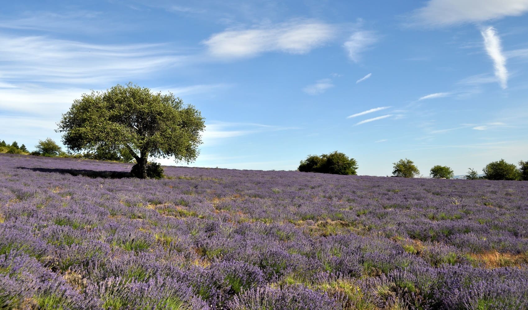
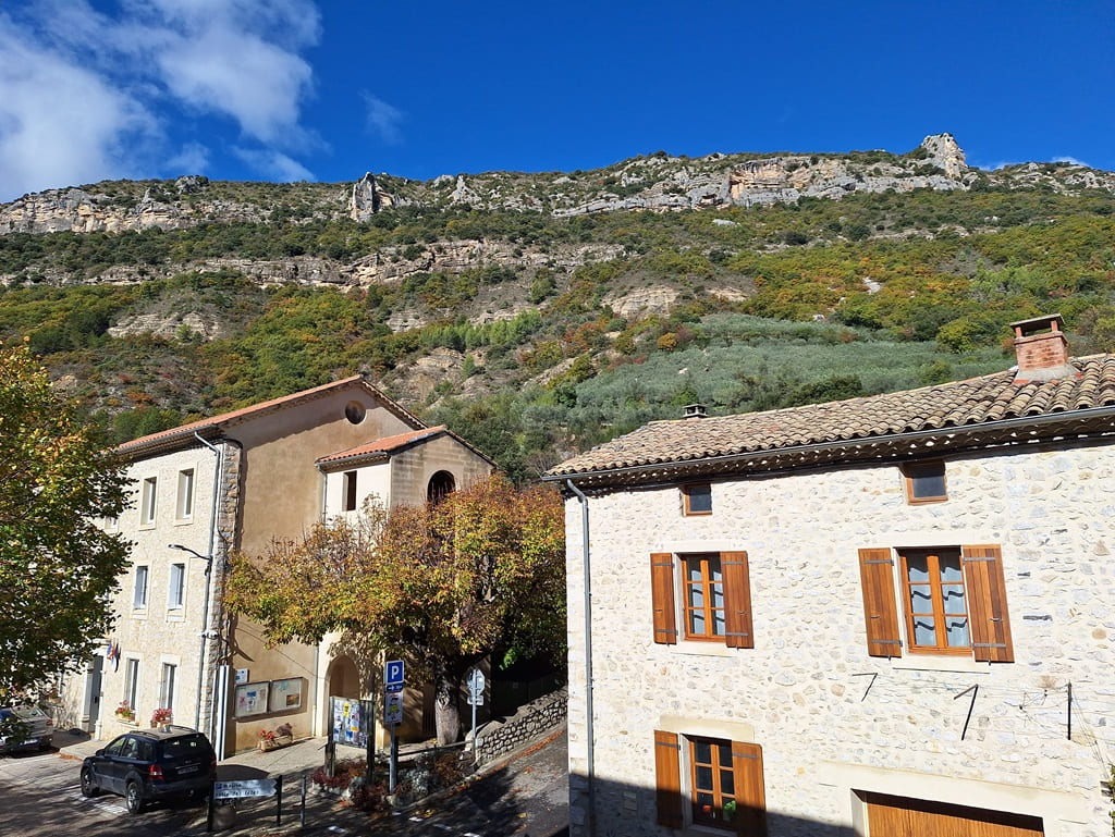
Nestled deep in the southern Drôme region, the Provençal Baronnies form a striking limestone massif where the Alps meet the Mediterranean under exceptionally clear, brilliant light. This unique territory, protected by its status as a Regional Natural Park, unfolds dramatic landscapes of arid, sun-baked ridges, vertiginous cliffs, and secluded valleys where vibrant lavender, Nyons olive trees, and linden trees flourish. History has left a profoundly strong imprint here, visible in charming hilltop villages such as Buis-les-Baronnies and Montbrun-les-Bains. The region's built heritage, masterfully constructed of dry stone and classic Roman tiles, blends seamlessly into a meticulously preserved natural environment that shelters a spectacular colony of griffon vultures. It is a land of vivid contrasts, where sweet apricot orchards stand directly alongside ancient holm oak forests and rugged peaks like the Montagne de la Lance. There are numerous hiking trails here, offering glorious panoramic views of the nearby Mont Ventoux in a profound silence that is barely disturbed by the rhythmic song of the cicadas.
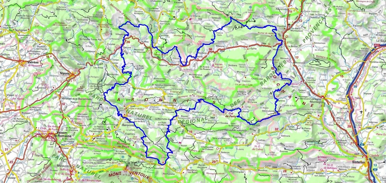
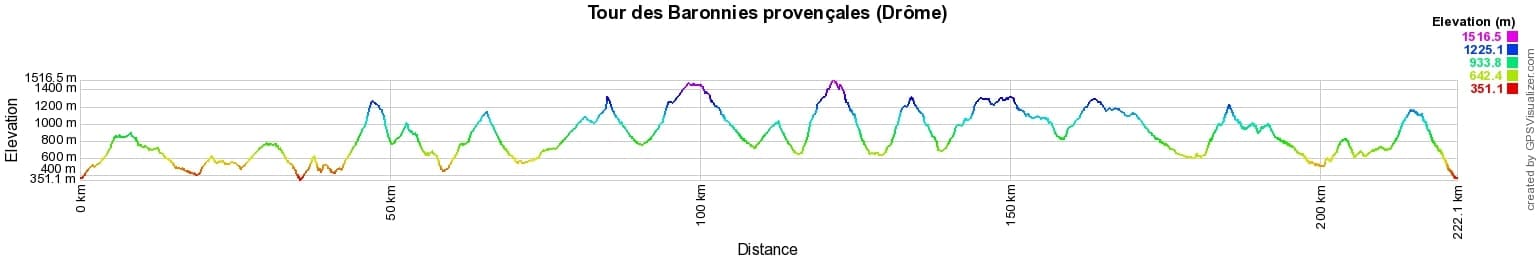
 Distance: 222km, Elevation maximum: 1519m, Elevation minimum: 355m, Elevation gain uphill: 10345m
IGN Maps: Nyons Remuzat Baronnies - 3139OT. Mont-Ventoux - 3140ET. Luc-En-Diois Valdrome Col de Cabre - IGN 3238OT. Banon - Sault - 3240OT.
|
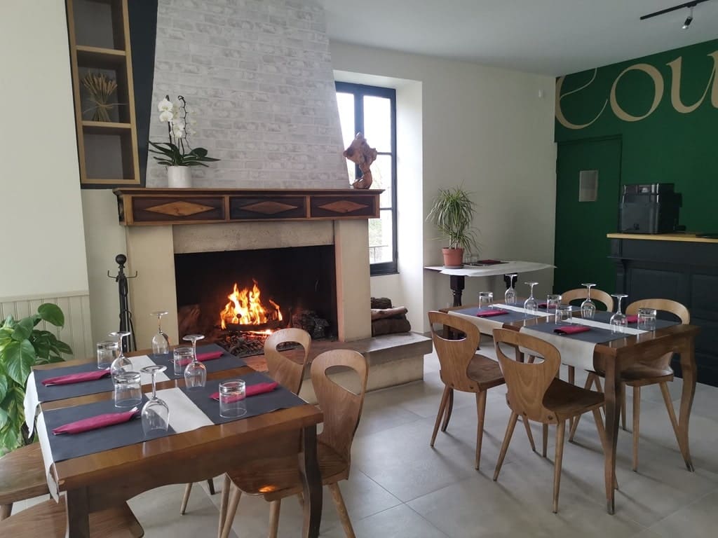
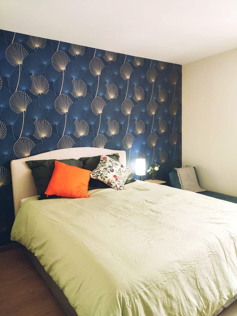
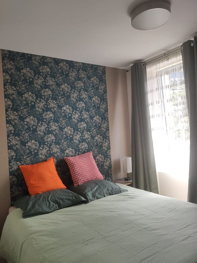
Sahune: Coumtaï Bed and Breakfast and Restaurant, M. Xavier Colussi, 06 23 11 81 44, Email. |
|
Nearby paths:
![]() It is advisable to follow the beacons all along your hike and to bring the FFRandonnée topo-guide. You will also find information on MonGR.fr.
It is advisable to follow the beacons all along your hike and to bring the FFRandonnée topo-guide. You will also find information on MonGR.fr.
GR®, PR®, GRP® and the corresponding markings are trademarks of the French Federation of Hiking. They may not be reproduced without permission. The French Federation of Hiking, state-approved, includes organizations that maintain hiking routes. It publishes guides for these routes. With your donations, support the actions of the thousands of volunteer markers of the FFRandonnée.
GR-Infos.com is an editorial partner of MonGR.fr.
| Return |

Former holiday hotel with a garden along the Allier, L'Etoile Guest House is located in La Bastide-Puylaurent between Lozere, Ardeche, and the Cevennes in the mountains of Southern France. At the crossroads of GR®7, GR®70 Stevenson Path, GR®72, GR®700 Regordane Way, GR®470 Allier River springs and gorges, GRP® Cevenol, Ardechoise Mountains, Margeride. Numerous loop trails for hiking and one-day biking excursions. Ideal for a relaxing and hiking getaway.
Copyright©gr-infos.com (Authorization for private use only)
To help us maintain and improve GR-Infos.com, a contribution of 2€ is desired via Wero or bank transfer. Thank you!