
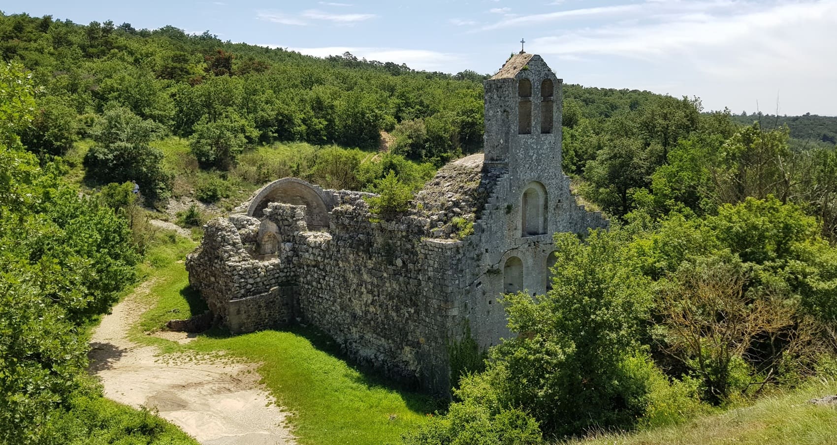
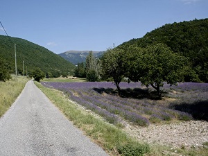
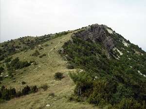
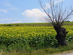
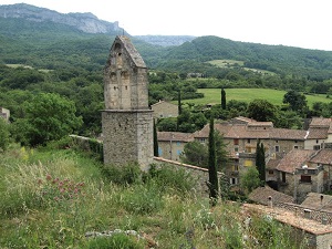
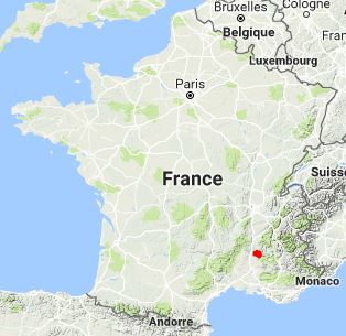
Starting in Dieulefit, this trail in the Drôme region winds its way between lavender fields and charming villages, beginning with the hills of Orcinas and Vesc. Hikers traverse the landscapes of Montjoux and La Roche-Saint-Secret-Béconne, where medieval heritage blends with limestone cliffs. Passing by the priory of Aleyrac and the parks of La Bégude-de-Mazenc, the scenery becomes more Mediterranean, with holm oaks and olive groves. History takes center stage in Le Poët-Laval, one of the most beautiful villages in France, a former stronghold of the Knights Hospitaller and a major center of Protestantism. The route becomes more challenging towards Eyzahut, nestled beneath imposing rock walls, before reaching Rochebaudin, a village perched above a narrow gorge. This loop offers a complete immersion in the Drôme Provençale, where the biodiversity of the Prealps meets the gentle warmth of the South.
The Pays de Dieulefit, located in the Drôme Provençale, is a renowned destination known for its exceptional climate and picturesque landscapes at the crossroads of Dauphiné and Provence. This region stands out with a strong identity linked to pottery and ceramics, with Dieulefit being a historical center for this craft due to its rich clay deposits. The environment is typical of the South, featuring fragrant lavender fields, oak and pine forests, and mountains such as La Lance and Miélandre. Architectural treasures include the perched village of Poët-Laval, classified among the Most Beautiful Villages of France, as well as templar remains. Slow tourism and outdoor sports are highlighted along the trails of the GR® de Pays that traverse the area, including the famous Huguenot Trail (GR® 965).
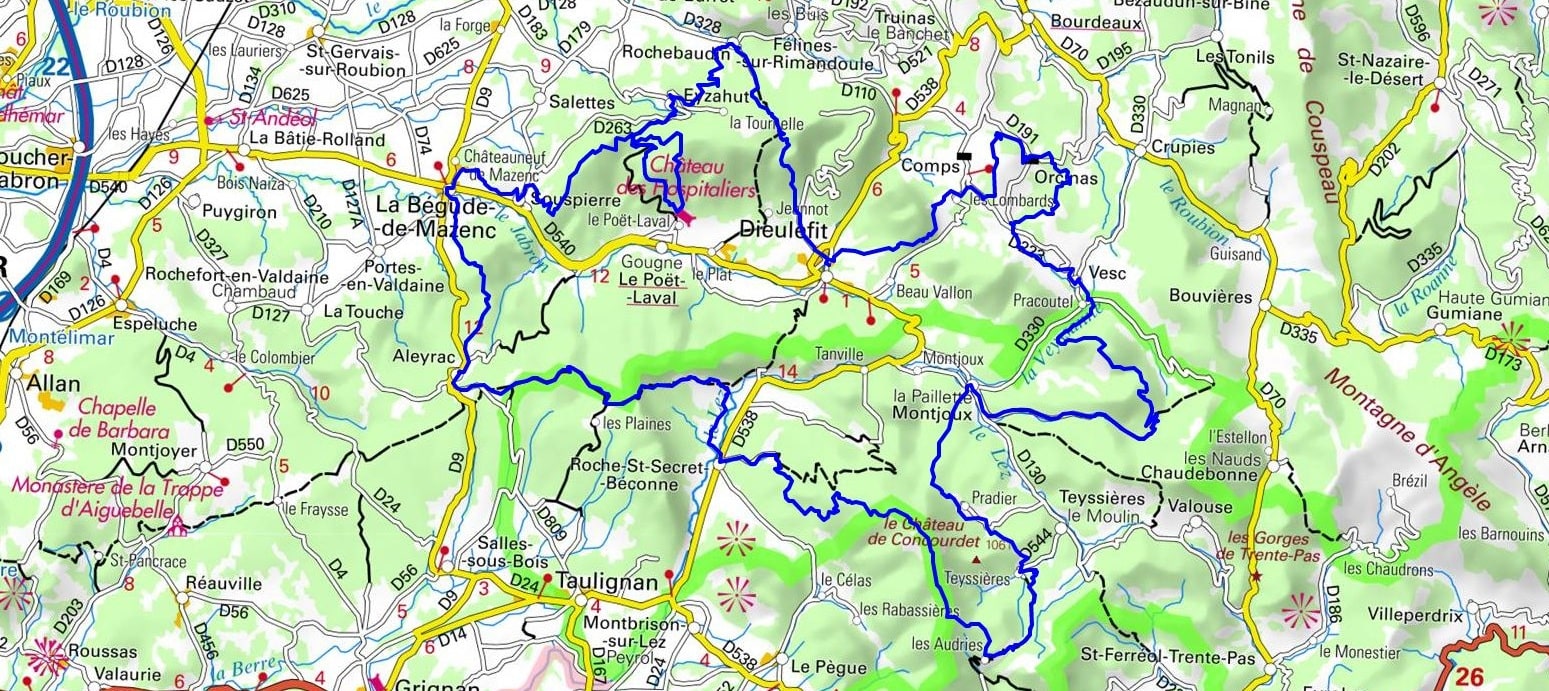
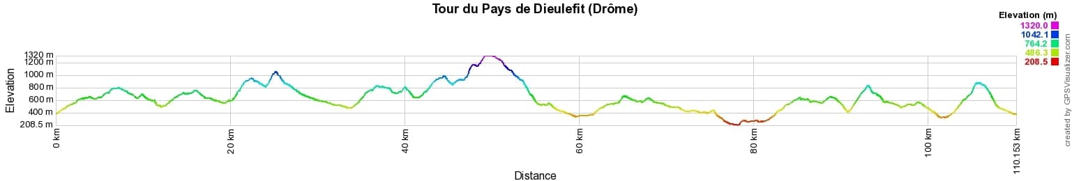
 Distance: 110km, Elevation maximum: 1316m, Elevation minimum: 213m, Elevation gain uphill: 5037m
IGN Maps: La Bégude-de-Mazenc (3038E). Dieulefit St-Nazaire-le-Désert Forêt de Saou (3138OT). Nyons Rémuzat Baronnies (3139OT).
Nearby paths:
![]() It is advisable to follow the trail markers all along your hike and to bring the FFRandonnée topo-guide. You will also find information on MonGR.fr.
It is advisable to follow the trail markers all along your hike and to bring the FFRandonnée topo-guide. You will also find information on MonGR.fr.
GR®, PR®, GRP® and the corresponding markings are trademarks of the French Federation of Hiking. They may not be reproduced without permission. The French Federation of Hiking, state-approved, includes organizations that maintain hiking routes. It publishes guides for these routes. With your donations, support the actions of the thousands of volunteer markers of the FFRandonnée.
GR-Infos.com is an editorial partner of MonGR.fr.
| Return |

Former holiday hotel with a garden along the Allier, L'Etoile Guest House is located in La Bastide-Puylaurent between Lozere, Ardeche, and the Cevennes in the mountains of Southern France. At the crossroads of GR®7, GR®70 Stevenson Path, GR®72, GR®700 Regordane Way, GR®470 Allier River springs and gorges, GRP® Cevenol, Ardechoise Mountains, Margeride. Numerous loop trails for hiking and one-day biking excursions. Ideal for a relaxing and hiking getaway.
Copyright©gr-infos.com (Authorization for private use only)
To help us maintain and improve GR-Infos.com, a contribution of 2€ is desired via Wero or bank transfer. Thank you!