
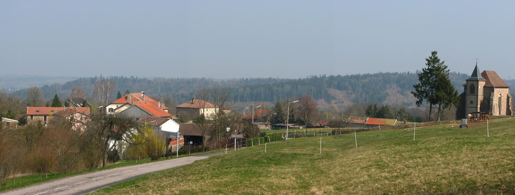
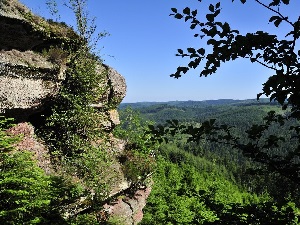
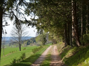
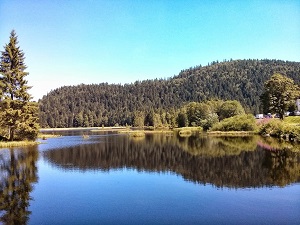
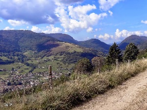
The GR®533 trail winds its way between the North (Grès), characterized by immense forest massifs, pink sandstone rocks with tormented shapes, and ruined castles, and the South (Cristallin), whose terrain rises towards the High Vosges. Here, the forests give way to the Hautes-Chaumes, vast high-altitude pastures offering panoramic views of the Black Forest and, on a clear day, the Alps, culminating in the famous Ballon peaks. Hikers traverse unspoiled nature, alternating between dense fir forests, mysterious peat bogs, and glacial cirques sheltering high-altitude lakes such as Pierre-Percée and Maix. Starting in the Moselle region, the trail plunges into vast beech and fir forests, passing by the memorial site of Donon, a sacred mountain where Celtic cults and Gallo-Roman remains intertwine. Hydraulic sawmills, pink sandstone chapels and farm-inns bear witness to a resilient mountain life.
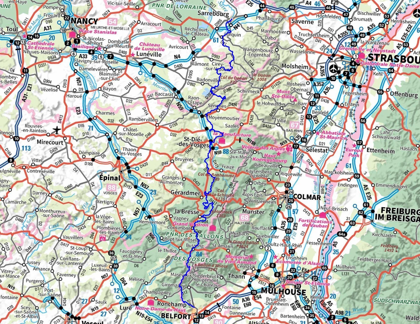
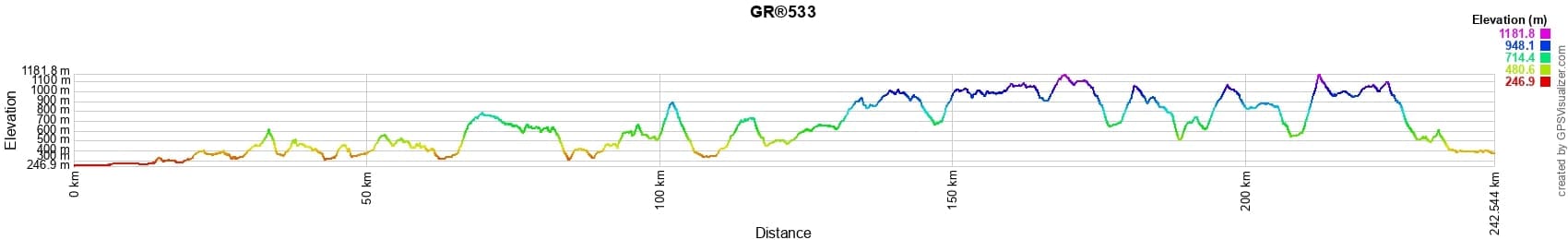
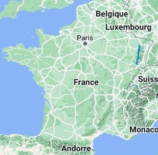
 Distance: 242km, Elevation maximum: 1170m, Elevation minimum: 247m, Elevation gain uphill: 7867m
IGN Maps: 3515SB - LORQUIN AVRICOURT. 3520ET - BALLON D'ALSACE KRUTH GIROMAGNY. 3520SB - LURE MÉLISEY. 3616OT - LAC DE PIERRE-PERCÉE ABRESCHVILLER LE DONON. 3617OT - SAINT-DIÉ-DES-VOSGES SENONES FRAIZE. 3618OT - GÉRARDMER LE HOHNECK LA BRESSE. 3619OT - BUSSANG BALLON D'ALSACE GRAND BALLON. 3621OT - BELFORT MONTBELIARD. 3715OT - SARREBOURG PHALSBOURG PAYS DES ÉTANGS.
Nearby paths:
![]() It is advisable to follow the beacons throughout your itinerary and to take the Fédération Française de la Randonnée Pédestre topo-guide with you. You will also find information on MonGR.fr.
It is advisable to follow the beacons throughout your itinerary and to take the Fédération Française de la Randonnée Pédestre topo-guide with you. You will also find information on MonGR.fr.
GR®, PR®, GRP®, and the corresponding signs of markings (white / red, yellow and yellow / red) are trademarks of the French Federation of Hiking. They may not be reproduced without permission. The French Federation of Hiking, state-approved, includes organizations that create and maintain hiking routes on GR®, PR®, and GRP®. It publishes guides for these topo hiking routes. With your donations, you support the actions of the thousands of FFRandonnée volunteer markers.
GR-Infos.com is an editorial partner of MonGR.fr.
| Return |

Former holiday hotel with a garden along the Allier, L'Etoile Guest House is located in La Bastide-Puylaurent between Lozere, Ardeche, and the Cevennes in the mountains of Southern France. At the crossroads of GR®7, GR®70 Stevenson Path, GR®72, GR®700 Regordane Way, GR®470 Allier River springs and gorges, GRP® Cevenol, Ardechoise Mountains, Margeride. Numerous loop trails for hiking and one-day biking excursions. Ideal for a relaxing and hiking getaway.
Copyright©gr-infos.com (Authorization for private use only)
To help us maintain and improve GR-Infos.com, a contribution of 2€ is desired via Wero or bank transfer. Thank you!