
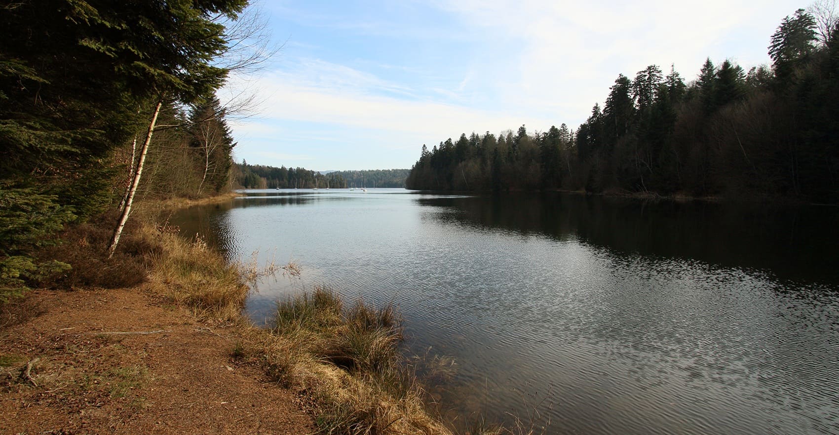
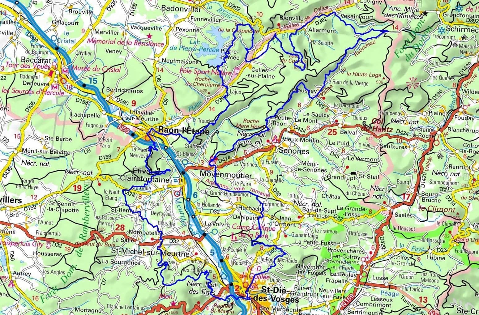
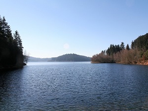
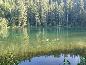
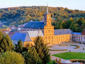
Starting in Saint-Dié-des-Vosges, the birthplace of America, the trail first passes through Nompatelize and Saint-Remy, sites of the 1914 battles, before reaching Raon-l'Étape, gateway to the Plaine Valley, renowned for its timber rafting. The route then climbs towards the Pierre-Percée site, whose lake with its sprawling arms evokes Scandinavian fjords amidst pink sandstone. Following the Celles-sur-Plaine Valley to Vexaincourt, one discovers unspoiled nature. Passing through Moussey recalls the poignant history of the Vosges Resistance, while Moyenmoutier impresses with its majestic Benedictine abbey, a jewel of the "Croix des Abbayes" (Cross of Abbeys). The return to Saint-Dié via Denipaire winds between green valleys and orchards, offering a perfect synthesis between low mountain terrain, monastic history and the freshness of the large forest lakes.
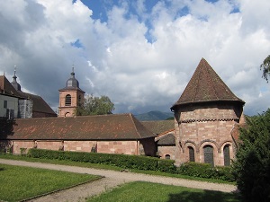
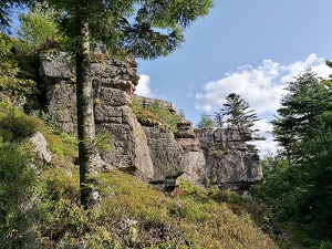
Northern Déodatie, a pivotal territory between the Vosges and Meurthe-et-Moselle departments, is a land of pink sandstone and deep forests shaped by industrial and spiritual history. Around Saint-Dié-des-Vosges, the birthplace of America, heritage is revealed through gems like the Étival-Clairefontaine Abbey, a testament to medieval monastic power. The landscapes are defined by the Ormont and Madeleine massifs, offering spectacular views of the blue line of the Vosges Mountains. Nature is omnipresent, between the Meurthe and Plaine valleys, where hiking trails wind through fir trees and remarkable rock formations. The crafts of crystal and textiles long thrived in these valleys, leaving an industrial legacy now transformed into cultural trails.
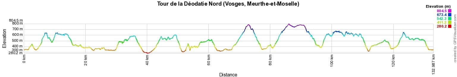
 Distance: 133km, Elevation maximum: 804m, Elevation minimum: 280m, Elevation gain uphill: 4240m
IGN Maps: 3617OT - SAINT-DIÉ-DES-VOSGES SENONES FRAIZE. 3516SB - LUNÉVILLE BACCARAT. 3616OT - LAC DE PIERRE-PERCÉE ABRESCHVILLER LE DONON. 3716ET - LE DONON OBERNAI LE MONT SAINT-ODILE VALLÉE DE LA BRUCHE. 3717ET - BARR LE HOHWALD VILLÉ HAUTE VALLÉE DE LA BRUCHE.
Nearby paths:
![]() It is advisable to follow the beacons all along your hike and to bring the FFRandonnée topo-guide. You will also find information on MonGR.fr.
It is advisable to follow the beacons all along your hike and to bring the FFRandonnée topo-guide. You will also find information on MonGR.fr.
GR®, PR®, GRP® and the corresponding markings are trademarks of the French Federation of Hiking. They may not be reproduced without permission. The French Federation of Hiking, state-approved, includes organizations that maintain hiking routes. It publishes guides for these routes. With your donations, support the actions of the thousands of volunteer markers of the FFRandonnée.
GR-Infos.com is an editorial partner of MonGR.fr.
| Return |

Former holiday hotel with a garden along the Allier, L'Etoile Guest House is located in La Bastide-Puylaurent between Lozere, Ardeche, and the Cevennes in the mountains of Southern France. At the crossroads of GR®7, GR®70 Stevenson Path, GR®72, GR®700 Regordane Way, GR®470 Allier River springs and gorges, GRP® Cevenol, Ardechoise Mountains, Margeride. Numerous loop trails for hiking and one-day biking excursions. Ideal for a relaxing and hiking getaway.
Copyright©gr-infos.com (Authorization for private use only)
To help us maintain and improve GR-Infos.com, a contribution of 2€ is desired via Wero or bank transfer. Thank you!