
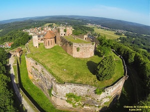
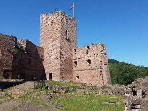
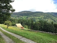
The GR®532 offers an intimate glimpse into Alsatian history, alternating between windswept peaks and industrial valleys. Starting in the Northern Vosges Regional Nature Park, hikers traverse a landscape of red sandstone, marked by the ruins of fortified castles like Fleckenstein, medieval sentinels of a contested border. Heading south, the geography changes: pine forests give way to grassy hills and the glacial cirques of the Upper Rhine. The heritage takes on a more spiritual dimension with the passage to Mont Sainte-Odile, a major pilgrimage site overlooking the Alsatian plain. On the nature front, the trail crosses biological reserves where chamois can be spotted on the slopes of the Hohneck or capercaillies in the wildest areas.

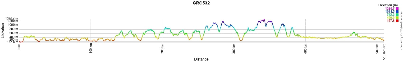
 Distance: 510km, Elevation maximum: 1325m, Elevation minimum: 156m, Elevation gain uphill: 14778m
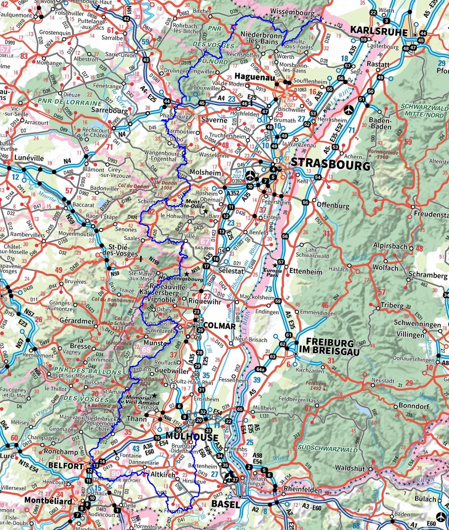
IGN Maps: 3914OT - WISSEMBOURG LAUTERBOURG SOUFFLENHEIM. 3713ET - BITCHE DAMBACH PNR DES VOSGES DU NORD. 3714ET - LA PETITE-PIERRE NIEDERBRONN-LES-BAINS PNR DES VOSGES DU NORD. 3715ET - SAVERNE WASSELONNE ROCHER DE DABO. 3715OT - SARREBOURG PHALSBOURG PAYS DES ÉTANGS. 3814ET - HAGUENAU LEMBACH PNR DES VOSGES DU NORD. 3616OT - LAC DE PIERRE-PERCÉE ABRESCHVILLER LE DONON. 3617OT - SAINT-DIÉ-DES-VOSGES SENONES FRAIZE. 3716ET - LE DONON OBERNAI LE MONT SAINT-ODILE VALLÉE DE LA BRUCHE. 3717ET - BARR LE HOHWALD VILLÉ HAUTE VALLÉE DE LA BRUCHE. 3718OT - SÉLESTAT COL DU BONHOMME SAINTE-MARIE-AUX-MINES KAYSERSBERG RIQUEWIHR. 3520ET - BALLON D'ALSACE KRUTH GIROMAGNY. 3618OT - GÉRARDMER LE HOHNECK LA BRESSE. 3619OT - BUSSANG BALLON D'ALSACE GRAND BALLON. 3620ET - GRAND BALLON CERNAY GUEBWILLER. 3621ET - DANNEMARIE DELLE SUNDGAU. 3621OT - BELFORT MONTBELIARD. 3720ET - MULHOUSE FORET DOMANIALE DE LA HARDT. 3721ET - ALTKIRCH BALE SUNDGAU.

Nearby paths:
![]() It is advisable to follow the beacons throughout your itinerary and to take the Fédération Française de la Randonnée Pédestre topo-guide with you. You will also find information on MonGR.fr.
It is advisable to follow the beacons throughout your itinerary and to take the Fédération Française de la Randonnée Pédestre topo-guide with you. You will also find information on MonGR.fr.
GR®, PR®, GRP®, and the corresponding signs of markings (white / red, yellow and yellow / red) are trademarks of the French Federation of Hiking. They may not be reproduced without permission. The French Federation of Hiking, state-approved, includes organizations that create and maintain hiking routes on GR®, PR®, and GRP®. It publishes guides for these topo hiking routes. With your donations, you support the actions of the thousands of FFRandonnée volunteer markers.
GR-Infos.com is an editorial partner of MonGR.fr.
| Return |

Former holiday hotel with a garden along the Allier, L'Etoile Guest House is located in La Bastide-Puylaurent between Lozere, Ardeche, and the Cevennes in the mountains of Southern France. At the crossroads of GR®7, GR®70 Stevenson Path, GR®72, GR®700 Regordane Way, GR®470 Allier River springs and gorges, GRP® Cevenol, Ardechoise Mountains, Margeride. Numerous loop trails for hiking and one-day biking excursions. Ideal for a relaxing and hiking getaway.
Copyright©gr-infos.com (Authorization for private use only)
To help us maintain and improve GR-Infos.com, a contribution of 2€ is desired via Wero or bank transfer. Thank you!