|
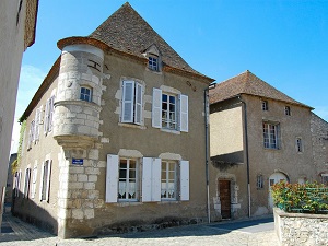
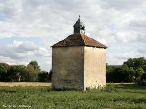
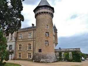
Hike on the GR®463 from Evaux-les-Bains to Le Sapey through Creuse, Puy-de-Dome and Allier department. Guest House, Bed and Breakfast, Hotel, Camping, Shelter, Inn, Shops. |

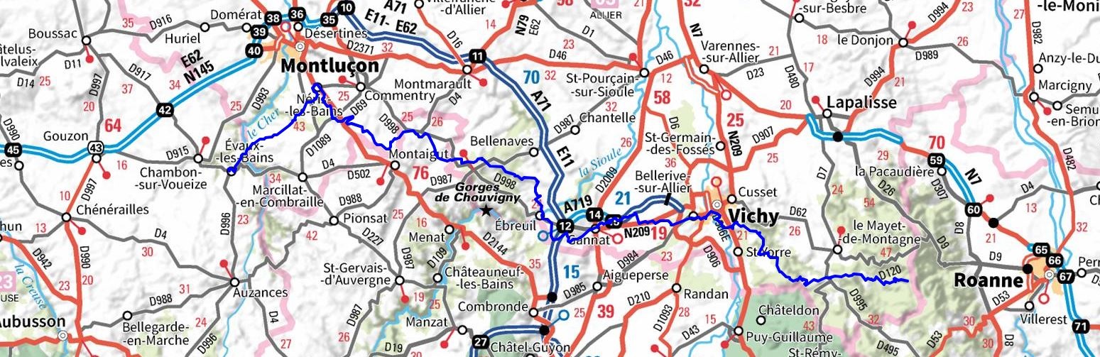
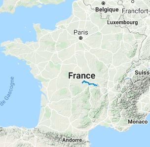
GR®463
From Evaux-les-Bains (Creuse) to Le Sapey (Allier)
171km
|

|
|
Hike on the GR®463 from Evaux-les-Bains to Le Sapey through Creuse, Puy-de-Dome and Allier department. Guest House, Bed and Breakfast, Hotel, Camping, Shelter, Inn, Shops. |
171km
|
|
 © GPX Private use only |
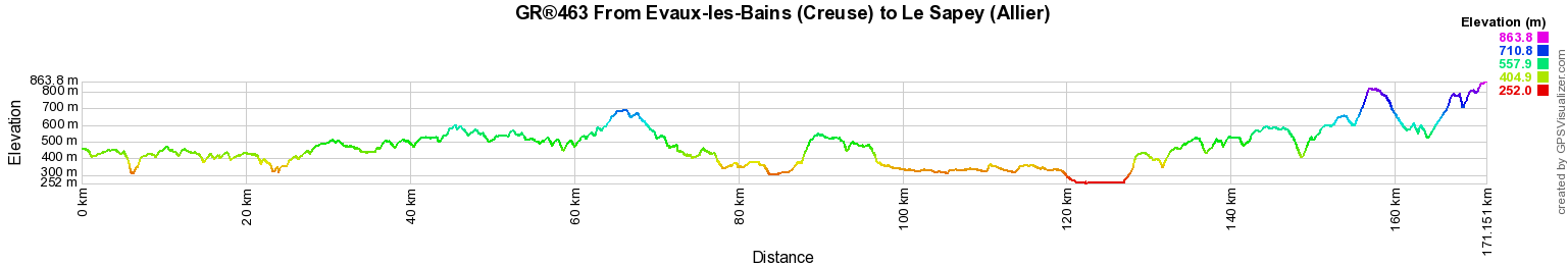
Distance: 171,13km, Elevation maximum: 874m, Elevation minimum: 249m, Elevation gain uphill: 3575m
IGN Maps: Evaux-les-Bains (2329E). Montluçon (2428O). St-Eloy-les-Mines Montaigut (2429E). Pionsat (2429O). Gannat (2529E). Menat Gorges de la Sioule (2529O). Vichy (2629E). Bellerive-sur-Allier (2629O). St-Yorre (2630E). St-Just-en-Chevalet Monts de la Madeleine (2730E). Le Mayet-de-Montagne (2730O).
Registration Accommodation or business owner on or near a GR®, you can appear on GR-INFOS For your registration, you can send me by email (papadimitriou4@gmail.com): your address and phone number, your website (Facebook page), a brief description with 5 beautiful photos of your establishment. Registration price : 100€/5 years per GR® or GRP®. Renewable. |
|
GR®463 From Evaux-les-Bains (Creuse) to Le Sapey (Allier)
From Evaux-les-Bains (Creuse) to Ebreuil (Allier)
From Ebreuil to Le Sapey (Allier)
Nearby paths:
On the Master Ringers Footsteps (Indre-Cher-Allier)
GR®3 Loire River trail
GR®41 Cher Valley
GR®46 From Tours (Indre-et-Loire) to Toulouse (Haute-Garonne)
GR®300 From Sancoins (Cher) to Puy-en-Velay (Haute-Loire)
GR®303 From Neris-les-Bains to Montcombroux-les-Mines (Allier)
GR®765 From Cluny (Saone-et-Loire) to Puy-en-Velay (Haute-Loire)
![]() It is advisable to follow the beacons all along your hike and to bring you the FFRandonnee topo-guide. You
will also find information on MonGR.fr.
It is advisable to follow the beacons all along your hike and to bring you the FFRandonnee topo-guide. You
will also find information on MonGR.fr.
GR®, PR®, GRP®, and the corresponding signs of markings (white / red, yellow and yellow / red) are trademarks of the French Federation of Hiking. They may not be reproduced without permission. The French Federation of Hiking, state-approved, includes organizations that create and maintain hiking routes on GR®, PR® and GRP®. It publishes guides these topo hiking routes.
With your donations, support the actions of the thousands of volunteer markers of the FFRandonnee.
GR-Infos.com is an editorial partner of MonGR.fr.

| Return |
Old romantic Hotel, L'Etoile Guest-House is a mountain retreat in the South of France. With a beautiful park along the Allier River, L'Etoile Guesthouse is located in La Bastide-Puylaurent between Lozere, Ardeche and Cevennes. Many hiking trails like GR®7, GR®70 Stevenson trail, GR®72, GR®700 Regordane way, Cevenol, GR®470 Allier river, Margeride, Ardechoise. Many hiking loops. The right place to relax.
Copyright©gr-infos.com (Authorization for private use only)