
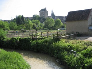
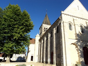
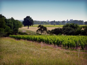
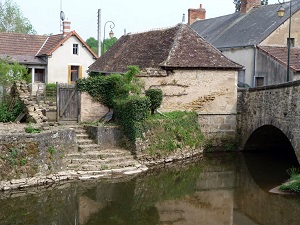
Inspired by George Sand's famous novel, the Sentier des Maîtres Sonneurs (Trail of the Master Bagpipers) is a literary and bucolic loop connecting Berry and Bourbonnais. Starting in La Châtre, the route immediately immerses you in history at Nohant, in front of the writer's former home, before crossing the Indre countryside towards La Berthenoux and its Romanesque churches. Continuing towards the Cher department via Châteaumeillant, renowned for its aged wines, the landscape becomes more hilly, alternating between vineyards and sunken lanes bordered by ancient hedgerows. Crossing into the Allier department via Huriel, with its medieval keep, marks the entry into Bourbonnais territory, where nature becomes wilder around Archignat and the Pierres Jaumâtres heath. The return journey begins in Sainte-Sévère-sur-Indre, a village made famous by Jacques Tati's film Jour de fête (The Big Day), offering a nostalgic glimpse into rural France.
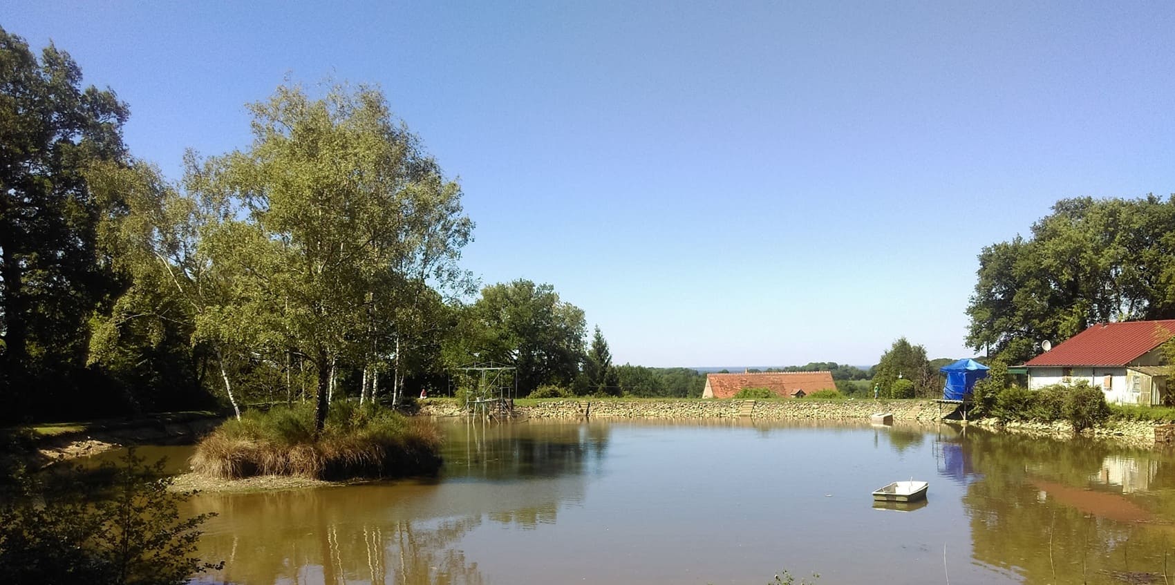
The "In the Footsteps of the Master Bagpipers" trail is a long-distance literary hiking route that delves into the heart of the bocage countryside between the Indre, Cher, and Allier rivers. The landscape is that described by George Sand in her eponymous novel, alternating between dense hedgerows, small rivers, and deep forests, offering a rural and unspoiled atmosphere. The trail tells the story of 19th-century peasant life and the musical traditions of Berry and Bourbonnais, centered around bagpipe and hurdy-gurdy players. The flora is rich in hedgerows and groves (oaks, hornbeams), while the fauna finds an ideal refuge, including numerous species of birds and small mammals typical of these land and water regions. It is an immersion in a unique historical and cultural heritage, offering a peaceful walk through the landscapes so dear to the writer.
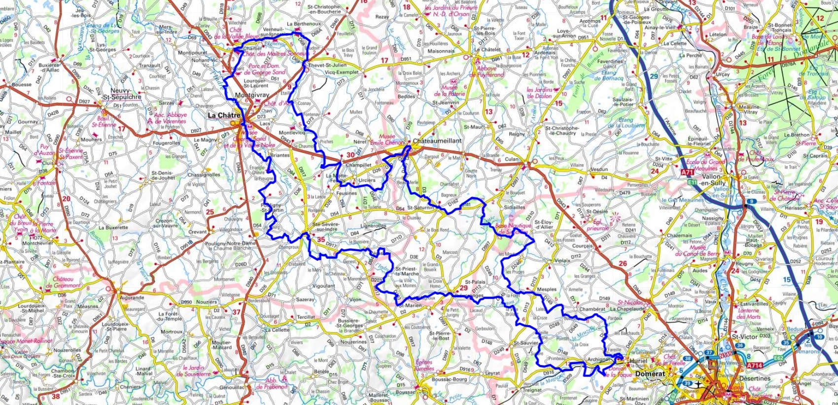
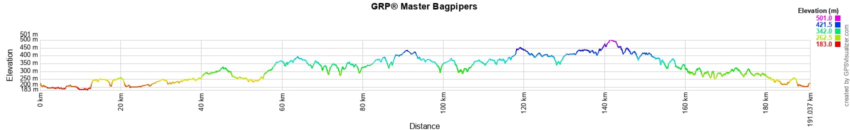
 Distance: 191km, Maximum elevation: 499m, Minimum elevation: 183m, Total ascent: 2038m
IGN Maps: La Berthenoux (2226E). La Chatre (2227E). Culan (2327E). Chateaumeillant (2327O). Huriel (2328E). Boussac (2328O).
Nearby paths:
![]() It is advisable to follow the beacons all along your hike and to bring the FFRandonnée topo-guide. You will also find information on MonGR.fr.
It is advisable to follow the beacons all along your hike and to bring the FFRandonnée topo-guide. You will also find information on MonGR.fr.
GR®, PR®, GRP® and the corresponding markings are trademarks of the French Federation of Hiking. They may not be reproduced without permission. The French Federation of Hiking, state-approved, includes organizations that maintain hiking routes. It publishes guides for these routes. With your donations, support the actions of the thousands of volunteer markers of the FFRandonnée.
GR-Infos.com is an editorial partner of MonGR.fr.
| Return |

Former holiday hotel with a garden along the Allier, L'Etoile Guest House is located in La Bastide-Puylaurent between Lozere, Ardeche, and the Cevennes in the mountains of Southern France. At the crossroads of GR®7, GR®70 Stevenson Path, GR®72, GR®700 Regordane Way, GR®470 Allier River springs and gorges, GRP® Cevenol, Ardechoise Mountains, Margeride. Numerous loop trails for hiking and one-day biking excursions. Ideal for a relaxing and hiking getaway.
Copyright©gr-infos.com (Authorization for private use only)
To help us maintain and improve GR-Infos.com, a contribution of 2€ is desired via Wero or bank transfer. Thank you!