23km
Paris is a magnificent city, but it is sometimes difficult to realize it when you travel through it by car or metro. The best way to discover the French capital is to cross it on foot. While walking, you have time to observe the details, soak up the atmosphere and meet people. We discover neighborhoods that we wouldn't have seen otherwise, and we have the opportunity to chat with the residents. We pass through lively neighborhoods, peaceful streets, and green parks. We see historical monuments, modern buildings, and works of art.
© GPX Usage prive |
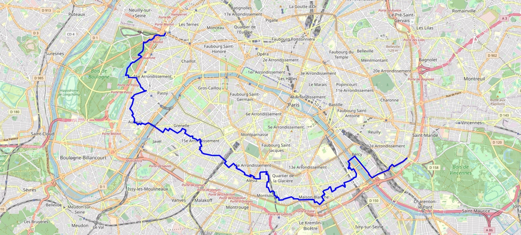
Distance: 23km, Altitude maximum: 71m, Altitude minimum: 28m, Dénivelé cumulé montée: 85m
Cartes IGN: 2314OT - PARIS FORÊT DE MEUDON FORÊT DE FAUSSES REPOSES.
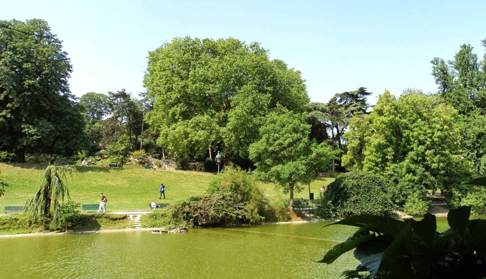
The hike starts at Porte Dorée in the 12th arrondissement. From there, you head towards Parc de Bercy, a vast urban park that houses gardens, museums, theaters, and restaurants. You then arrive at the Bibliothèque François-Mitterrand. You then continue on to Square Cyprian Norwid, a small, quiet park with a statue of the Polish poet Cyprian Norwid. Next, you head towards Jardin Berthe Morisot, a public garden that houses a statue of the Impressionist artist Berthe Morisot, then towards Square des Chamaillards. Next, you follow the Petite Ceinture du 13ème, a former railway line converted into a greenway. You then arrive at Jardin Charles Trenet, a public garden that houses a statue of the French singer and songwriter Charles Trenet. You then continue on to Parc Montsouris, a large park with lakes and gardens. You then arrive at Square Alberto Giacometti, a small park with a statue of the Swiss artist Alberto Giacometti, then Square Saint-Lambert, a small park with a statue of the French writer Victor Hugo. Next, you continue on to Pont Mirabeau, an iconic bridge in Paris that crosses the Seine. You then arrive at Jardin du Ranelagh, a large public garden with lawns, trees, and flowers, and then to Bois de Boulogne, the largest park in Paris.
Registration Accommodation or business owner on or near a GR®, you can appear on GR-INFOS For your registration, you can send me by email (papadimitriou4@gmail.com): your address and phone number, your website (Facebook page), a brief description with 5 beautiful photos of your establishment. Registration price : 100€/5 years per GR® or GRP®. Renewable. |
Nearby paths:
Across Paris (West-East)
Across Paris (North-South)
Across Paris (West-East-South)
Across Paris (East-West-North)
Around Ceinture Verte of Ile-de-France
GR®1 Around Ile de France region
GR®11 Around Pays d’Ile de France
GR®2 Seine River trail
GR®11 Around Pays d'Ile de France
GR®14 Ardennes trail
GR®14A From Vincennes (Val-de-Marne) to Nogent-l'Artaud (Aisne)
GR®75 Around Paris
GR®655 Via Turonensis
It is advisable to follow the beacons all along your hike and to bring you the FFRandonnee topo-guide. You will also find information on MonGR.fr.
GR®, PR®, GRP®, and the corresponding signs of markings (white / red, yellow and yellow / red) are trademarks of the French Federation of Hiking. They may not be reproduced without permission. The French Federation of Hiking, state-approved, includes organizations that create and maintain hiking routes on GR®, PR® and GRP®. It publishes guides these topo hiking routes.
With your donations, support the actions of the thousands of volunteer markers of the FFRandonnee.
GR-Infos.com is an editorial partner of MonGR.fr.
Return |
Former holiday hotel with a garden along the Allier, L'Etoile Guest House is located in La Bastide-Puylaurent between Lozere, Ardeche, and the Cevennes in the mountains of Southern France. At the crossroads of GR®7, GR®70 Stevenson Path, GR®72, GR®700 Regordane Way (St Gilles), GR®470 Allier River springs and gorges, GRP® Cevenol, Ardechoise Mountains, Margeride. Numerous loop trails for hiking and one-day biking excursions. Ideal for a relaxing and hiking getaway.
Copyright©gr-infos.com (Authorization for private use only)