|
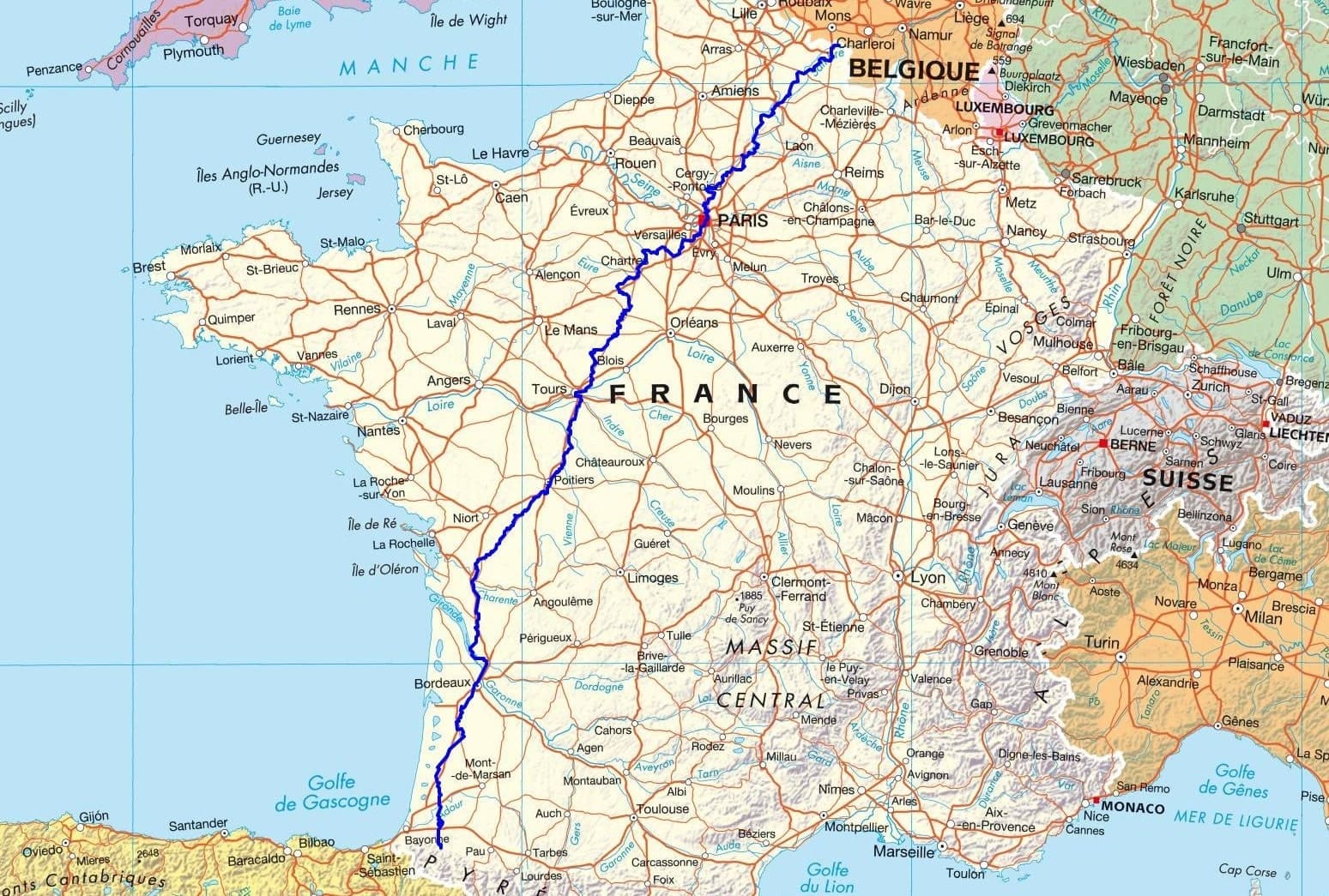
GR®655 Via Turonensis
From Vieux-Reng (Nord) to the Gibraltar Stele (Pyrenees-Atlantiques)
|

|
The Via Turonensis has its origins in the 9th century, at the same time that the cult of Saint James, the apostle of Jesus, began to spread across Europe. Pilgrims traveled various routes to reach the sanctuary of Santiago de Compostela. The Via Turonensis was often taken by pilgrims seeking to express their faith, obtain indulgences, or honor the memory of Saint James. These travelers were often motivated by a desire for spirituality, as well as by the curiosity to discover new landscapes and cultures. As the number of pilgrims increased, the communities along the Via Turonensis began to prosper. Inns, hotels, and places of worship were established to accommodate travelers, boosting the local economy. Markets were held, facilitating trade and cultural exchanges between regions. The path is lined with numerous churches, chapels, and abbeys that bear witness to the religious significance of the route.

Google Maps - Google Earth


 Distance: 1486km, Elevation maximum: 261m, Elevation minimum: 2m, Elevation gain uphill: 9959m
GR®655 EAST From Villebon-sur-Yvette (Essonne) to Vouvray (Indre-et-Loire)

 It is advisable to follow the beacons all along your hike and to bring you the FFRandonnee topo-guide. You
will also find information on MonGR.fr.
GR®, PR®, GRP®, and the corresponding signs of markings (white / red, yellow and yellow / red) are trademarks of the French
Federation of Hiking. They may not be reproduced without permission. The French Federation of Hiking, state-approved, includes organizations that create and maintain hiking routes on GR®, PR® and
GRP®. It publishes guides these topo hiking routes. With your donations, support the actions of the thousands of volunteer markers of the FFRandonnee.
GR-Infos.com is an editorial partner of MonGR.fr.


Former holiday hotel with a garden along the Allier, L'Etoile Guest House is located in La Bastide-Puylaurent between Lozere, Ardeche, and the Cevennes in the mountains of Southern France. At the crossroads of GR®7, GR®70 Stevenson Path, GR®72, GR®700 Regordane Way, GR®470 Allier River springs and gorges, GRP® Cevenol, Ardechoise Mountains, Margeride. Numerous loop trails for hiking and one-day biking excursions. Ideal for a relaxing and hiking getaway.
Copyright©gr-infos.com (Authorization for private use only)


