
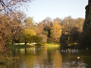
The route begins beneath the Arc de Triomphe, then continues towards Parc Monceau and Square des Batignolles. The ascent of Montmartre hill, via its famous cemetery, leads to Place du Tertre and the Sacré-Cœur Basilica, offering a unique view of the capital. Descending eastward through Parc Saïd Bouziri and Place Stalingrad, the terrain becomes more pronounced again in the steep valleys of the Buttes-Chaumont, then to Parc de Belleville, a veritable balcony overlooking the city. The route crosses the Jardin du Carré de Baudouin before reaching the monumental silence of Père Lachaise Cemetery, where French history rests beneath centuries-old trees. Nature reclaims the former Petite Ceinture railway line at the Jardin de la Gare de Charonne, culminating in a spectacular finale along the Coulée Verte René-Dumont. This suspended ribbon, a global pioneer in urban greening, flies over the 12th arrondissement all the way to the Porte Dorée.
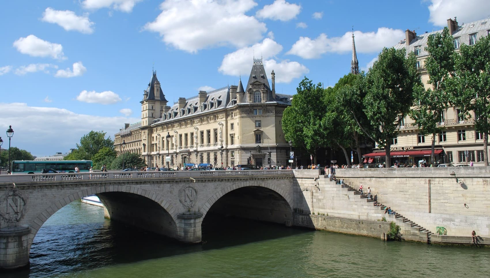
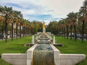
The route through Paris from Porte Maillot to Porte Dorée traverses the capital from its westernmost point to its southeastern edge, linking the edges of the city's two major woods. The landscape reflects a significant architectural evolution, from the Maillot business district to the grand central monuments, culminating at the Palais de la Porte Dorée. The history of this route is intertwined with the broader history of Paris, from the 19th-century fortifications, whose gates still stand, to the splendor of the 1931 Colonial Exposition. The flora encountered is primarily that of the tree-lined avenues typical of Paris (plane trees, horse chestnuts) and the surrounding green spaces. The fauna is concentrated along the Seine and around the Bois de Vincennes, where waterfowl and small urban mammals find refuge in these green lungs.
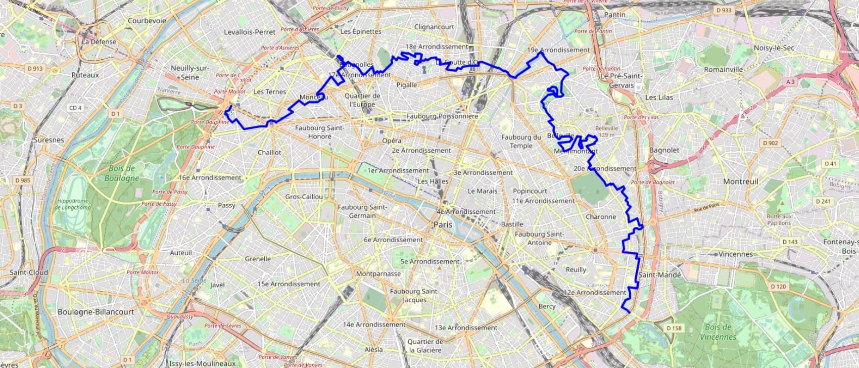
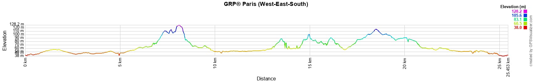


 Distance: 26km, Elevation maximum: 126m, Elevation minimum: 38m, Elevation gain uphill: 248m
IGN Maps: 2314OT - PARIS FORÊT DE MEUDON FORÊT DE FAUSSES REPOSES.
Nearby paths:
![]() It is advisable to follow the beacons all along your hike and to bring the FFRandonnée topo-guide. You will also find information on MonGR.fr.
It is advisable to follow the beacons all along your hike and to bring the FFRandonnée topo-guide. You will also find information on MonGR.fr.
GR®, PR®, GRP® and the corresponding markings are trademarks of the French Federation of Hiking. They may not be reproduced without permission. The French Federation of Hiking, state-approved, includes organizations that maintain hiking routes. It publishes guides for these routes. With your donations, support the actions of the thousands of volunteer markers of the FFRandonnée.
GR-Infos.com is an editorial partner of MonGR.fr.
| Return |

Former holiday hotel with a garden along the Allier, L'Etoile Guest House is located in La Bastide-Puylaurent between Lozere, Ardeche, and the Cevennes in the mountains of Southern France. At the crossroads of GR®7, GR®70 Stevenson Path, GR®72, GR®700 Regordane Way, GR®470 Allier River springs and gorges, GRP® Cevenol, Ardechoise Mountains, Margeride. Numerous loop trails for hiking and one-day biking excursions. Ideal for a relaxing and hiking getaway.
Copyright©gr-infos.com (Authorization for private use only)
To help us maintain and improve GR-Infos.com, a contribution of 2€ is desired via Wero or bank transfer. Thank you!