
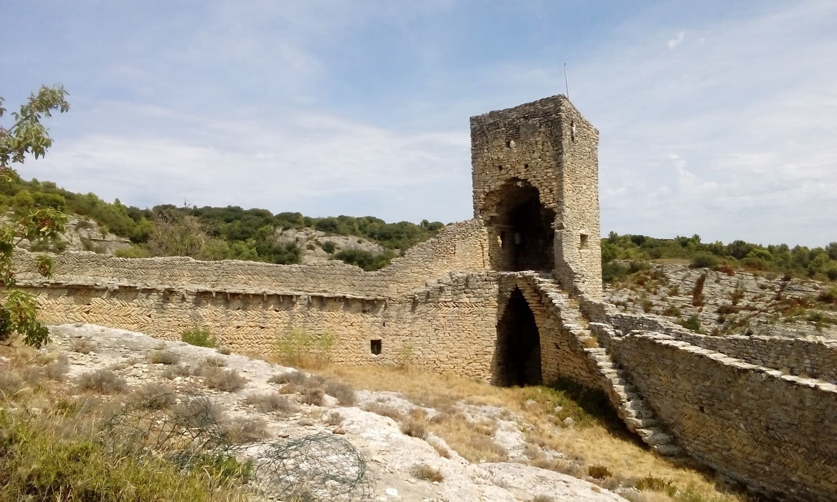
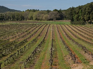
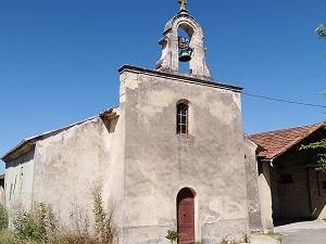
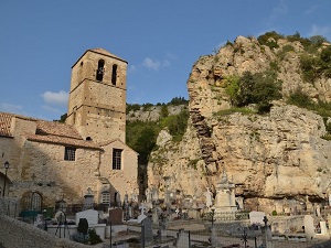
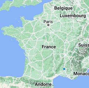
Starting from Mondragon, the trail climbs steeply through a forest of Aleppo pines and holm oaks, where the scent of thyme and rosemary accompanies every step towards Rochegude. This village, dominated by its majestic castle, marks the entrance to an area where the Côtes-du-Rhône wine region creates verdant checkerboard patterns at the foot of the siliceous hills. Crossing the heart of the massif towards Uchaux, one discovers unspoiled nature, dotted with old stone farmhouses and small Romanesque chapels nestled under the Provençal sun. The adventure culminates on the cliffs of Mornas, where the medieval fortress seems suspended above the Rhône Valley, offering a breathtaking view of the river and Mont Ventoux. This historic site, a true stone sentinel, tells the story of centuries of territorial defense against invasions.
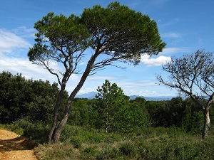
The Romans were the first to cultivate vines in this region. They also built aqueducts and roads which contributed to the development of viticulture. In the Middle Ages, the Uchaux massif was an important region for wine production. The monks of the abbey of Saint-André de Villeneuve-lès-Avignon owned vineyards in the region and contributed to the fame of Uchaux wines. Scrubland is a characteristic vegetation of the Uchaux massif. It is composed of aromatic plants, such as thyme, rosemary, and lavender. There are olive trees, oaks, pines, and many other trees and shrubs. You can see storks, herons, and eagles there.
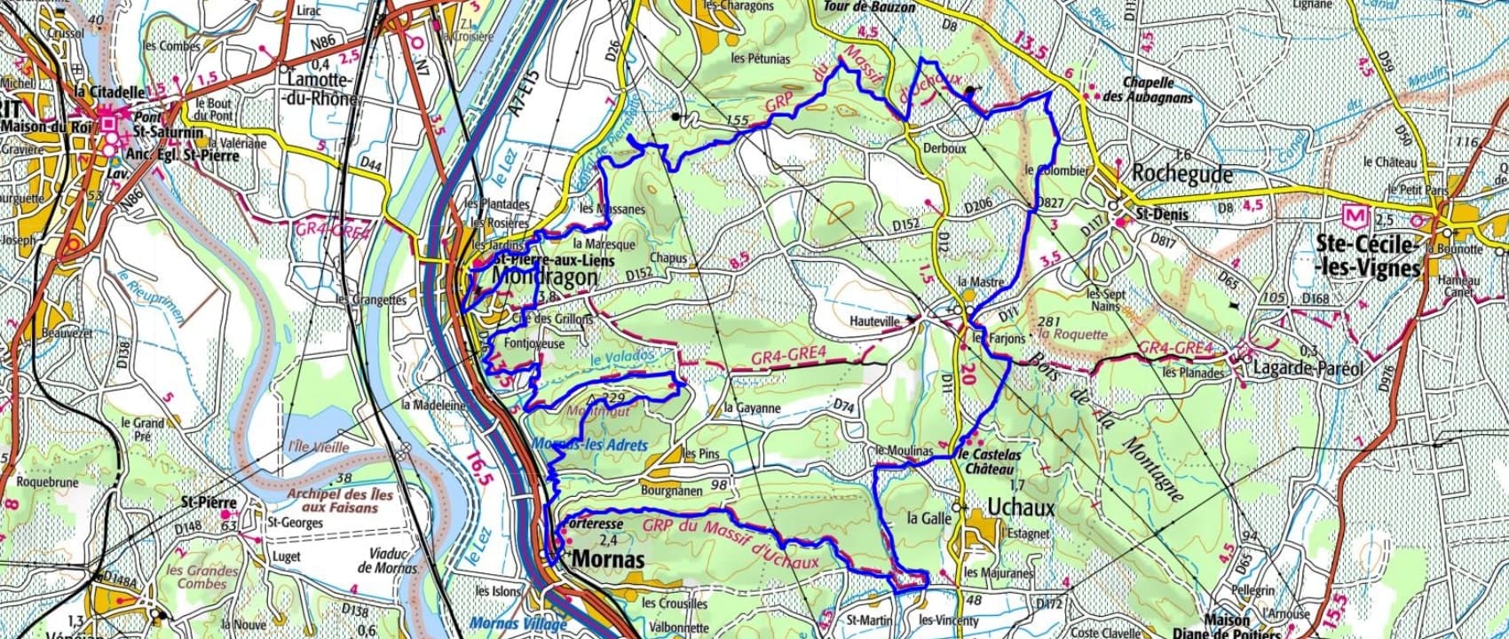
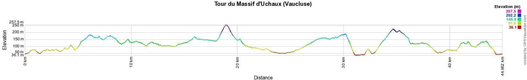
 Distance: 45km, Maximum elevation: 257m, Minimum elevation: 36m, Total ascent: 930m
IGN Maps: 3040OT - ORANGE MASSIF D'UCHAUX. 3039ET - VALRÉAS SAINT-PAUL-TROIS-CHÂTEAUX.
Nearby paths:
![]() It is advisable to follow the beacons all along your hike and to bring the FFRandonnée topo-guide. You will also find information on MonGR.fr.
It is advisable to follow the beacons all along your hike and to bring the FFRandonnée topo-guide. You will also find information on MonGR.fr.
GR®, PR®, GRP® and the corresponding markings are trademarks of the French Federation of Hiking. They may not be reproduced without permission. The French Federation of Hiking, state-approved, includes organizations that maintain hiking routes. It publishes guides for these routes. With your donations, support the actions of the thousands of volunteer markers of the FFRandonnée.
GR-Infos.com is an editorial partner of MonGR.fr.
| Return |

Former holiday hotel with a garden along the Allier, L'Etoile Guest House is located in La Bastide-Puylaurent between Lozere, Ardeche, and the Cevennes in the mountains of Southern France. At the crossroads of GR®7, GR®70 Stevenson Path, GR®72, GR®700 Regordane Way, GR®470 Allier River springs and gorges, GRP® Cevenol, Ardechoise Mountains, Margeride. Numerous loop trails for hiking and one-day biking excursions. Ideal for a relaxing and hiking getaway.
Copyright©gr-infos.com (Authorization for private use only)
To help us maintain and improve GR-Infos.com, a contribution of 2€ is desired via Wero or bank transfer. Thank you!