
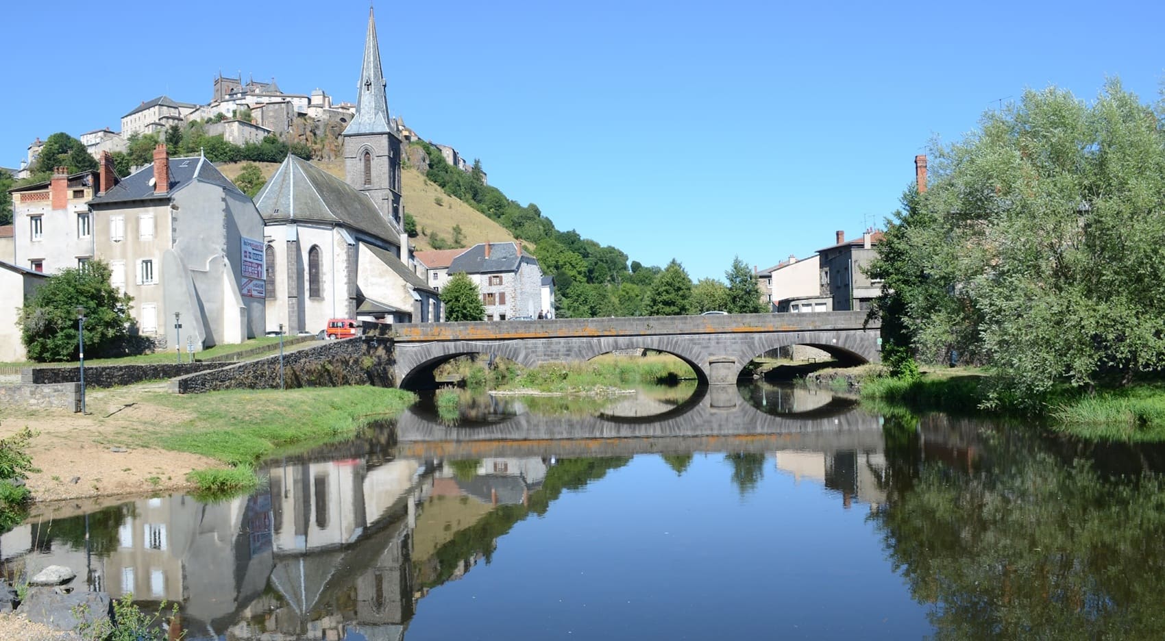
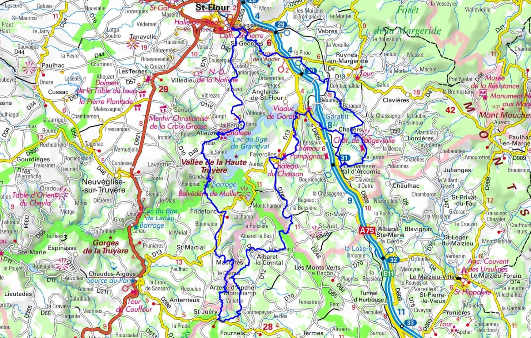
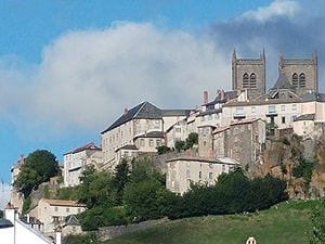
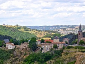
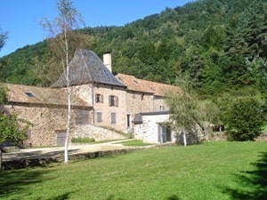
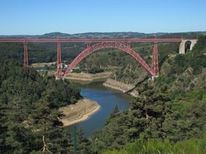
Starting from the medieval town of Saint-Flour, the trail first passes through Saint-Georges and Chaliers, a charming village clinging to its spur, before revealing the elegant metal structure of the Garabit Viaduct, a masterpiece by Gustave Eiffel that spans the gorges in a vibrant red. As you continue towards Val-d'Arcomie and Albaret-le-Comtal, the landscape becomes more austere, marked by granite and the vast plateaus of the Margeride. The heritage becomes more intimate in Saint-Juéry and Maurines, where the slate roofs bear witness to a rural architecture resilient to the mountain climate. Near Fridefont, viewpoints offer sweeping views of the meanders submerged by dams, creating veritable inland fjords where nature reclaims its domain. The adventure culminates in front of the romantic ruins of Alleuze Castle, a legendary fortress from the Hundred Years' War perched on its rocky outcrop in the middle of the waters.
The Truyère gorges create a spectacular landscape, deeply incised into the Aubrac plateau and the Cantal mountains, straddling the Lozère and Cantal departments. The landscape is characterized by a rugged relief carved from granite and basalt, with sheer walls now dominated by vast reservoirs. The modern history of these gorges is inextricably linked to the 20th-century construction of impressive hydroelectric dams. The flora is that of a dense, humid forest, composed of deciduous and coniferous trees clinging to the steep slopes. The fauna is rich, particularly along the river and lakes, where fish and birds of prey such as the red kite soar above this wild, industrial, and unspoiled territory.
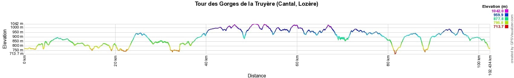

 Distance: 102km, Maximum elevation: 1041m, Minimum elevation: 727m, Total ascent: 2493m
IGN Maps: 2535SB - SAINT-FLOUR MURAT. 2536SB - CHAUDES-AIGUES FAVEROLLES GORGES DE LA TRUYÈRE. 2636SB - SAUGUES LE MALZIEU-VILLE MONT MOUCHET.

Nearby paths:
![]() It is advisable to follow the beacons all along your hike and to bring the FFRandonnée topo-guide. You will also find information on MonGR.fr.
It is advisable to follow the beacons all along your hike and to bring the FFRandonnée topo-guide. You will also find information on MonGR.fr.
GR®, PR®, GRP® and the corresponding markings are trademarks of the French Federation of Hiking. They may not be reproduced without permission. The French Federation of Hiking, state-approved, includes organizations that maintain hiking routes. It publishes guides for these routes. With your donations, support the actions of the thousands of volunteer markers of the FFRandonnée.
GR-Infos.com is an editorial partner of MonGR.fr.
| Return |

Former holiday hotel with a garden along the Allier, L'Etoile Guest House is located in La Bastide-Puylaurent between Lozere, Ardeche, and the Cevennes in the mountains of Southern France. At the crossroads of GR®7, GR®70 Stevenson Path, GR®72, GR®700 Regordane Way, GR®470 Allier River springs and gorges, GRP® Cevenol, Ardechoise Mountains, Margeride. Numerous loop trails for hiking and one-day biking excursions. Ideal for a relaxing and hiking getaway.
Copyright©gr-infos.com (Authorization for private use only)
To help us maintain and improve GR-Infos.com, a contribution of 2€ is desired via Wero or bank transfer. Thank you!