
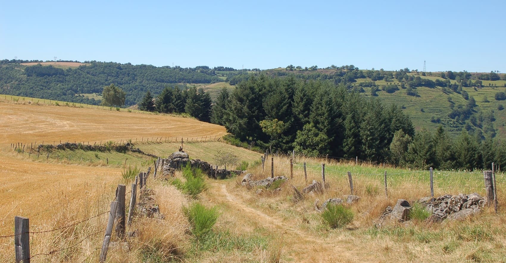
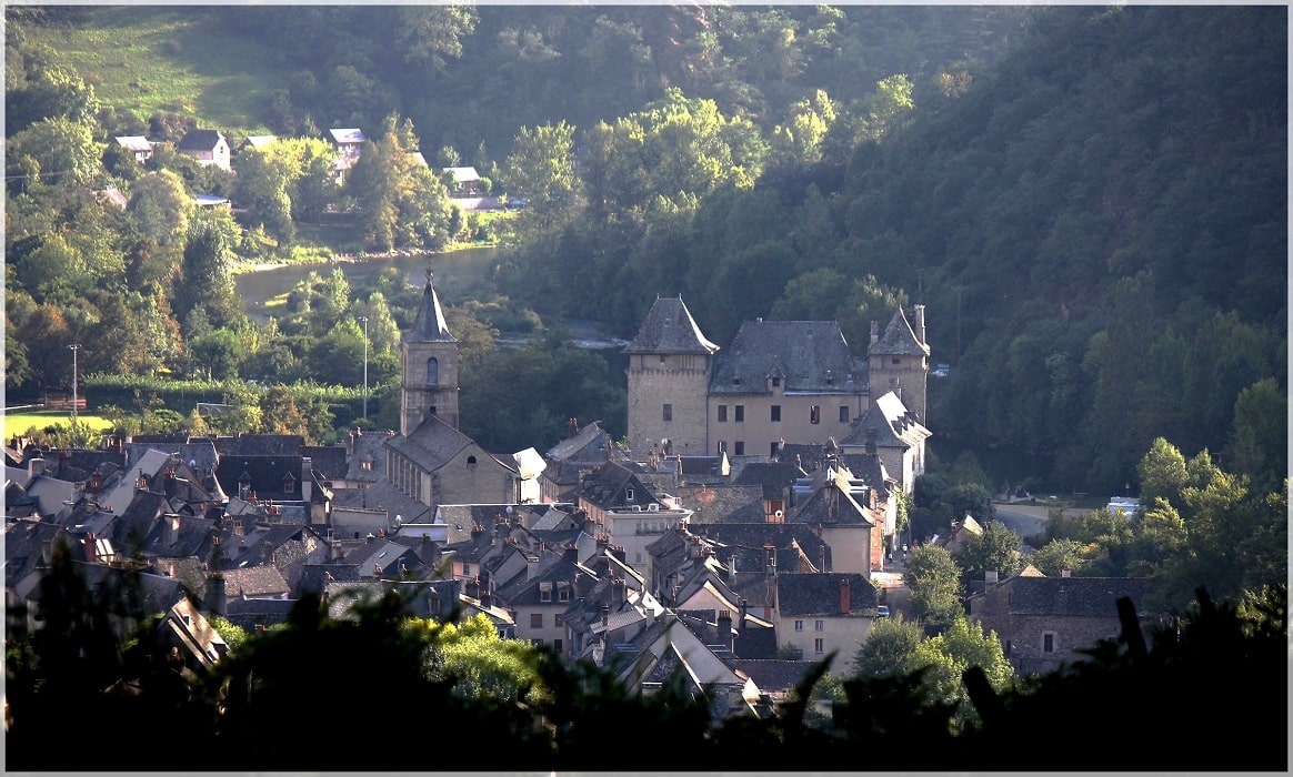
Starting from Entraygues-sur-Truyère, the trail climbs towards Golinhac and its Romanesque church, offering panoramic views of the Aubrac mountains, before descending to Espeyrac, a medieval village built on granite. Wild nature unfolds through wooded gorges and steep slopes where schist dominates the landscape. Historical heritage reasserts itself in Saint-Hippolyte, with its characterful houses overlooking the valley, and in Campouriez, sentinel of the high plateau. This hike is an immersion into the soul of the Entraygues region, between mountain vineyards and listed Gothic bridges. Hikers cross chestnut forests and pastures where the silence is broken only by the murmur of water. Each stage tells the story of a land of passage, shaped by pilgrims and the power of mountain streams. The journey ends at the foot of the towers of Entraygues Castle.
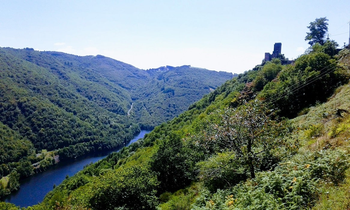
The Truyère and Lot valleys form a wild link between the Cantal and Aveyron regions, where water has carved breathtaking gorges. On the Truyère side, the landscape is marked by human engineering with the impressive dams of Sarrans and Grandval, overlooked by the majestic Garabit viaduct, a work by Gustave Eiffel. Watchtowers and Romanesque churches dot these steep-sided valleys. Between the Aubrac plateau and the Cantal mountains, these valleys tell a story of passage and resistance. The Camin d’Olt, which literally means the “Lot Way” in Occitan, has a history inextricably linked to that of the Lot River, a vital communication route since antiquity, which has sculpted fertile valleys and spectacular meanders at the foot of the Aubrac plateau. Originally, these paths were used by boatmen, merchants, and farmers who connected medieval strongholds to agricultural lands. Beyond its economic function, the Camin d’Olt long served as a relief route and link for pilgrims heading towards Conques on the Via Podiensis (GR®65).
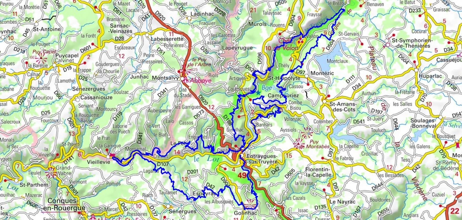
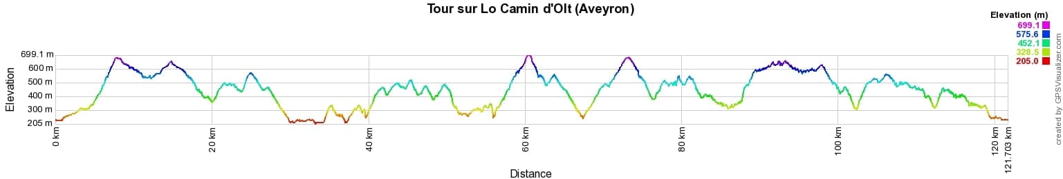


 Distance: 122km, Elevation maximum: 699m, Elevation minimum: 205m, Elevation gain uphill: 4723m
IGN Maps: 2337SB - MAURS / MONTSALVY. 2338SB - DECAZEVILLE / MARCILLAC-VALLON / CONQUES. 2437SB - LAGUIOLE / ENTRAYGUES-SUR-TRUYERE. 2438SB - ESPALION / ESTAING.
|
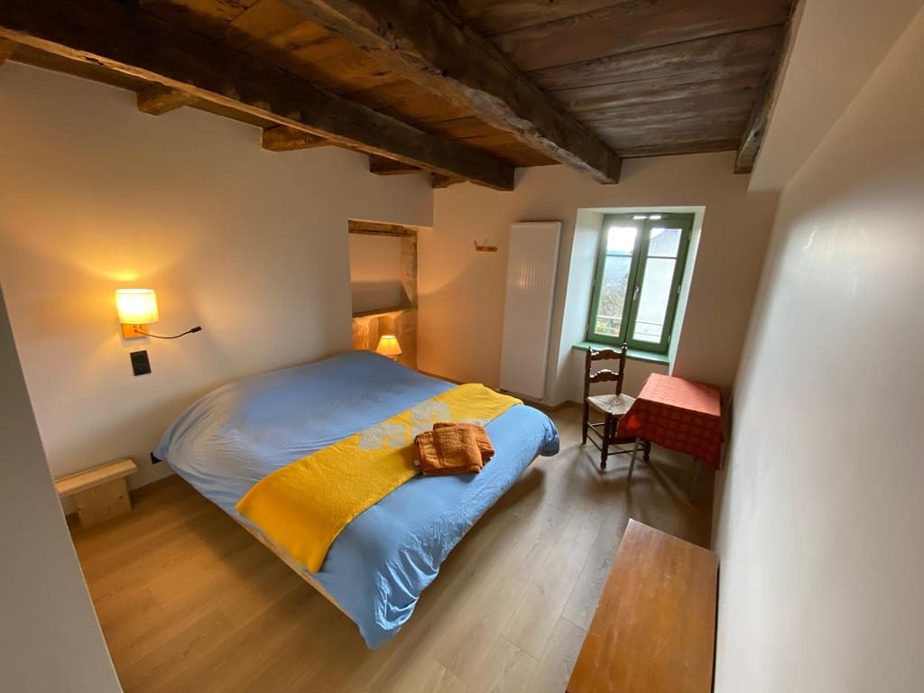
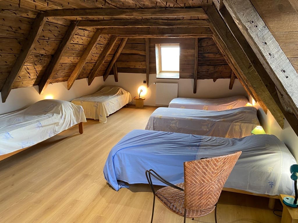
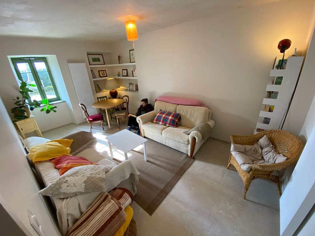
Le Fel: Le Nid de Roussy Stopover gite, 06 19 34 35 19, Email. |
|
Nearby paths:
![]() It is advisable to follow the beacons all along your hike and to bring the FFRandonnée topo-guide. You will also find information on MonGR.fr.
It is advisable to follow the beacons all along your hike and to bring the FFRandonnée topo-guide. You will also find information on MonGR.fr.
GR®, PR®, GRP® and the corresponding markings are trademarks of the French Federation of Hiking. They may not be reproduced without permission. The French Federation of Hiking, state-approved, includes organizations that maintain hiking routes. It publishes guides for these routes. With your donations, support the actions of the thousands of volunteer markers of the FFRandonnée.
GR-Infos.com is an editorial partner of MonGR.fr.
| Return |

Former holiday hotel with a garden along the Allier, L'Etoile Guest House is located in La Bastide-Puylaurent between Lozere, Ardeche, and the Cevennes in the mountains of Southern France. At the crossroads of GR®7, GR®70 Stevenson Path, GR®72, GR®700 Regordane Way, GR®470 Allier River springs and gorges, GRP® Cevenol, Ardechoise Mountains, Margeride. Numerous loop trails for hiking and one-day biking excursions. Ideal for a relaxing and hiking getaway.
Copyright©gr-infos.com (Authorization for private use only)
To help us maintain and improve GR-Infos.com, a contribution of 2€ is desired via Wero or bank transfer. Thank you!