
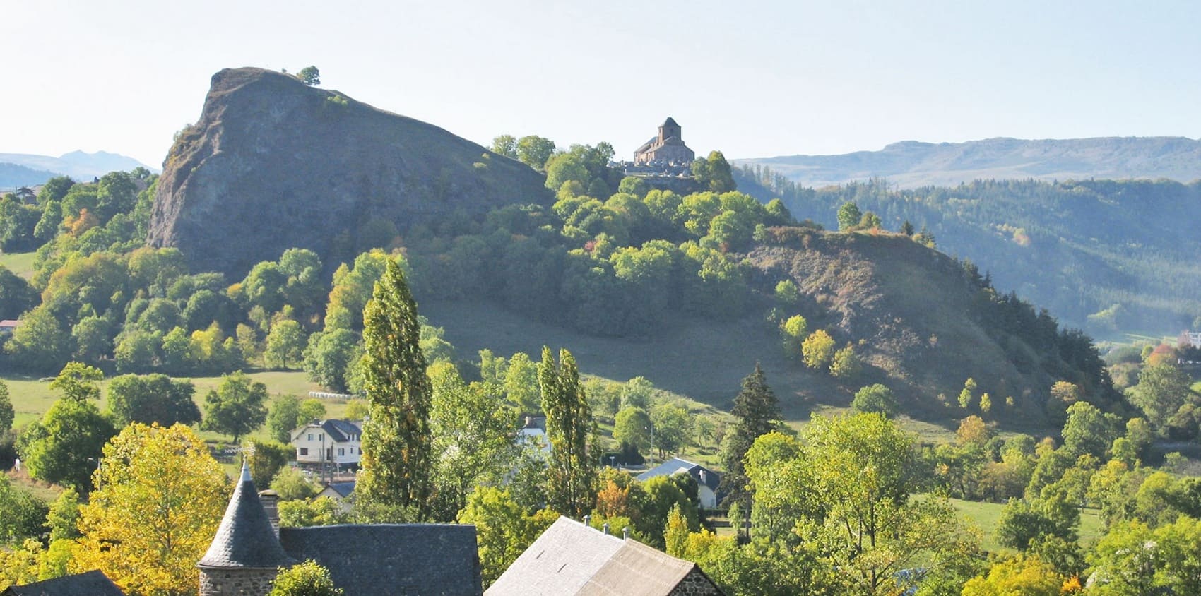
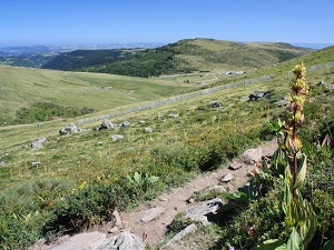
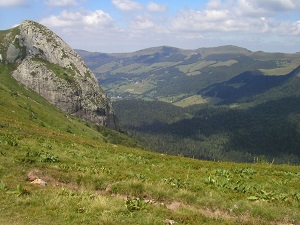
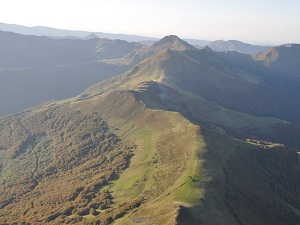
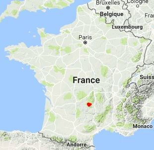
The GR®400, culminating at the Plomb du Cantal (1,855 m), is characterized by a unique radial geography where ancient glacial valleys radiate outwards from iconic peaks such as Puy Mary and Puy Griou. Historically, this route is inextricably linked to pastoralism and the "cow mountains," where cheese was once made in *burons*—the isolated stone huts that still dot the ridges. The built heritage, marked by the robustness of basalt and slate, is revealed in charming villages like Falgoux and Mandailles. The trail traverses landscapes of magnificent cirques and verdant summer pastures, which serve as havens of exceptional biodiversity. Marmots, chamois, and mouflon are easily spotted, while birds of prey soar high above the heather moors.
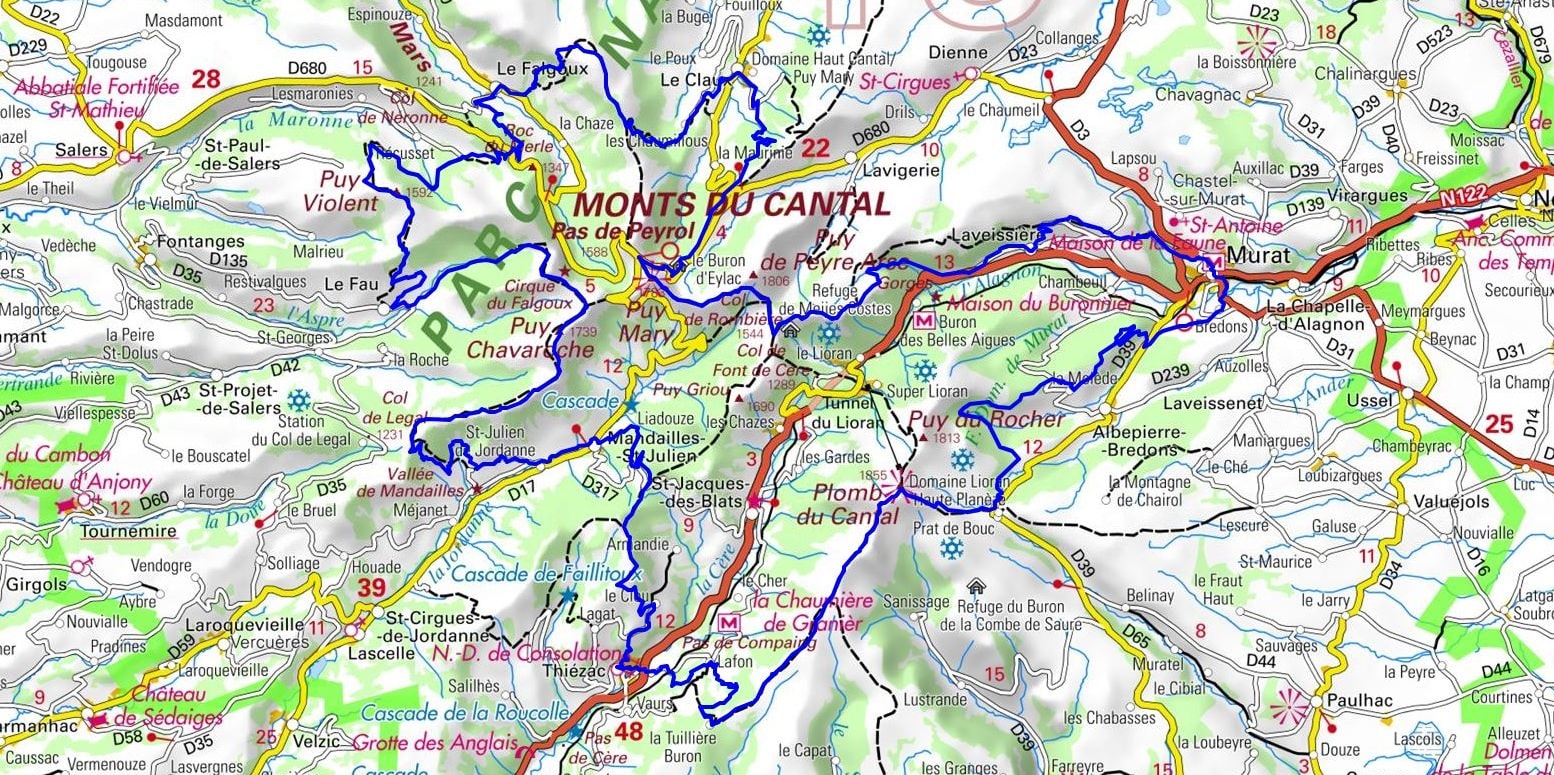
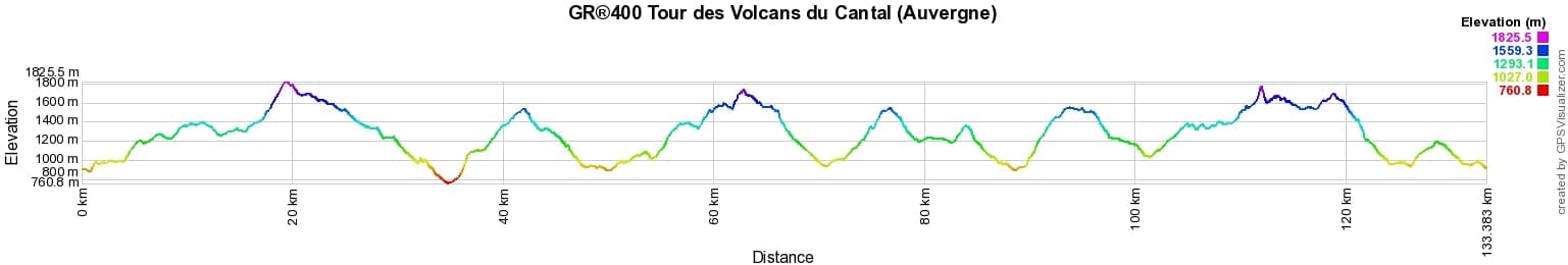
 Distance: 134.31km, Elevation maximum: 1818m, Elevation minimum: 766m, Elevation gain uphill: 6416m
IGN Maps: 2535SB - SAINT-FLOUR MURAT. 2435OT - MONTS DU CANTAL PNR DES VOLCANS D'AUVERGNE. 2436SB - VIC-SUR-CÈRE PIERREFORT.
Nearby paths:
![]() It is advisable to follow the beacons throughout your itinerary and to take the Fédération Française de la Randonnée Pédestre topo-guide with you. You will also find information on MonGR.fr.
It is advisable to follow the beacons throughout your itinerary and to take the Fédération Française de la Randonnée Pédestre topo-guide with you. You will also find information on MonGR.fr.
GR®, PR®, GRP®, and the corresponding signs of markings (white / red, yellow and yellow / red) are trademarks of the French Federation of Hiking. They may not be reproduced without permission. The French Federation of Hiking, state-approved, includes organizations that create and maintain hiking routes on GR®, PR®, and GRP®. It publishes guides for these topo hiking routes. With your donations, you support the actions of the thousands of FFRandonnée volunteer markers.
GR-Infos.com is an editorial partner of MonGR.fr.
| Return |

Former holiday hotel with a garden along the Allier, L'Etoile Guest House is located in La Bastide-Puylaurent between Lozere, Ardeche, and the Cevennes in the mountains of Southern France. At the crossroads of GR®7, GR®70 Stevenson Path, GR®72, GR®700 Regordane Way, GR®470 Allier River springs and gorges, GRP® Cevenol, Ardechoise Mountains, Margeride. Numerous loop trails for hiking and one-day biking excursions. Ideal for a relaxing and hiking getaway.
Copyright©gr-infos.com (Authorization for private use only)
To help us maintain and improve GR-Infos.com, a contribution of 2€ is desired via Wero or bank transfer. Thank you!