
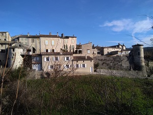
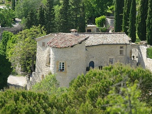
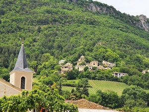
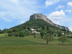
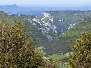
The Gervanne Valley offers a wild and scenic route starting from Beaufort-sur-Gervanne, a medieval village standing guard over the southern Vercors mountains. The trail winds its way towards Mirabel-et-Blacons, where the industrial heritage of the former paper mills stands alongside unspoiled nature. Ascending towards Gigors-et-Lozeron, hikers discover a limestone plateau that feels like the edge of the world, rich in exceptional flora and offering panoramic views of the Trois Becs peaks. The Plan-de-Baix stop reveals the majestic Druise waterfall, while the arrival in Léoncel is marked by the understated elegance of its 12th-century Cistercian abbey, a jewel of high-altitude Romanesque art. The route descends via Eygluy-Escoulin, crossing boxwood forests and vertiginous cliffs where large birds of prey nest. Between the olive groves of the lower valley and the alpine pastures of the upper country, the landscape bears witness to a fascinating transition between Provençal and mountain influences.
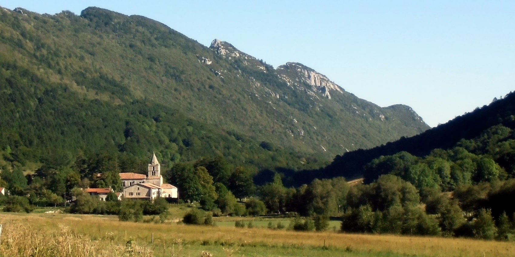
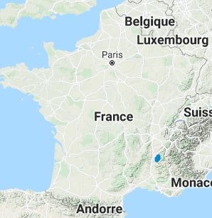
The Gervanne is both the name of a river and the valley it has carved out in the Drôme department, in the Auvergne-Rhône-Alpes region. This tributary of the Drôme springs from the heights of the Vercors massif, near the Col de la Bataille, at an altitude of about 1,200 meters. The river, known for its clear waters, flows generally from north to south before joining the Drôme at Mirabel-et-Blacons. The region lies at the crossroads of mountain and Mediterranean climates, offering a rich diversity of landscapes: forests, steep cliffs, and spectacular waterfalls, including the famous Chute de la Druise. The valley is a preserved area, largely included in the Vercors Regional Natural Park. It is particularly appreciated by hikers who can follow the Grand Tour de la Gervanne, a Grande Randonnée de Pays (GRP®) trail of about one hundred kilometers, renowned for its significant elevation gain and the discovery of picturesque villages like Beaufort-sur-Gervanne.
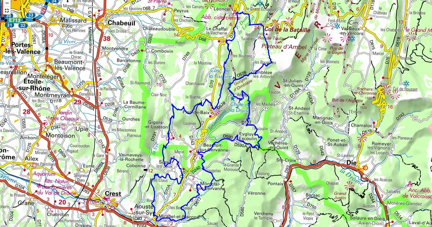
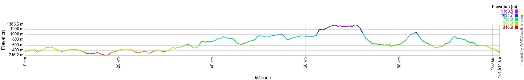
 Distance: 90km, Elevation maximum: 1384m, Elevation minimum: 215m, Elevation gain uphill: 4119m
IGN Maps: 3136ET - COMBE-LAVAL / FORÊT DE LENTE / PNR DU VERCORS. 3136SB - BOURG-DE-PÉAGE/CHABEUIL. 3137OT - DIE / CREST / PNR DU VERCORS.
Nearby paths:
![]() It is advisable to follow the trail markers all along your hike and to bring the FFRandonnée topo-guide. You will also find information on MonGR.fr.
It is advisable to follow the trail markers all along your hike and to bring the FFRandonnée topo-guide. You will also find information on MonGR.fr.
GR®, PR®, GRP® and the corresponding markings are trademarks of the French Federation of Hiking. They may not be reproduced without permission. The French Federation of Hiking, state-approved, includes organizations that maintain hiking routes. It publishes guides for these routes. With your donations, support the actions of the thousands of volunteer markers of the FFRandonnée.
GR-Infos.com is an editorial partner of MonGR.fr.
| Return |

Former holiday hotel with a garden along the Allier, L'Etoile Guest House is located in La Bastide-Puylaurent between Lozere, Ardeche, and the Cevennes in the mountains of Southern France. At the crossroads of GR®7, GR®70 Stevenson Path, GR®72, GR®700 Regordane Way, GR®470 Allier River springs and gorges, GRP® Cevenol, Ardechoise Mountains, Margeride. Numerous loop trails for hiking and one-day biking excursions. Ideal for a relaxing and hiking getaway.
Copyright©gr-infos.com (Authorization for private use only)
To help us maintain and improve GR-Infos.com, a contribution of 2€ is desired via Wero or bank transfer. Thank you!