
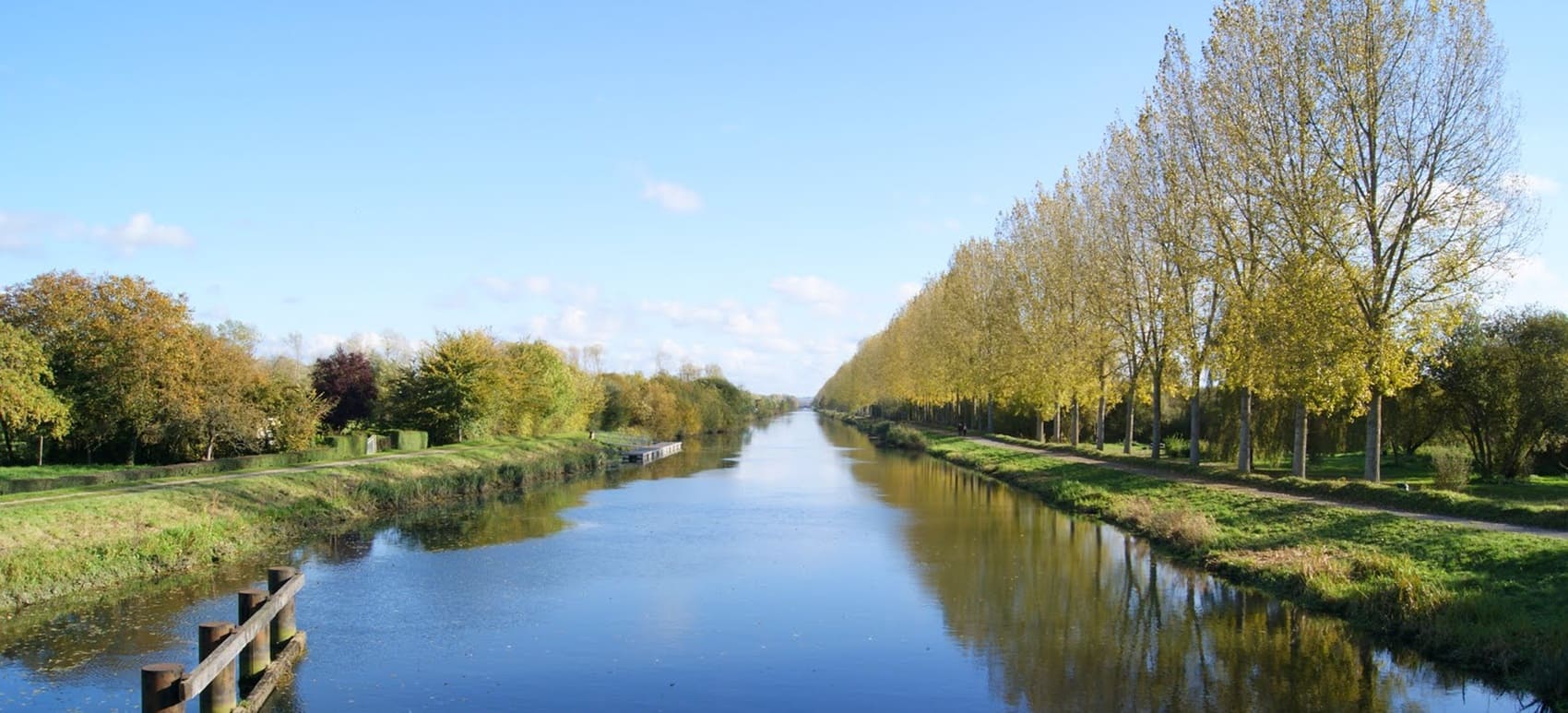
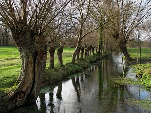
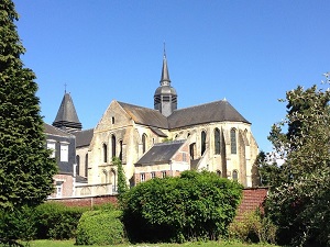
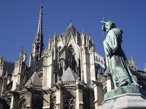
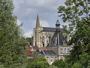
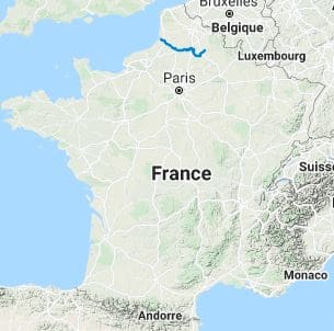
The GR800, the true waterway of the Hauts-de-France region, follows the Somme River from its source to its mouth. The trail meanders first through bucolic landscapes and verdant valleys before reaching Saint-Quentin and its majestic basilica. The route then reaches Amiens, famous for its Gothic cathedral and its renowned Hortillonnages, a labyrinth of floating gardens where nature reigns supreme. Between Abbeville and the sea, the river widens, revealing exceptional biodiversity with reedbeds and protected marshes, havens for migratory birds. The journey culminates in the Bay of Somme, at Saint-Valery-sur-Somme, where the ever-changing light and the vastness of the estuary offer one of the most beautiful seascapes in Europe.
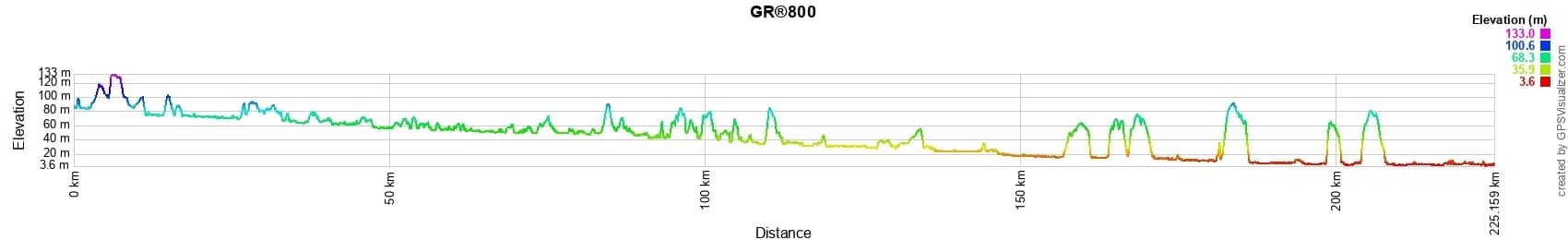

 Distance: 225km, Maximum elevation: 133m, Minimum elevation: 4m, Total ascent: 946m
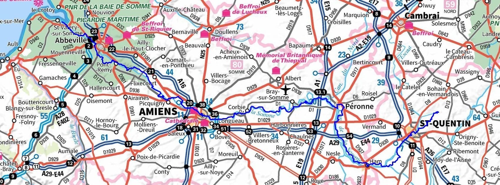
IGN Maps : 2408SB - ALBERT / BRAY-SUR-SOMME. 2508SB - PERONNE / ROISEL. 2509SB - HAM / NESLE. 2608SB - BOHAIN-EN-VERMANDOIS / VILLERS-OUTREAUX. 2609SB - SAINT-QUENTIN. 2308SB - AMIENS / CORBIE. 2207SB - ABBEVILLE / DOMART-EN-PONTHIEU. 2208SB - HALLENCOURT / MOLLIENS / DREUIL. 2107OT - LE TREPORT / SAINT-VALERY-SUR-SOMME / BAIE DE SOMME.
Nearby paths:
![]() It is advisable to follow the beacons all along your hike and to bring the FFRandonnee topo-guide with you. You will also find information on MonGR.fr.
It is advisable to follow the beacons all along your hike and to bring the FFRandonnee topo-guide with you. You will also find information on MonGR.fr.
GR®, PR®, GRP®, and the corresponding signs of markings (white / red, yellow and yellow / red) are trademarks of the French Federation of Hiking. They may not be reproduced without permission. The French Federation of Hiking, state-approved, includes organizations that create and maintain hiking routes on GR®, PR® and GRP®. It publishes guides for these topo hiking routes. With your donations, you support the actions of the thousands of volunteer markers of the FFRandonnee.
GR-Infos.com is an editorial partner of MonGR.fr.
| Return |

Former holiday hotel with a garden along the Allier, L'Etoile Guest House is located in La Bastide-Puylaurent between Lozere, Ardeche, and the Cevennes in the mountains of Southern France. At the crossroads of GR®7, GR®70 Stevenson Path, GR®72, GR®700 Regordane Way, GR®470 Allier River springs and gorges, GRP® Cevenol, Ardechoise Mountains, Margeride. Numerous loop trails for hiking and one-day biking excursions. Ideal for a relaxing and hiking getaway.
Copyright©gr-infos.com (Authorization for private use only)
To help us maintain and improve GR-Infos.com, a contribution of 2€ is desired via Wero or bank transfer. Thank you!