
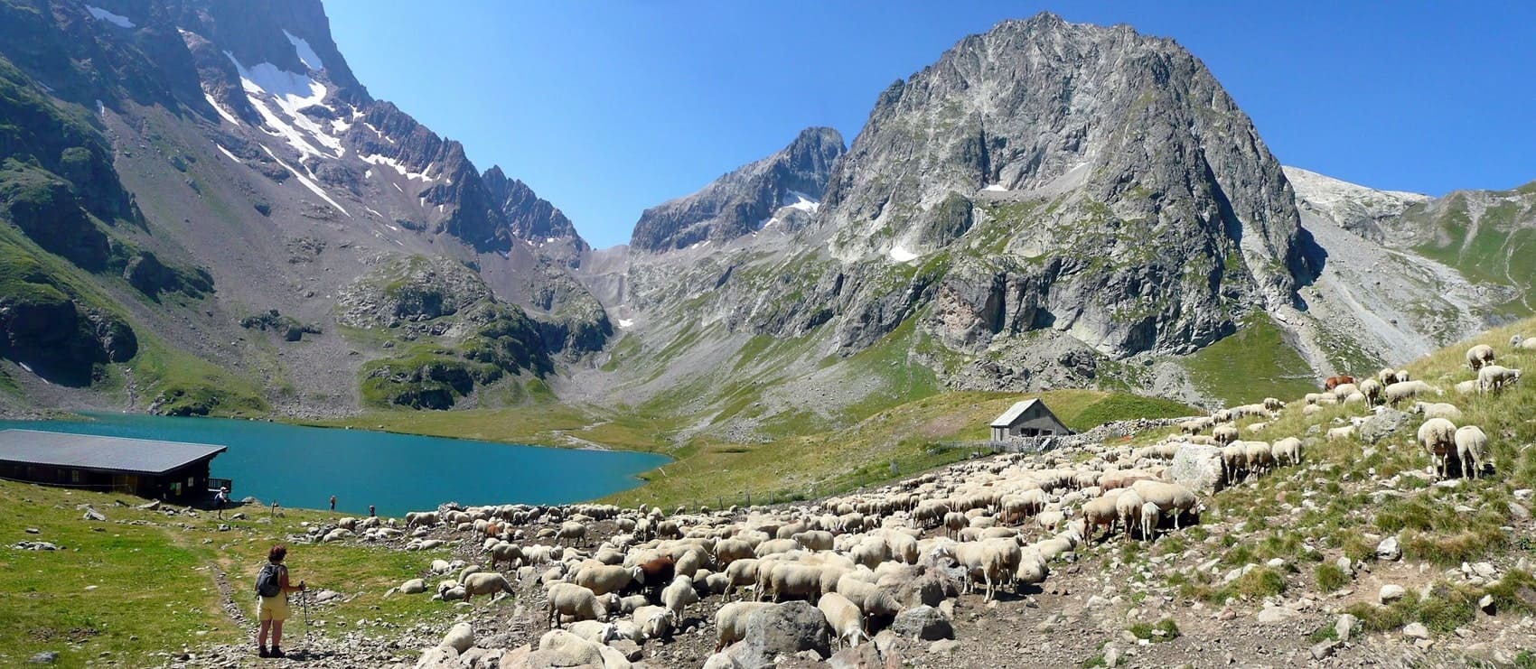
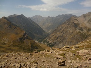
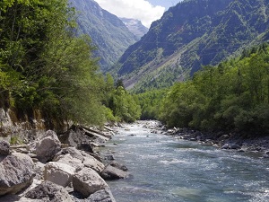
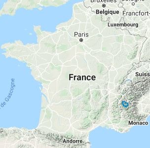
Considered one of the wildest long-distance hiking trails in Europe, the GR®54 encircles the Oisans and Écrins mountain ranges for approximately 180 kilometres. This legendary route traverses spectacular high-mountain landscapes, marked by iconic peaks such as La Meije and the Barre des Écrins, and crosses challenging mountain passes exceeding 2,500 metres. In terms of nature, hikers explore a sanctuary where chamois graze on steep slopes and golden eagles soar above cirques. The flora is exceptional, with rare Arctic-Alpine plants and extensive meadows of wildflowers during summer, making this one of the most rewarding mountain circuits in France.
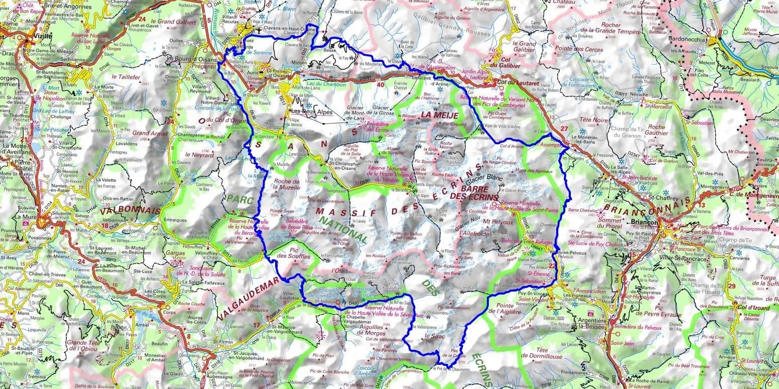
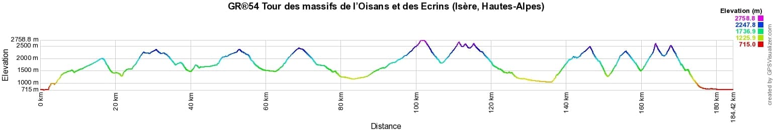
 Distance: 184km, Elevation maximum: 2759m, Elevation minimum: 717m, Elevation gain uphill: 11982m
Nearby paths:
![]() It is advisable to follow the beacons all along your hike and to bring the FFRandonnée topo-guide. You will also find information on MonGR.fr.
It is advisable to follow the beacons all along your hike and to bring the FFRandonnée topo-guide. You will also find information on MonGR.fr.
GR®, PR®, GRP®, and the corresponding signs of markings (white/red, yellow and yellow/red) are trademarks of the French Federation of Hiking. They may not be reproduced without permission. The French Federation of Hiking, state-approved, includes organizations that create and maintain hiking routes on GR®, PR® and GRP®. It publishes topo-guides for these hiking routes. With your donations, support the actions of the thousands of volunteer markers of the FFRandonnée.
GR-Infos.com is an editorial partner of MonGR.fr.
| Return |

Former holiday hotel with a garden along the Allier, L'Etoile Guest House is located in La Bastide-Puylaurent between Lozere, Ardeche, and the Cevennes in the mountains of Southern France. At the crossroads of GR®7, GR®70 Stevenson Path, GR®72, GR®700 Regordane Way, GR®470 Allier River springs and gorges, GRP® Cevenol, Ardechoise Mountains, Margeride. Numerous loop trails for hiking and one-day biking excursions. Ideal for a relaxing and hiking getaway.
Copyright©gr-infos.com (Authorization for private use only)
To help us maintain and improve GR-Infos.com, a contribution of 2€ is desired via Wero or bank transfer. Thank you!