
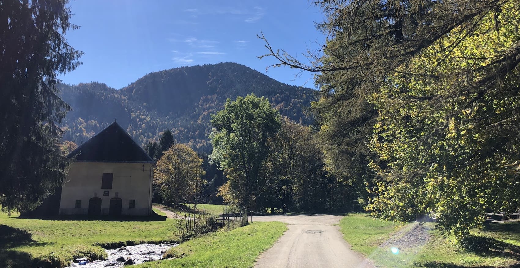
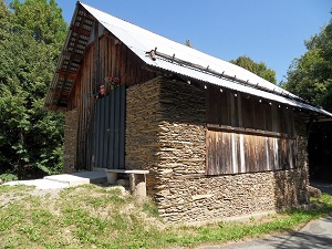
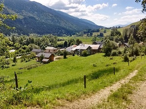
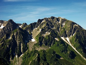
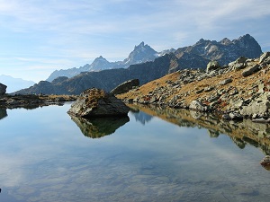
The GR738 pays homage to the pastoral and mining past of the massif, where iron was once extracted. From the north, the ascent towards the Col de la Perche and Col de la Perrière plunges hikers into a world of granite solitude, far from ski lifts. The demanding and technical route then crosses the Col de l'Aigleton to reveal magnificent panoramas of the sharp peaks of the range, a veritable crystal spine. Water is the other jewel of this journey: the legendary Lac du Crozet, with its famous spillway that feels like the end of the world, reflects the surrounding peaks before the trail reaches the Chamrousse resort. The final descent towards Vizille crosses the Lac Luitel National Nature Reserve, the oldest in France, protecting an exceptional peat bog and a fragile biodiversity inherited from the last ice age.
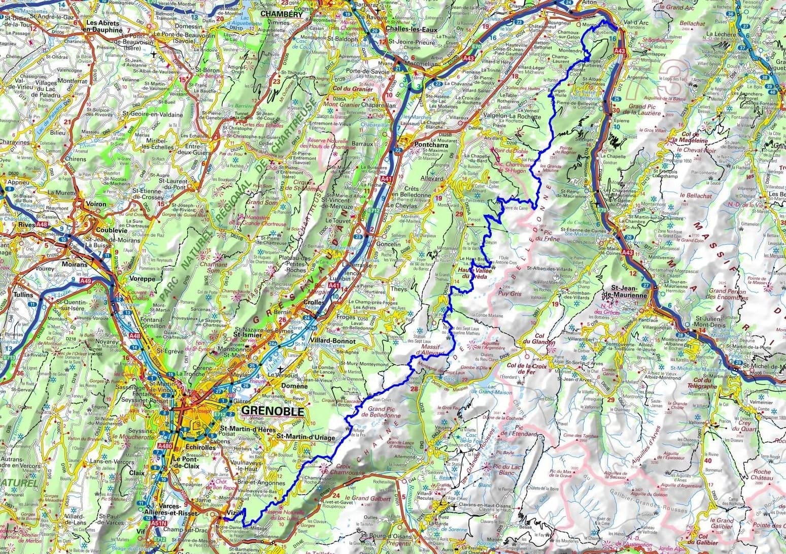
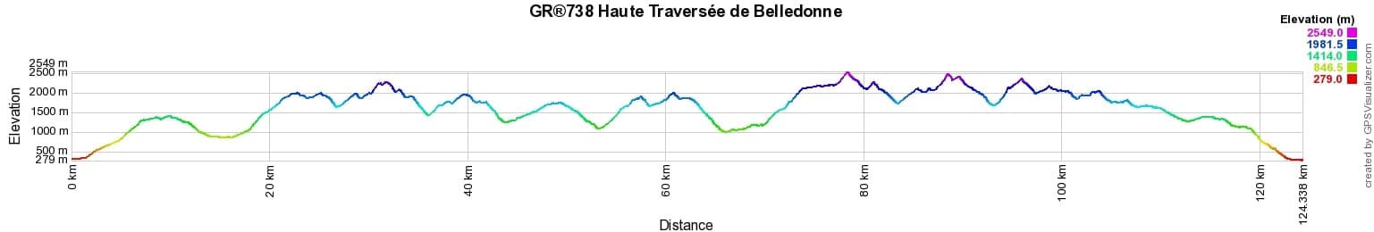
 Distance: 124.78km, Maximum elevation: 2551m, Minimum elevation: 279m, Total ascent: 10159m
IGN Maps: 3334OT - MASSIF DE LA CHARTREUSE SUD / SAINT-PIERRE-DE-CHARTREUSE / VILLARD-BONNOT. 3335ET - LE BOURG-D'OISANS / L'ALPE D'HUEZ / GRANDES-ROUSSES / SEPT LAUX. 3335OT - GRENOBLE / CHAMROUSSE / BELLEDONNE. 3432ET - ALBERTVILLE. 3432OT - MASSIF DES BAUGES. 3433OT - ALLEVARD / BELLEDONNE NORD.
Nearby paths:
![]() It is advisable to follow the beacons all along your hike and to bring the FFRandonnee topo-guide with you. You will also find information on MonGR.fr.
It is advisable to follow the beacons all along your hike and to bring the FFRandonnee topo-guide with you. You will also find information on MonGR.fr.
GR®, PR®, GRP®, and the corresponding signs of markings (white / red, yellow and yellow / red) are trademarks of the French Federation of Hiking. They may not be reproduced without permission. The French Federation of Hiking, state-approved, includes organizations that create and maintain hiking routes on GR®, PR® and GRP®. It publishes guides for these topo hiking routes. With your donations, you support the actions of the thousands of volunteer markers of the FFRandonnee.
GR-Infos.com is an editorial partner of MonGR.fr.
| Return |

Former holiday hotel with a garden along the Allier, L'Etoile Guest House is located in La Bastide-Puylaurent between Lozere, Ardeche, and the Cevennes in the mountains of Southern France. At the crossroads of GR®7, GR®70 Stevenson Path, GR®72, GR®700 Regordane Way, GR®470 Allier River springs and gorges, GRP® Cevenol, Ardechoise Mountains, Margeride. Numerous loop trails for hiking and one-day biking excursions. Ideal for a relaxing and hiking getaway.
Copyright©gr-infos.com (Authorization for private use only)
To help us maintain and improve GR-Infos.com, a contribution of 2€ is desired via Wero or bank transfer. Thank you!