
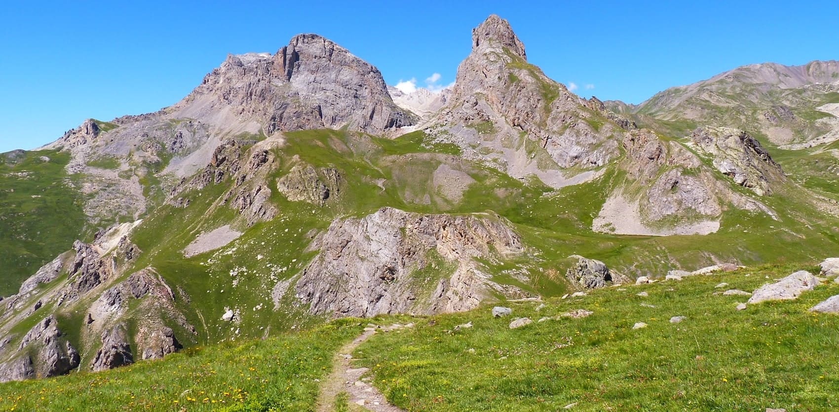
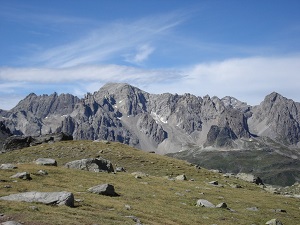
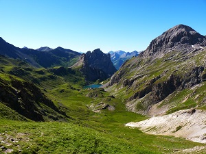
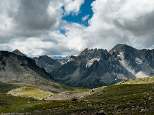
Dominating the Clarée Valley from its 3,178-metre summit, Mont Thabor is an iconic peak of the Hautes-Alpes, which was part of Italy until 1947. Its lunar and barren landscape, composed of quartzites and breccia, offers a striking contrast to the emerald lakes that dot its ascent. In terms of heritage, the Notre-Dame-du-Thabor chapel, perched near the summit, bears witness to a long history of devotion. The flora, adapted to the harsh Alpine conditions, includes edelweiss and various saxifrages. The chamois, ibex and marmot share this high-altitude territory, making the GR®57 an exceptional circuit for lovers of wild and remote mountain landscapes.
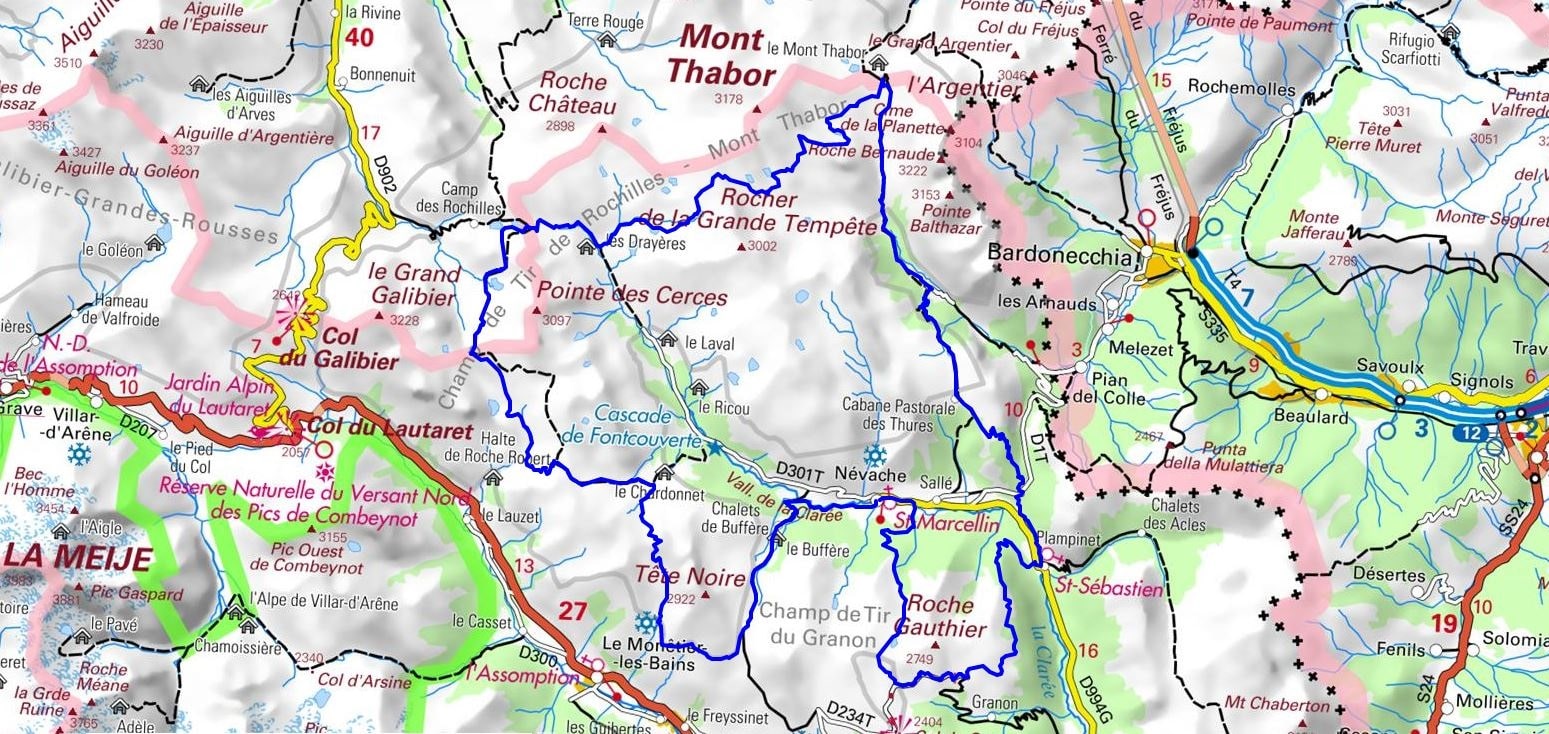
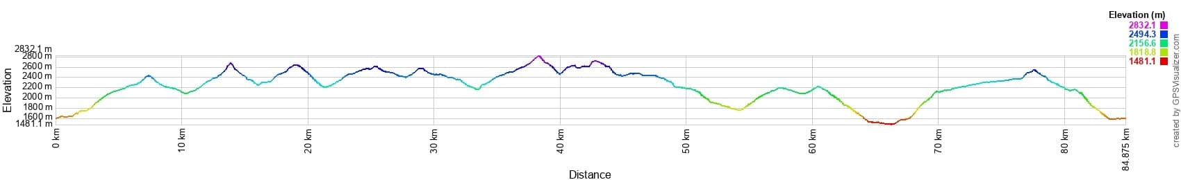
 Distance: 84km, Elevation maximum: 2829m, Elevation minimum: 1480m, Elevation gain uphill: 5152m
Nearby paths:
![]() It is advisable to follow the beacons all along your hike and to bring the FFRandonnée topo-guide. You will also find information on MonGR.fr.
It is advisable to follow the beacons all along your hike and to bring the FFRandonnée topo-guide. You will also find information on MonGR.fr.
GR®, PR®, GRP®, and the corresponding signs of markings (white/red, yellow and yellow/red) are trademarks of the French Federation of Hiking. They may not be reproduced without permission. The French Federation of Hiking, state-approved, includes organizations that create and maintain hiking routes on GR®, PR® and GRP®. It publishes topo-guides for these hiking routes. With your donations, support the actions of the thousands of volunteer markers of the FFRandonnée.
GR-Infos.com is an editorial partner of MonGR.fr.
| Return |

Former holiday hotel with a garden along the Allier, L'Etoile Guest House is located in La Bastide-Puylaurent between Lozere, Ardeche, and the Cevennes in the mountains of Southern France. At the crossroads of GR®7, GR®70 Stevenson Path, GR®72, GR®700 Regordane Way, GR®470 Allier River springs and gorges, GRP® Cevenol, Ardechoise Mountains, Margeride. Numerous loop trails for hiking and one-day biking excursions. Ideal for a relaxing and hiking getaway.
Copyright©gr-infos.com (Authorization for private use only)
To help us maintain and improve GR-Infos.com, a contribution of 2€ is desired via Wero or bank transfer. Thank you!