|
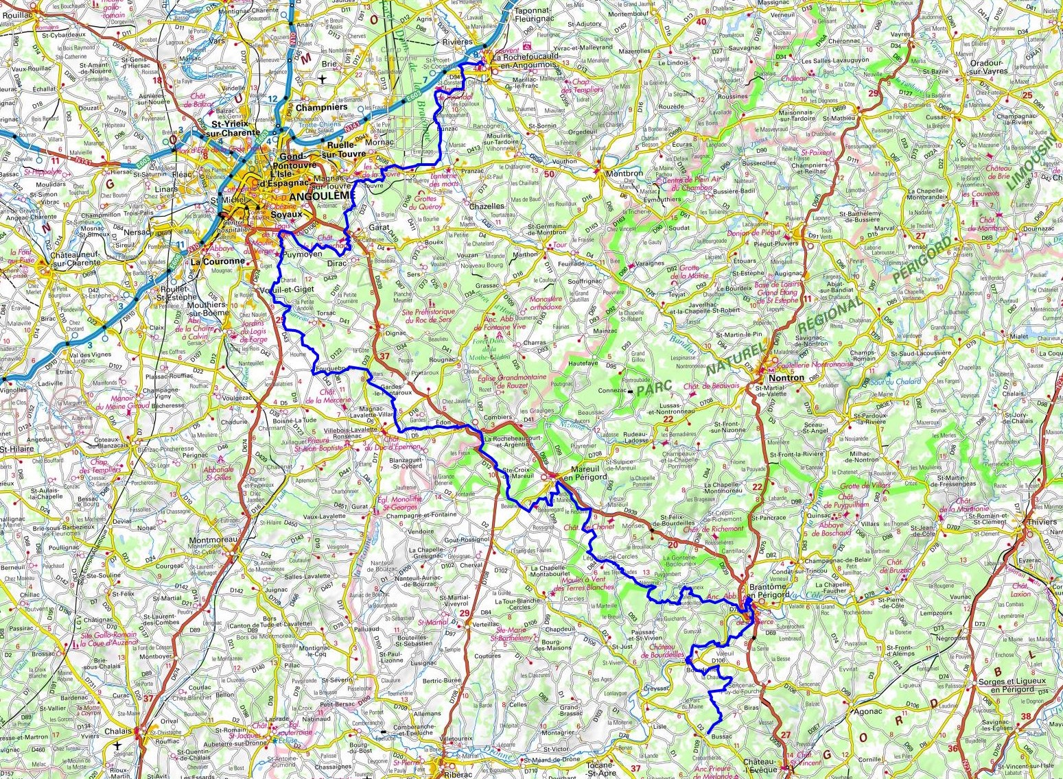
Hike on the GR®36 through Charente and Dordogne department from La Rochefoucauld to Bussac via Pranzac, Touvre, Dirac, Puymoyen, Fouquebrune, Edon,
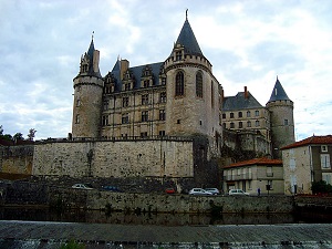
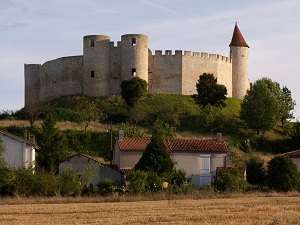
Mareuil, Jovelle, Boulouneix, Brantome and Valeuil. Guest House, Bed and Breakfast, Hotel, Camping, Shelter, Inn, Shops.
|

|

GR®36
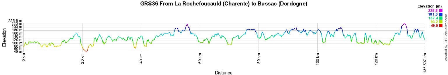
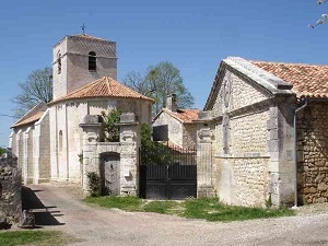
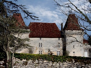
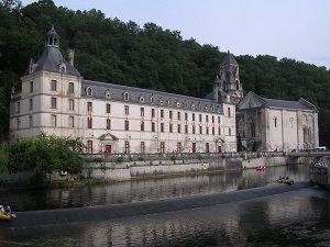
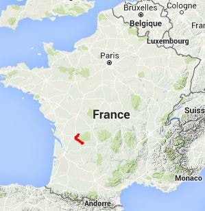
From La Rochefoucauld (Charente) to Bussac (Dordogne)
From Channel to Pyrenees
136km
Google Maps - Google Earth

© GPX Private use only |
Distance: 136km, Elevation maximum: 227m, Elevation minimum: 46m, Elevation gain uphill: 1751m
IGN Maps: Angouleme Est / Ruelle-sur-Touvre (1732E). Angouleme (1732O). Villebois-Lavalette (1733E). La
Rochefoucauld (1831O). Nontron (1833E). Mareuil (Dordogne). (1833O) Perigueux (1934O).

Registration
Accommodation or business owner on or near a GR®, you can appear on GR-INFOS
For your registration, you can send me by email (papadimitriou4@gmail.com): your address and phone number, your website (Facebook page), a brief description with 5 beautiful photos of your establishment.
Registration price : 100€/5 years per GR® or GRP®. Renewable. |
|
GR®36 From Channel to Pyrenees
From Ouistreham (Calvados) to Putanges-Pont-Ecrepin (Orne)
From Putanges-Pont-Ecrepin (Orne) to Mont-Saint-Jean (Sarthe)
From Mont-Saint-Jean to St Mars-d'Outille (Sarthe)
From St Mars-d'Outille (Sarthe) to Allonnes (Maine-et-Loire)
From Allonnes (Maine-et-Loire) to Gourge (Deux-Sevres)
From Gourge to Chize (Deux-Sevres)
From Chize (Deux-Sevres) to La Rochefoucauld (Charente)
From La Rochefoucauld (Charente) to Bussac (Dordogne)
From Bussac to Les Eyzies-de-Tayac-Sireuil (Dordogne)
From Les Eyzies-de-Tayac-Sireuil (Dordogne) to Prayssac (Lot)
From Prayssac (Lot) to Savignac (Aveyron)
From Savignac (Aveyron) to Marsal (Tarn)
From Marsal to Cambounes (Tarn)
From Cambounes (Tarn) to Ribaute (Aude)
From Ribaute (Aude) to Sournia (Pyrenees-Orientales)
From Sournia to Bourg-Madame (Pyrenees-Orientales)
Wikipedia GR®36
 It is advisable to follow the beacons all along your hike and to bring you the FFRandonnee topo-guide. You
will also find information on MonGR.fr.
It is advisable to follow the beacons all along your hike and to bring you the FFRandonnee topo-guide. You
will also find information on MonGR.fr.
GR®, PR®, GRP®, and the corresponding signs of markings (white / red, yellow and yellow / red) are trademarks of the French
Federation of Hiking. They may not be reproduced without permission. The French Federation of Hiking, state-approved, includes organizations that create and maintain hiking routes on GR®, PR® and
GRP®. It publishes guides these topo hiking routes.
With your donations, support the actions of the thousands of volunteer markers of the FFRandonnee.
GR-Infos.com is an editorial partner of MonGR.fr.

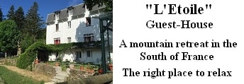
Old romantic Hotel, L'Etoile Guest-House is a mountain retreat in the South of France. With a
beautiful park along the Allier River, L'Etoile Guesthouse is located in La Bastide-Puylaurent between Lozere, Ardeche and Cevennes. Many hiking trails like
GR®7, GR®70 Stevenson trail, GR®72, GR®700 Regordane way, Cevenol, GR®470 Allier river,
Margeride, Ardechoise. Many hiking loops. The right place to relax.
Copyright©gr-infos.com (Authorization for private use only)