
|
|
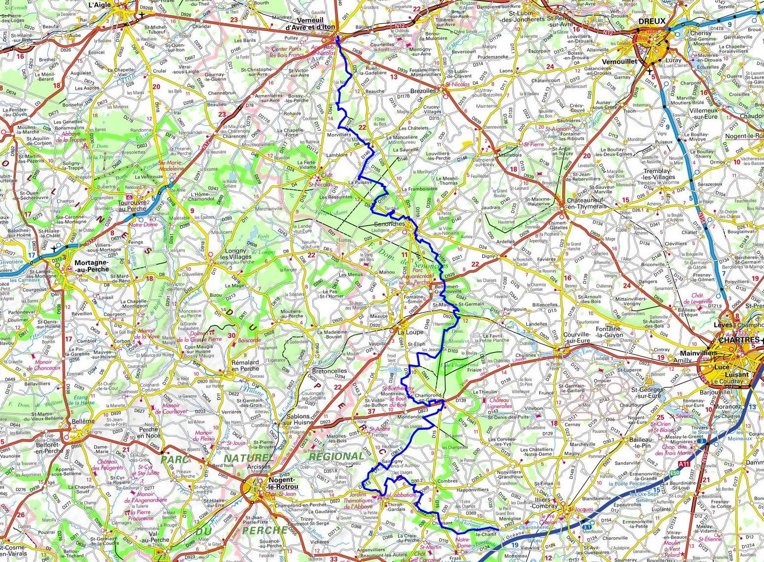
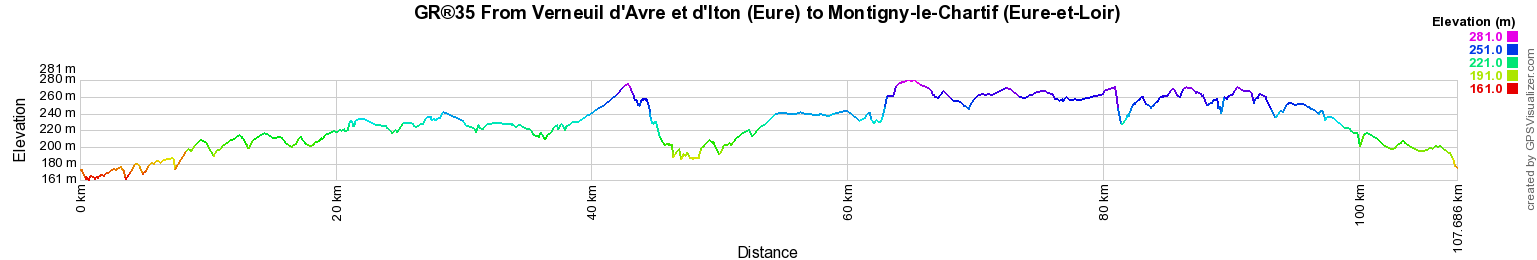
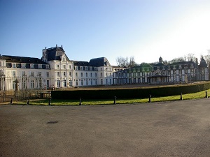
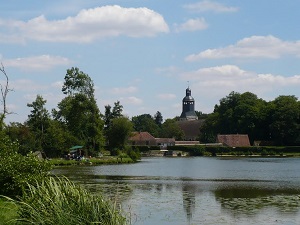
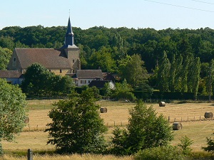
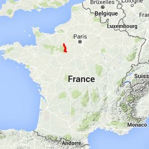
Hike on the GR®35 through Eure and Eure-et-Loir department from Verneuil d'Avre et d'Iton to Montigny-le-Chartif via La Puisaye, Senonches, Fontaine-Aubert, Champrond-en-Gatine, Les Mussets and Thiron-Gardais. Guest House, Bed and Breakfast, Hotel, Camping, Shelter, Inn, Shops. |

107km
|
 © GPX Private use only |
Distance: 107km, Elevation maximum: 289m, Elevation minimum: 159m, Elevation gain uphill: 664m
IGN
Maps: Verneuil d'Avre et d'Iton (1915E). La Loupe (1916E). Thiron-Gardais (1917E). Chateauneuf-en-Thymerais
(2016O). Illiers-Combray (2017O).
Registration Accommodation or business owner on or near a GR®, you can appear on GR-INFOS For your registration, you can send me by email (papadimitriou4@gmail.com): your address and phone number, your website (Facebook page), a brief description with 5 beautiful photos of your establishment. Registration price : 100€/5 years per GR® or GRP®. Renewable. |
|
GR®35 From Verneuil d'Avre et d'Iton (Eure) to Rochefort-sur-Loire (Maine-et-Loire)
From Verneuil d'Avre et d'Iton (Eure) to Montigny-le-Chartif (Eure-et-Loir)
From Montigny-le-Chartif (Eure-et-Loir) to Pezou (Loir-et-Cher)
From Pezou (Loir-et-Cher) to Vaas (Sarthe)
From Vaas (Sarthe) to Rochefort-sur-Loire (Maine-et-Loire)
![]() It is advisable to follow the beacons all along your hike and to bring you the FFRandonnee topo-guide. You
will also find information on MonGR.fr.
It is advisable to follow the beacons all along your hike and to bring you the FFRandonnee topo-guide. You
will also find information on MonGR.fr.
GR®, PR®, GRP®, and the corresponding signs of markings (white / red, yellow and yellow / red) are trademarks of the French Federation of Hiking. They may not be reproduced without permission. The French Federation of Hiking, state-approved, includes organizations that create and maintain hiking routes on GR®, PR® and GRP®. It publishes guides these topo hiking routes.
With your donations, support the actions of the thousands of volunteer markers of the FFRandonnee.
GR-Infos.com is an editorial partner of MonGR.fr.

| Return |
Old romantic Hotel, L'Etoile Guest-House is a mountain retreat in the South of France. With a beautiful park along the Allier River, L'Etoile Guesthouse is located in La Bastide-Puylaurent between Lozere, Ardeche and Cevennes. Many hiking trails like GR®7, GR®70 Stevenson trail, GR®72, GR®700 Regordane way, Cevenol, GR®470 Allier river, Margeride, Ardechoise. Many hiking loops. The right place to relax.
Copyright©gr-infos.com (Authorization for private use only)