GR France. Long Hiking Trails. Long Distance Footpaths

GR®35

From La Loupe (Eure-et-Loir) to Rochefort-sur-Loire (Maine-et-Loire)

Chemins de Grandes Randonnees

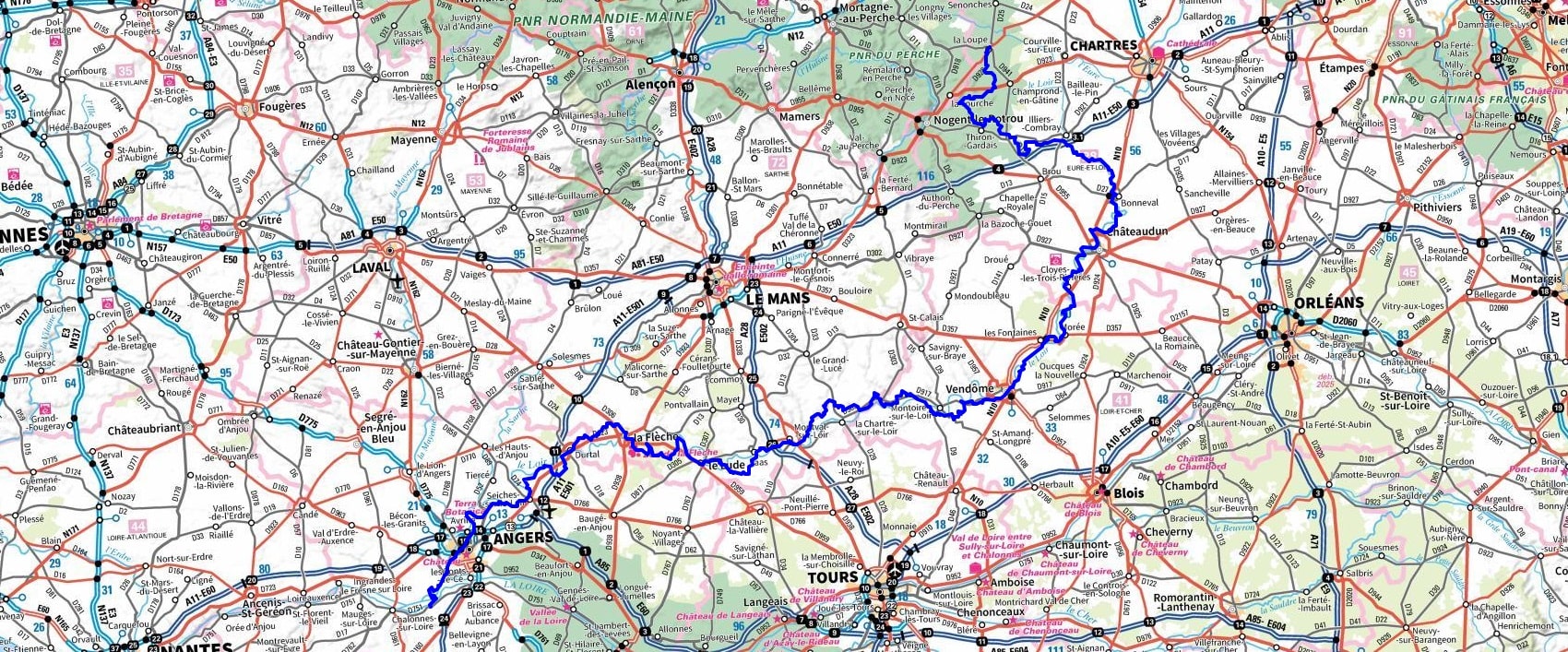
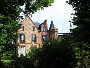
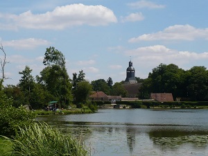
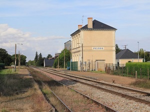
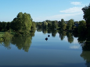
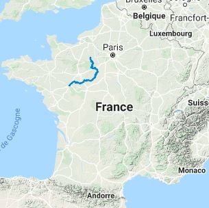
The GR®35, between Perche and Anjou along the Loir Valley, winds its way between verdant hills and Percheron manor houses before entering the Loir-et-Cher department, where history is etched on the facades of castles and charming towns like Montoire-sur-le-Loir. The landscape then transforms into Maine-et-Loire, revealing vine-covered hillsides and troglodytic dwellings carved into the white tufa stone. Nature here is punctuated by the meanders of the river, where grey herons and kingfishers thrive amidst protected deciduous forests. The influence of the Counts of Anjou and poets like Ronsard accompanies the hiker to the edge of the Sarthe department, offering an immersion in a rural and unspoiled France. As you approach Rochefort-sur-Loire, the terrain becomes slightly more pronounced, opening up spectacular panoramas of the confluence of the Loire and the Louet rivers.

GR®35 Hiking from La Loupe (Eure-et-Loir) to Rochefort-sur-Loire (Maine-et-Loire)

Eure-et-Loir is characterized by varied landscapes, ranging from river valleys, such as that of the Eure, to hills. Agricultural land predominates, particularly wheat fields. The flora includes meadows, deciduous forests, and hedgerows. Deer and roe deer can be found there. Loir-et-Cher is renowned for its bocage landscapes, valleys, and chateaux. The region is home to a diverse flora, with vineyards, forests, and wetlands. The fauna includes many species of migratory and resident birds, as well as mammals like wild boars and foxes. Sarthe is characterized by hilly landscapes, valleys, and vast plateaus, complemented by rivers such as the Sarthe and the Loir. The diversity of habitats allows for a rich flora, including species of oak, birch, and conifers. The fauna includes species such as the green woodpecker, heron, and roe deer, as well as pollinating insects. Maine-et-Loire presents a great diversity of landscapes, from the vineyards of Anjou to the valleys of the Loire. There are also many rivers and slopes. The region is rich in biodiversity, with vineyards, forests, and wetlands. The fauna includes species such as the European mink, aquatic birds, and various mammals.

Google Maps - Google Earth

GR35 Hiking from La Loupe (Eure-et-Loir) to Rochefort-sur-Loire (Maine-et-Loire) 1

GR35 Hiking from La Loupe (Eure-et-Loir) to Rochefort-sur-Loire (Maine-et-Loire) 2

GR35 Hiking from La Loupe (Eure-et-Loir) to Rochefort-sur-Loire (Maine-et-Loire) 3GR35 Hiking from La Loupe (Eure-et-Loir) to Rochefort-sur-Loire (Maine-et-Loire) 4GR35 Hiking from La Loupe (Eure-et-Loir) to Rochefort-sur-Loire (Maine-et-Loire) 5GR35 Hiking from La Loupe (Eure-et-Loir) to Rochefort-sur-Loire (Maine-et-Loire) 6GR35 Hiking from La Loupe (Eure-et-Loir) to Rochefort-sur-Loire (Maine-et-Loire) 7

GR35 Hiking from La Loupe (Eure-et-Loir) to Rochefort-sur-Loire (Maine-et-Loire) 9
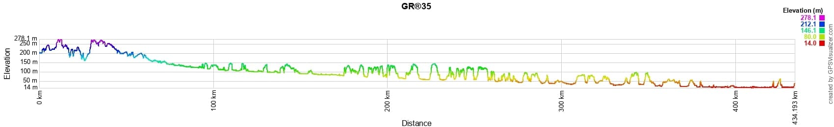
Distance: 434km, Elevation maximum: 277m, Elevation minimum: 14m, Elevation gain uphill: 2947m
IGN Maps: La Loupe (1916E). Thiron-Gardais (1917E). Chateauneuf-en-Thymerais (2016O). Illiers-Combray (2017O).
Bailleau-le-Pin (2017E). Chateaudun (2018E). La Chapelle-du-Noyer (2019E). Cloyes-sur-le-Loir (2019O). St-Ouen Selommes (2020O). Foret de Berce Chateau-du-Loir (1720ET). Chateau-la-Valliere (1721E). La Chartre-sur-le-Loir (1820E). Chateau-du-Loir (1821O). Vendome (1920E). Montoire-sur-le-Loir (1920O). St-Ouen Selommes (2020O). La Fleche (1620E). Bauge (1621E). Durtal (1621O). Le Lude (1721O).


GR35 Hiking from La Loupe (Eure-et-Loir) to Rochefort-sur-Loire (Maine-et-Loire) 10Nearby paths:
GR®3 Loire River trail
GR®22 Mont Saint-Michel trail
GR®36 From Channel to Pyrenees
GR®235 From La Touzeliere to La Vallee de la Flotte (Sarthe)
GR®365 From La Chapelle-Janson (Ille-et-Vilaine) to Durtal (Maine-et-Loire)
GR®655 Via Turonensis

Mon GRIt is advisable to follow the beacons all along your hike and to bring you the FFRandonnee topo-guide. You will also find information on MonGR.fr.

GR®, PR®, GRP®, and the corresponding signs of markings (white / red, yellow and yellow / red) are trademarks of the French Federation of Hiking. They may not be reproduced without permission. The French Federation of Hiking, state-approved, includes organizations that create and maintain hiking routes on GR®, PR® and GRP®. It publishes guides these topo hiking routes. With your donations, support the actions of the thousands of volunteer markers of the FFRandonnee.

GR-Infos.com is an editorial partner of MonGR.fr.


Return


L'Etoile Guesthouse between Cevennes, Ardeche and Lozere in the South of France

Former holiday hotel with a garden along the Allier, L'Etoile Guest House is located in La Bastide-Puylaurent between Lozere, Ardeche, and the Cevennes in the mountains of Southern France. At the crossroads of GR®7, GR®70 Stevenson Path, GR®72, GR®700 Regordane Way, GR®470 Allier River springs and gorges, GRP® Cevenol, Ardechoise Mountains, Margeride. Numerous loop trails for hiking and one-day biking excursions. Ideal for a relaxing and hiking getaway.

Copyright©gr-infos.com (Authorization for private use only)