
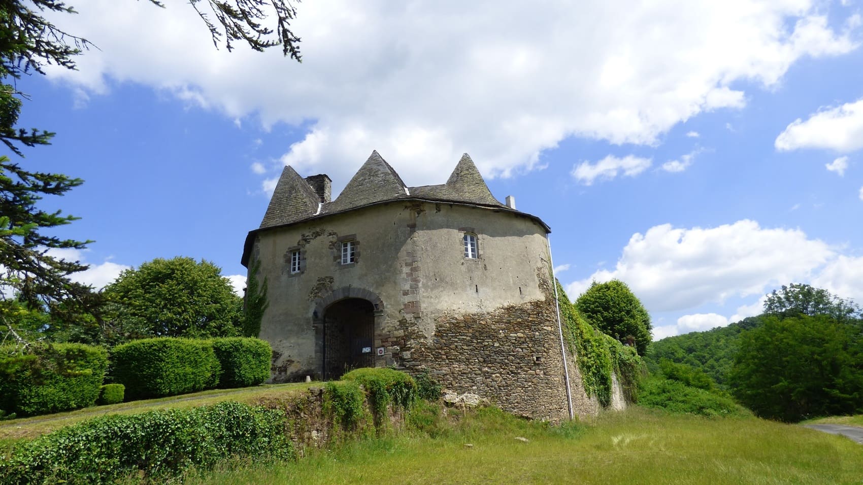
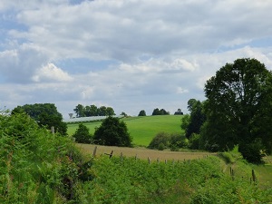
Starting from Vigeois, the trail climbs towards Meyvialle and Bleygeat, offering glimpses of the narrow, steep-sided river winding below. The built heritage is revealed in the hamlets of Le Mas and Le Theil, where the stone houses bear witness to a preserved rural architecture. Passing through Estivaux and Pouch, the trail enters a lush natural landscape of oak and chestnut forests, havens for a subtle biodiversity. The route continues through La Roche and Vertougit, highlighting the steepness of the terrain and revealing spectacular views of the valley's meanders. Local history is palpable near Bourzat and Rouffignac, former rural strongholds where the silence is broken only by the murmur of the water. The path then winds through Le Bois-de-Bourzat and the hamlets of Viallevaleix, offering total immersion in a landscape of hedgerows and cool undergrowth.
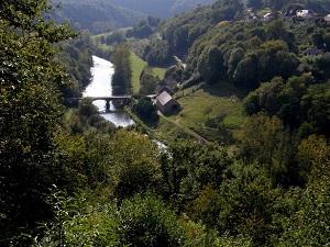
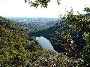
The Vézère gorges in Corrèze offer a wild and rugged landscape, a stark contrast to the plains of southwestern France. The river has carved its bed into the granite and schist bedrock of the Millevaches Plateau, creating steep cliffs and spectacular meanders. The flora is typical of a cool, damp environment, characterized by dense deciduous and coniferous forests, as well as a wide variety of mosses and ferns. The history of these gorges is linked to the harshness of the Limousin region and, more recently, to hydroelectric power, with several dams transforming the river's course into lakes. Wildlife is well-preserved, with the presence of the European otter and numerous fish species, notably trout, in the clear waters near picturesque villages like Treignac.
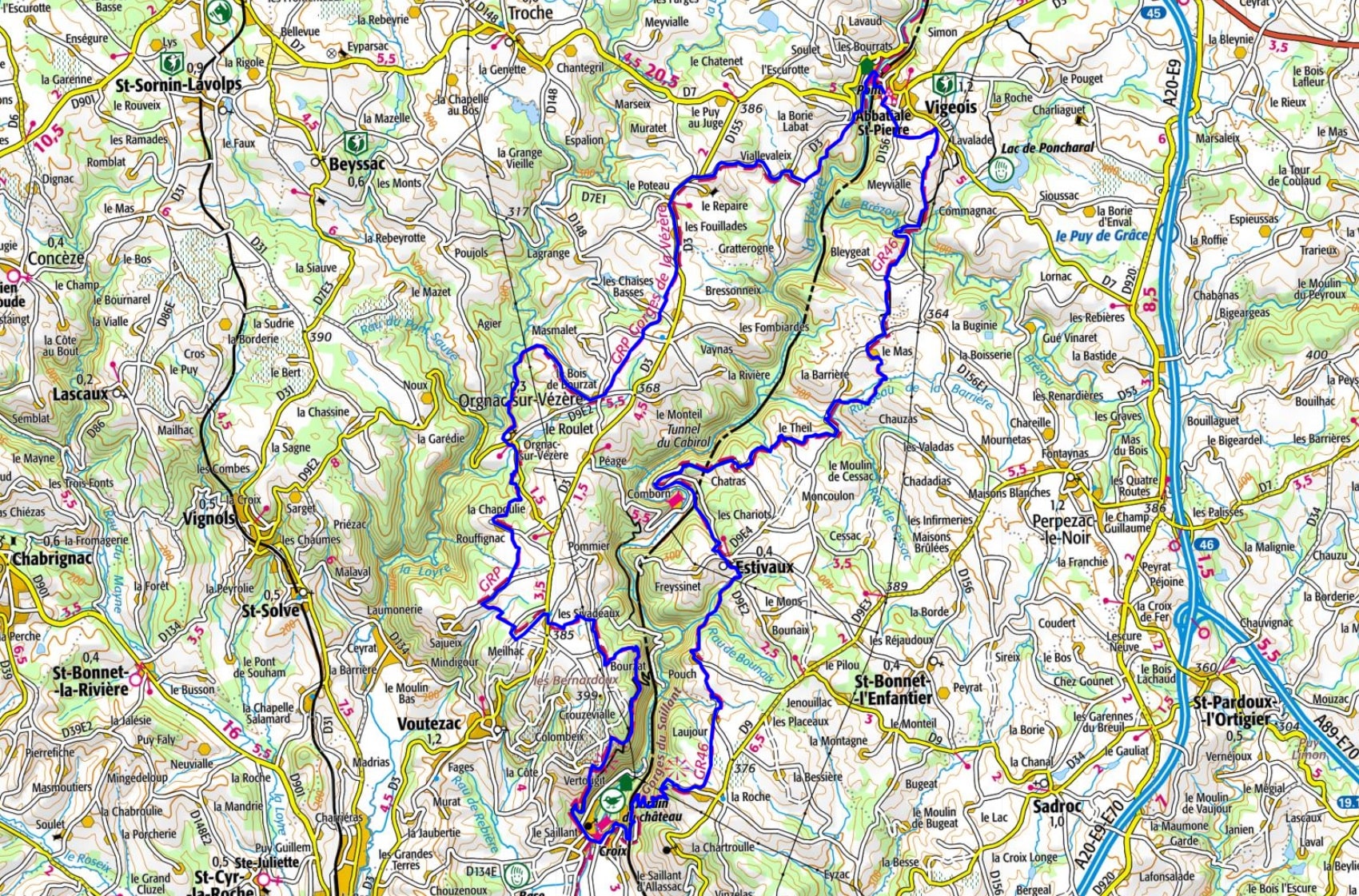
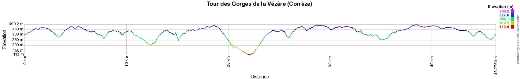
 Distance: 46km, Maximum elevation: 398m, Minimum elevation: 117m, Total ascent: 1287m
IGN Maps: Uzerche - 2133O. Donzenac Gorges de la Vezere - 2134O.
Nearby paths:
![]() It is advisable to follow the beacons all along your hike and to bring the FFRandonnée topo-guide. You will also find information on MonGR.fr.
It is advisable to follow the beacons all along your hike and to bring the FFRandonnée topo-guide. You will also find information on MonGR.fr.
GR®, PR®, GRP® and the corresponding markings are trademarks of the French Federation of Hiking. They may not be reproduced without permission. The French Federation of Hiking, state-approved, includes organizations that maintain hiking routes. It publishes guides for these routes. With your donations, support the actions of the thousands of volunteer markers of the FFRandonnée.
GR-Infos.com is an editorial partner of MonGR.fr.
| Return |

Former holiday hotel with a garden along the Allier, L'Etoile Guest House is located in La Bastide-Puylaurent between Lozere, Ardeche, and the Cevennes in the mountains of Southern France. At the crossroads of GR®7, GR®70 Stevenson Path, GR®72, GR®700 Regordane Way, GR®470 Allier River springs and gorges, GRP® Cevenol, Ardechoise Mountains, Margeride. Numerous loop trails for hiking and one-day biking excursions. Ideal for a relaxing and hiking getaway.
Copyright©gr-infos.com (Authorization for private use only)
To help us maintain and improve GR-Infos.com, a contribution of 2€ is desired via Wero or bank transfer. Thank you!