
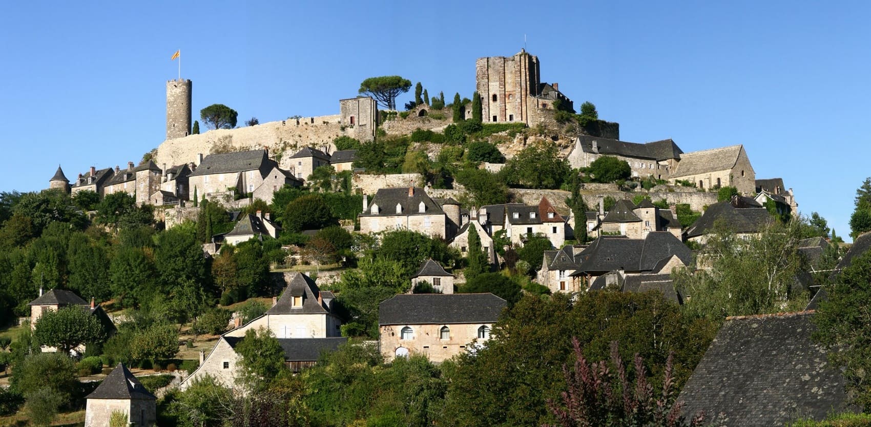
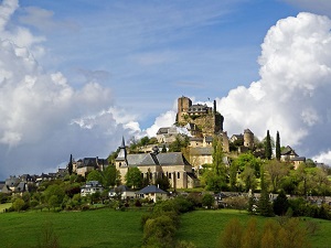
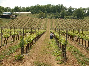
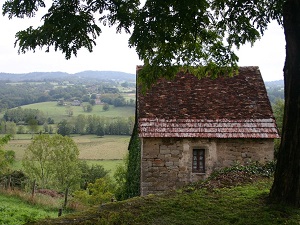
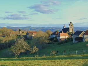
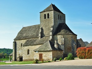
The GR480, nicknamed the "Corrèze to Dordogne Trail," immerses hikers in the southern reaches of the Lower Limousin region. The trail begins in Turenne, one of the "Most Beautiful Villages of France," whose medieval silhouette proudly overlooks a past as an independent viscounty. The limestone plateaus of the Corrèze causse gradually give way to the more rugged terrain of the Xaintrie. Built heritage is omnipresent: Romanesque churches, houses with slate roofs, and the remains of castles that once guarded the feudal borders abound. Nature expresses itself with a wild force, particularly upon the spectacular arrival at the Gorges de la Cère. Here, the water has carved narrow, deep canyons, surrounded by beech and oak forests where numerous birds of prey nest. The path winds between cliffs and rocky chaos, offering dizzying views of this impetuous river which marks the border between Corrèze and Cantal.
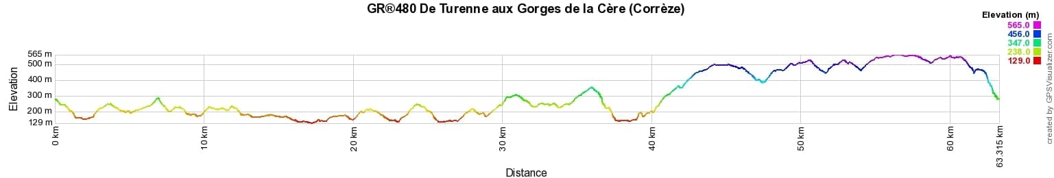
 Distance: 63,62km, Elevation maximum: 564m, Elevation minimum: 129m, Elevation gain uphill: 1692m
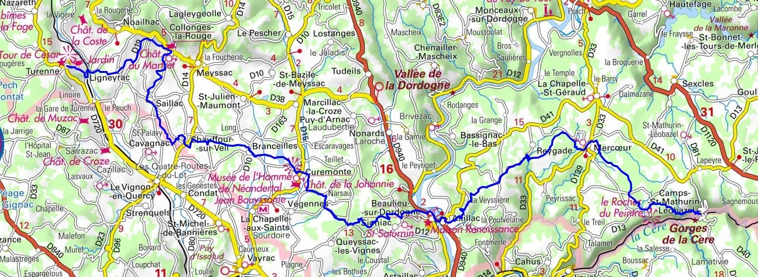
IGN Maps: Peynat Meyssac - 2135E. Brive-La-Gaillarde - 2135O. Rocamadour - Padirac - 2136ET. Argentat - 2235O. Sousceyrac - 2236E. Saint-Cere - 2236O.
Nearby paths:
![]() It is advisable to follow the beacons all along your hike and to bring you the FFRandonnee topo-guide. You will also find information on MonGR.fr.
It is advisable to follow the beacons all along your hike and to bring you the FFRandonnee topo-guide. You will also find information on MonGR.fr.
GR®, PR®, GRP®, and the corresponding signs of markings (white / red, yellow and yellow / red) are trademarks of the French Federation of Hiking. They may not be reproduced without permission. The French Federation of Hiking, state-approved, includes organizations that create and maintain hiking routes on GR®, PR® and GRP®. It publishes guides these topo hiking routes. With your donations, support the actions of the thousands of volunteer markers of the FFRandonnee.
GR-Infos.com is an editorial partner of MonGR.fr.
| Return |

Former holiday hotel with a garden along the Allier, L'Etoile Guest House is located in La Bastide-Puylaurent between Lozere, Ardeche, and the Cevennes in the mountains of Southern France. At the crossroads of GR®7, GR®70 Stevenson Path, GR®72, GR®700 Regordane Way, GR®470 Allier River springs and gorges, GRP® Cevenol, Ardechoise Mountains, Margeride. Numerous loop trails for hiking and one-day biking excursions. Ideal for a relaxing and hiking getaway.
Copyright©gr-infos.com (Authorization for private use only)
To help us maintain and improve GR-Infos.com, a contribution of 2€ is desired via Wero or bank transfer. Thank you!