
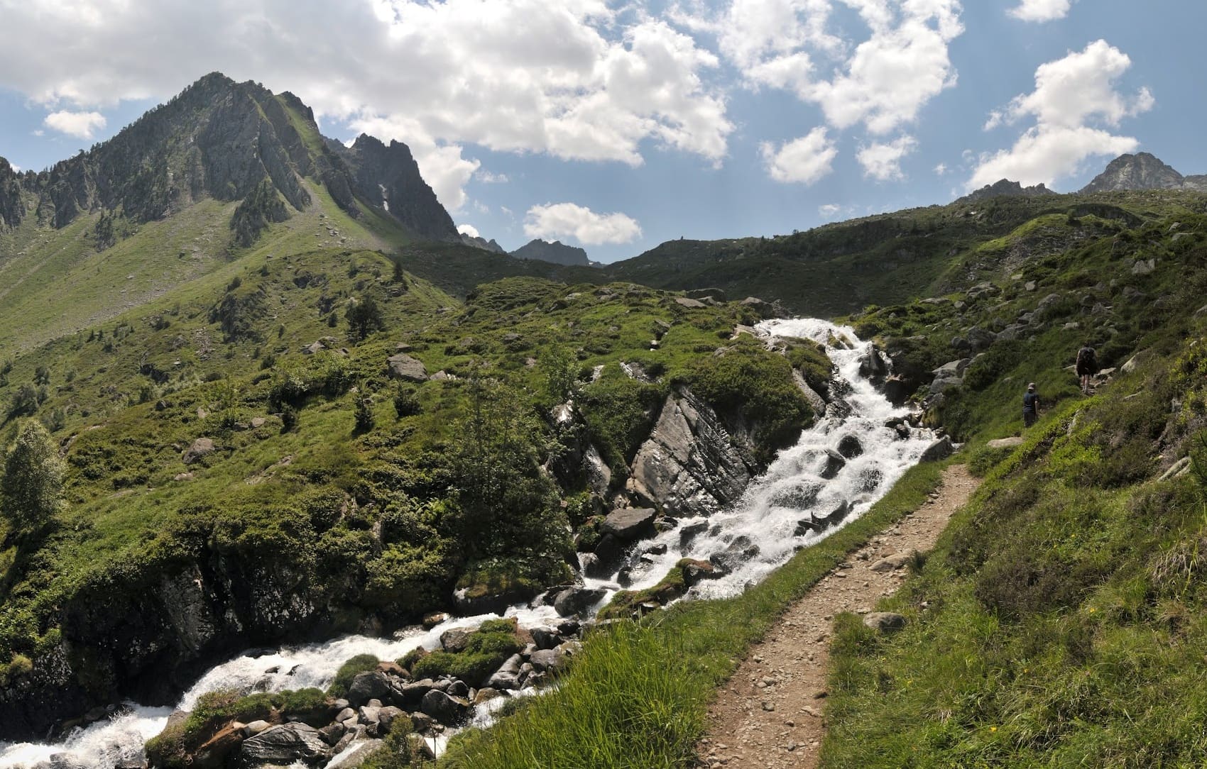
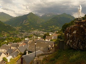
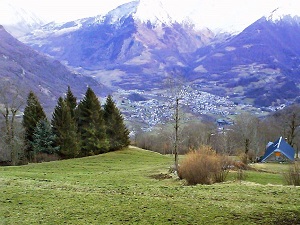
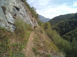
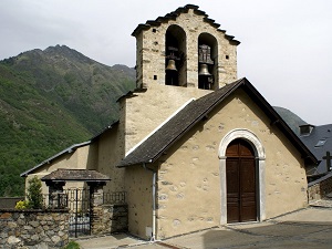
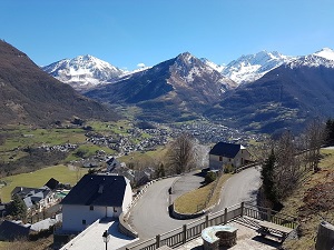
Starting in Sazos, famous for its restored watermills and listed Romanesque church, the trail climbs gently towards Grust, a natural balcony offering breathtaking views of the Néouvielle massif. The route then plunges into wilder landscapes, crossing the Sarrat ravine to the murmur of mountain streams and the cool shade of beech woods. This stage reveals the dramatic geology of the Pyrenees, between dark schist and high-altitude pastures where flocks of Barégeoise sheep graze. The path finally reaches Viscos, a charming village clinging to the mountainside, whose narrow streets bear witness to centuries-old pastoral architecture and resilience in the face of the mountains. Local religious heritage, with its small bell towers, punctuates this historically rich route, recalling the former isolation of these mountain communities.
The Pays Toy is a mountainous region located in the Hautes-Pyrénées, in the Occitanie region. It is made up of seven valleys: the Barèges valley, the Cauterets valley, the Luz-Saint-Sauveur valley, the Saint-Savin valley, the Gavarnie valley, the Arrens valley, and the Laruns valley. The name "Toy" comes from the Gascon word "tot", which means "small". This name was formerly used to refer to the inhabitants of these valleys, who were considered smaller than those of other Pyrenean valleys. The Pays Toy is a region rich in history and culture. It is home to many picturesque villages, Romanesque churches, and medieval castles. The region is also known for its exceptional natural landscapes, including the Cirque de Gavarnie, the Col du Tourmalet, and the Pic du Midi de Bigorre.
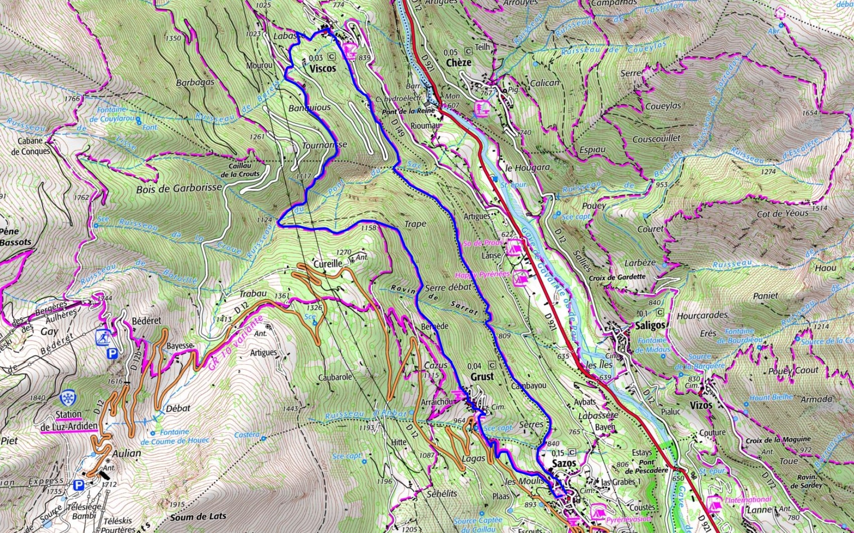
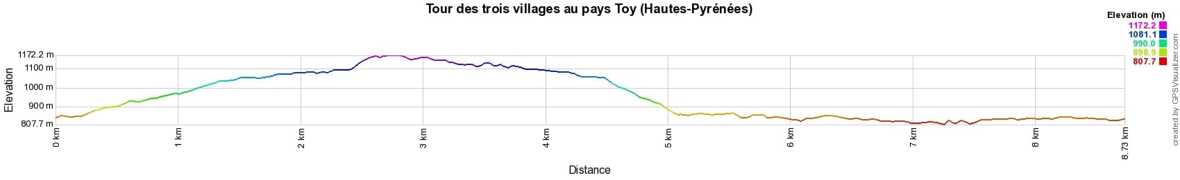
 Distance: 9km, Maximum elevation: 1172m, Minimum elevation: 808m, Total ascent: 422m
IGN Maps: 1748OT - GAVARNIE/LUZ-SAINT-SAUVEUR/PN DES PYRENEES.

Nearby paths:
![]() It is advisable to follow the beacons all along your hike and to bring the FFRandonnée topo-guide. You will also find information on MonGR.fr.
It is advisable to follow the beacons all along your hike and to bring the FFRandonnée topo-guide. You will also find information on MonGR.fr.
GR®, PR®, GRP® and the corresponding markings are trademarks of the French Federation of Hiking. They may not be reproduced without permission. The French Federation of Hiking, state-approved, includes organizations that maintain hiking routes. It publishes guides for these routes. With your donations, support the actions of the thousands of volunteer markers of the FFRandonnée.
GR-Infos.com is an editorial partner of MonGR.fr.
| Return |

Former holiday hotel with a garden along the Allier, L'Etoile Guest House is located in La Bastide-Puylaurent between Lozere, Ardeche, and the Cevennes in the mountains of Southern France. At the crossroads of GR®7, GR®70 Stevenson Path, GR®72, GR®700 Regordane Way, GR®470 Allier River springs and gorges, GRP® Cevenol, Ardechoise Mountains, Margeride. Numerous loop trails for hiking and one-day biking excursions. Ideal for a relaxing and hiking getaway.
Copyright©gr-infos.com (Authorization for private use only)
To help us maintain and improve GR-Infos.com, a contribution of 2€ is desired via Wero or bank transfer. Thank you!