
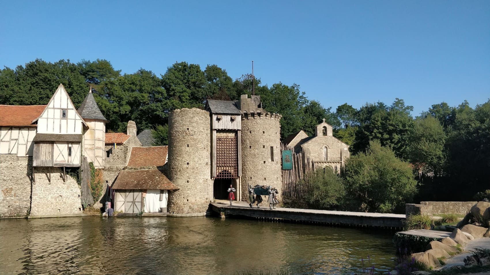
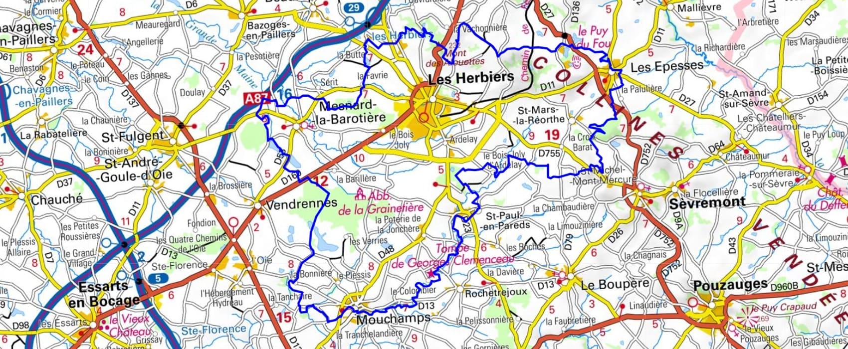
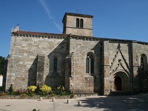
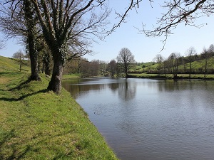
Starting in Mouchamps, a charming town perched on a rocky spur, the trail winds its way towards Mesnard-la-Barotière and its 12th-century church, before reaching Les Herbiers, overlooked by Mont des Alouettes and its ancient windmills. The route then leads to the iconic Puy du Fou theme park, where medieval heritage and popular culture converge in a protected forest setting. Passing through Les Epesses, hikers discover granite and schist architecture typical of the Haut-Bocage region, surrounded by hedgerows and sunken lanes filled with shade. Nature expresses itself here through a mosaic of wetlands and hidden valleys where the Maine River flows, offering refuge to discreet wildlife. The journey continues towards Saint-Paul-en-Pareds, revealing landscapes of gentle hills that bear witness to authentic rural life and a peaceful way of living.
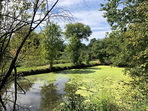
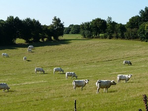
The region is formed by the valleys of the Sèvre Nantaise and Maine rivers. The landscape is hilly and green, with many fields, forests, and villages. The region is rich in biodiversity. The flora consists of oaks, beeches, chestnuts, pines, and many other trees and shrubs. The fauna of the Sèvre and Maine region is also rich and varied. The main animal species are deer, wild boar, roe deer, fox, rabbit, pheasant, pigeon, otter, weasel, marten, lizard, frog, beaver, European mink, and the greater horseshoe bat. There are also many birds, including swans, ducks, herons, and storks.
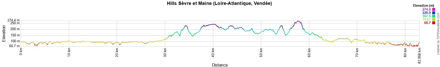
 Distance: 83km, Maximum elevation: 274m, Minimum elevation: 61m, Total ascent: 876m
IGN Maps: 1325SB - MONTAIGU / SAINT-FULGENT. 1326SB - LA ROCHE-SUR-YON / BOURNEZEAU. 1425SB - LES HERBIERS / MAULEON. 1426SB - CHANTONNAY / POUZAUGES / LA CHATAIGNERAIE.
Nearby paths:
![]() It is advisable to follow the beacons all along your hike and to bring the FFRandonnée topo-guide. You will also find information on MonGR.fr.
It is advisable to follow the beacons all along your hike and to bring the FFRandonnée topo-guide. You will also find information on MonGR.fr.
GR®, PR®, GRP® and the corresponding markings are trademarks of the French Federation of Hiking. They may not be reproduced without permission. The French Federation of Hiking, state-approved, includes organizations that maintain hiking routes. It publishes guides for these routes. With your donations, support the actions of the thousands of volunteer markers of the FFRandonnée.
GR-Infos.com is an editorial partner of MonGR.fr.
| Return |

Former holiday hotel with a garden along the Allier, L'Etoile Guest House is located in La Bastide-Puylaurent between Lozere, Ardeche, and the Cevennes in the mountains of Southern France. At the crossroads of GR®7, GR®70 Stevenson Path, GR®72, GR®700 Regordane Way, GR®470 Allier River springs and gorges, GRP® Cevenol, Ardechoise Mountains, Margeride. Numerous loop trails for hiking and one-day biking excursions. Ideal for a relaxing and hiking getaway.
Copyright©gr-infos.com (Authorization for private use only)
To help us maintain and improve GR-Infos.com, a contribution of 2€ is desired via Wero or bank transfer. Thank you!