
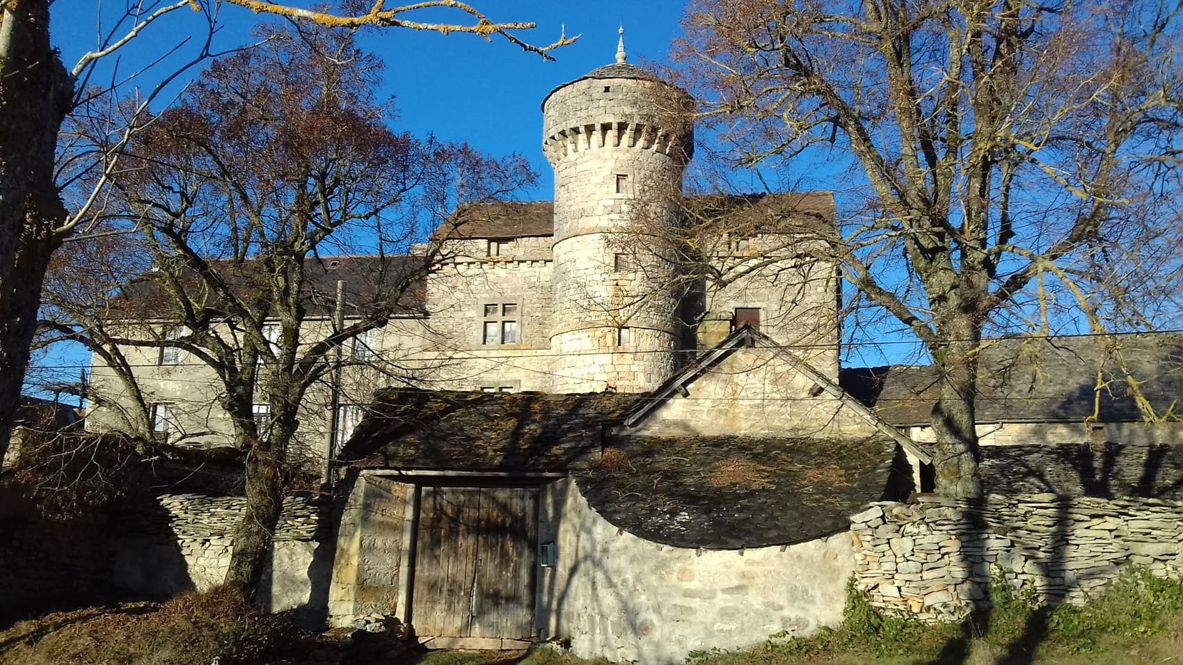
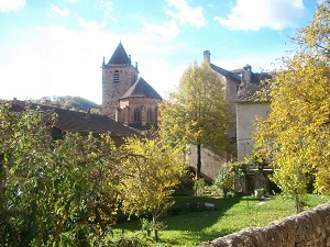
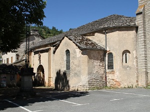
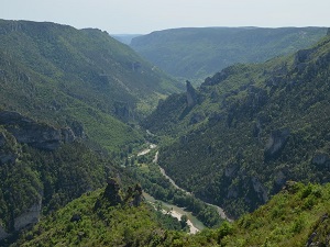
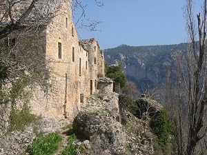
Starting from La Canourgue, nicknamed the "Venice of Lozère," the trail climbs onto the plateau, passing through the hamlets of Chanac and Le Falisson. Here, the architecture of the Causses region is revealed with its limestone houses with slate roofs and massive stone vaults. The landscape changes during the descent towards Sainte-Énimie, a medieval town listed among the most beautiful villages in France, nestled in the heart of the vertiginous Tarn Gorges. The path then climbs back up towards Laval-du-Tarn and skirts the cliffs of Saint-Georges-de-Lévéjac, offering breathtaking views of the canyon. The wild nature of the Causses, home to griffon vultures and rare endemic flora, contrasts with the gentle vineyards of Mostuéjouls, in the Aveyron region. Finally, the religious and pastoral heritage, from wayside crosses to isolated sheepfolds of Pertuzades, punctuates the return to Banassac, a town rich in its past as a center of Gallo-Roman ceramics.
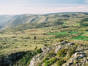
The Causse de Sauveterre has an area of approximately 600 km². It is characterized by a landscape of limestone plateaus, pine forests and dry grasslands. The climate is Mediterranean, with hot, dry summers and mild winters. The Causse de Sauveterre is an important place for biodiversity. It is home to many species of plants and animals, including the griffon vulture, the wall lizard and the asp viper. The Causse de Sauveterre is home to many species of plants including lavender, rosemary, thyme, broom, holm oak, Scots pine and animals such as the griffon vulture, the wall lizard, the asp viper, the deer, the wild boar and the fox.
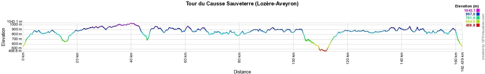
 Distance: 162km, Elevation maximum: 1035m, Elevation minimum: 457m, Elevation gain uphill: 4150m
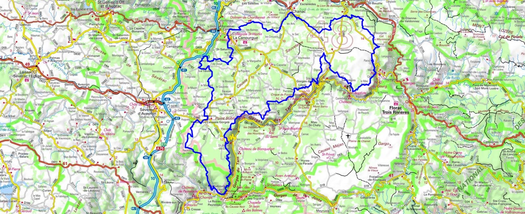
IGN Maps: Severac-le-Chateau (2539E). Florac (2639E). Ste-enimie Gorges du Tarn (2639O). Gorges du Tarn et de la Jonte Causse Mejean PN des Cevennes (2640OT). Aguessac Gorges du Tarn (2540E). Millau Gorges de la Dourbie Causse Noir (2641OT).

Nearby paths:
![]() It is advisable to follow the beacons all along your hike and to bring the FFRandonnée topo-guide. You will also find information on MonGR.fr.
It is advisable to follow the beacons all along your hike and to bring the FFRandonnée topo-guide. You will also find information on MonGR.fr.
GR®, PR®, GRP® and the corresponding markings are trademarks of the French Federation of Hiking. They may not be reproduced without permission. The French Federation of Hiking, state-approved, includes organizations that maintain hiking routes. It publishes guides for these routes. With your donations, support the actions of the thousands of volunteer markers of the FFRandonnée.
GR-Infos.com is an editorial partner of MonGR.fr.
| Return |

Former holiday hotel with a garden along the Allier, L'Etoile Guest House is located in La Bastide-Puylaurent between Lozere, Ardeche, and the Cevennes in the mountains of Southern France. At the crossroads of GR®7, GR®70 Stevenson Path, GR®72, GR®700 Regordane Way, GR®470 Allier River springs and gorges, GRP® Cevenol, Ardechoise Mountains, Margeride. Numerous loop trails for hiking and one-day biking excursions. Ideal for a relaxing and hiking getaway.
Copyright©gr-infos.com (Authorization for private use only)
To help us maintain and improve GR-Infos.com, a contribution of 2€ is desired via Wero or bank transfer. Thank you!