
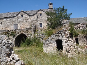
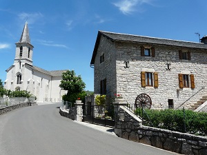
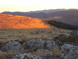
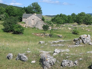
Starting from Meyrueis, the Causse Méjean offers a complete immersion in the highest and most arid of the Lozère's great limestone plateaus. This plateau unfolds steppe-like landscapes reminiscent of Mongolia, where the horizon seems infinite between sky and stone. Passing through Saint-Pierre-des-Tripiers and along the Tarn cliffs, hikers discover a unique pastoral heritage, marked by farms with massive stone vaulted architecture. Nature here is wild: majestic griffon vultures can be observed soaring above the cliffs of Rieisse, or Przewalski's horses near the hamlet of Villaret. The trail crosses fascinating geological sites such as the chaos of dolomitic boulders, before reaching Montignac and the solitary expanses of Anilhac. The built heritage, including circular lavognes for herds and centuries-old sheepfolds in La Codamine, testifies to a thousand-year-old adaptation to the scarcity of water.
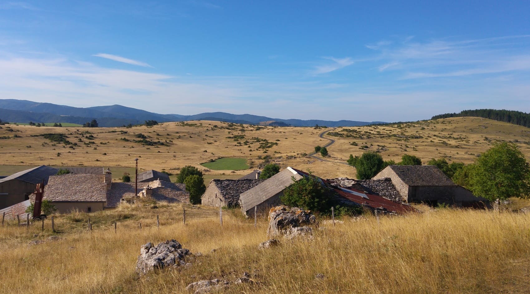
The Causse Méjean is a vast limestone plateau located in the heart of the Lozère region, forming one of the Grands Causses, a UNESCO World Heritage Site recognized for its agro-pastoral landscape. The landscape is spectacular, composed of vast, flat, rocky expanses dotted with limestone pavements and sinkholes, typical of karst topography. The flora is adapted to the dry, shallow soils, dominated by dry grasslands where orchids and other rare species thrive. The history of the Méjean is one of a thousand-year-old sheep-farming tradition, with livestock farming as the central activity shaping these expanses for centuries. This activity has fostered the return of iconic wildlife: the Causse is world-renowned for the successful reintroduction of griffon vultures that soar above these vast, untamed spaces.
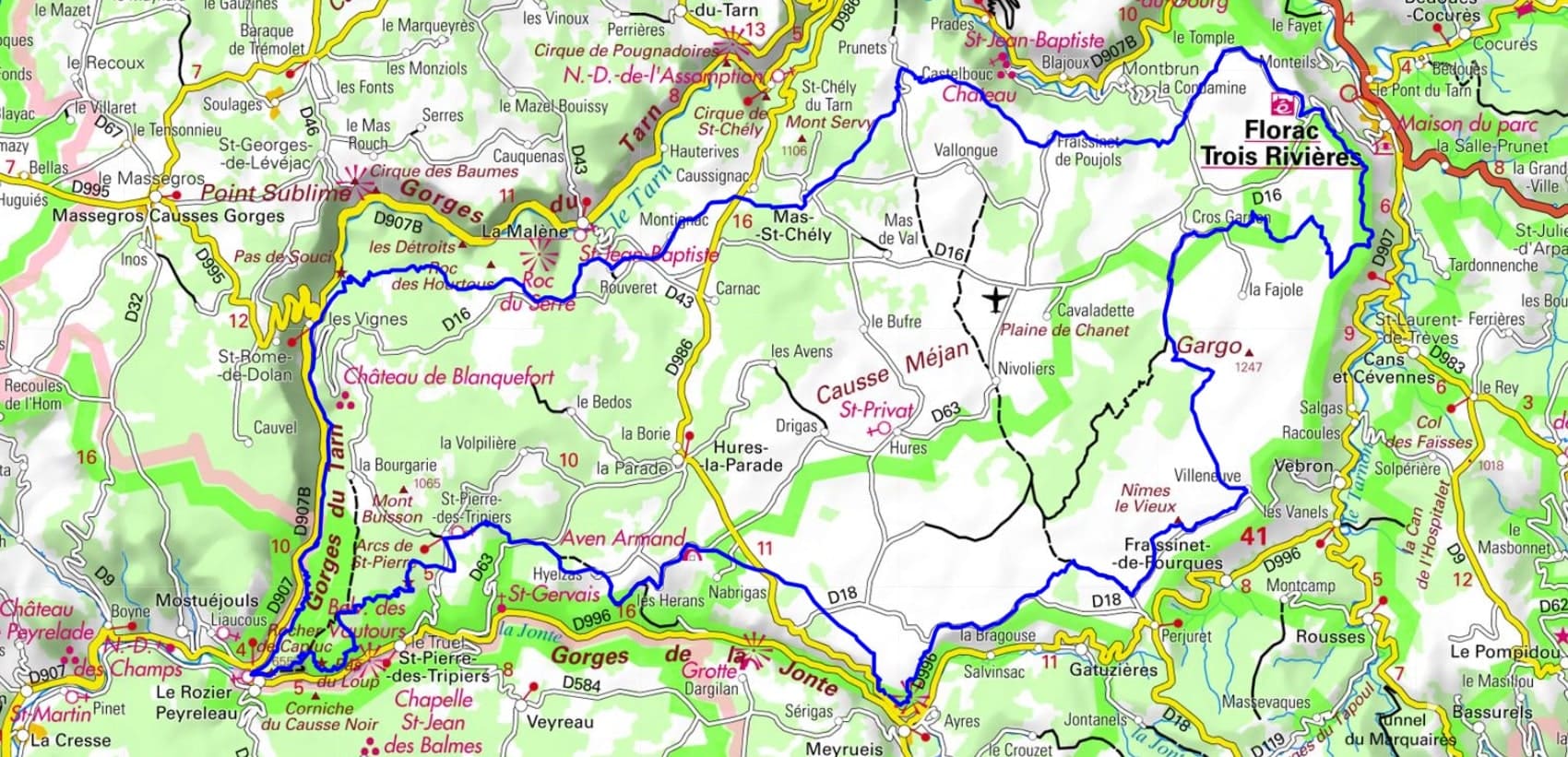
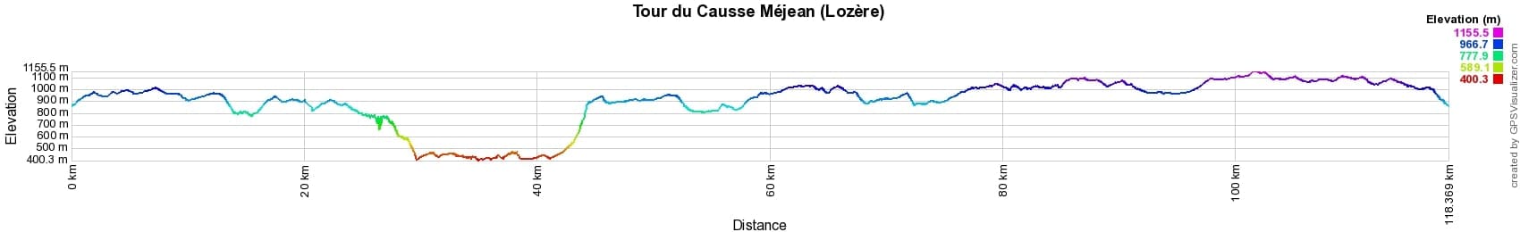
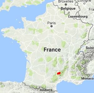
 Distance: 118km, Elevation maximum: 1157m, Elevation minimum: 405m, Elevation gain uphill: 3559m
IGN Maps: Aguessac Gorges du Tarn - 2540E. Florac - 2639E. Sainte-Énimie Gorges-Du-Tarn - 2639O. Gorges du Tarn et de la Jonte Causse Méjean Pn des Cévennes - 2640OT. Mont-Aigoual Le Vigan Pn des Cévennes - 2641ET. Millau Gorges de la Dourbie Causse Noir - 2641OT.
Nearby paths:
![]() It is advisable to follow the beacons all along your hike and to bring the FFRandonnée topo-guide. You will also find information on MonGR.fr.
It is advisable to follow the beacons all along your hike and to bring the FFRandonnée topo-guide. You will also find information on MonGR.fr.
GR®, PR®, GRP® and the corresponding markings are trademarks of the French Federation of Hiking. They may not be reproduced without permission. The French Federation of Hiking, state-approved, includes organizations that maintain hiking routes. It publishes guides for these routes. With your donations, support the actions of the thousands of volunteer markers of the FFRandonnée.
GR-Infos.com is an editorial partner of MonGR.fr.
| Return |

Former holiday hotel with a garden along the Allier, L'Etoile Guest House is located in La Bastide-Puylaurent between Lozere, Ardeche, and the Cevennes in the mountains of Southern France. At the crossroads of GR®7, GR®70 Stevenson Path, GR®72, GR®700 Regordane Way, GR®470 Allier River springs and gorges, GRP® Cevenol, Ardechoise Mountains, Margeride. Numerous loop trails for hiking and one-day biking excursions. Ideal for a relaxing and hiking getaway.
Copyright©gr-infos.com (Authorization for private use only)
To help us maintain and improve GR-Infos.com, a contribution of 2€ is desired via Wero or bank transfer. Thank you!