
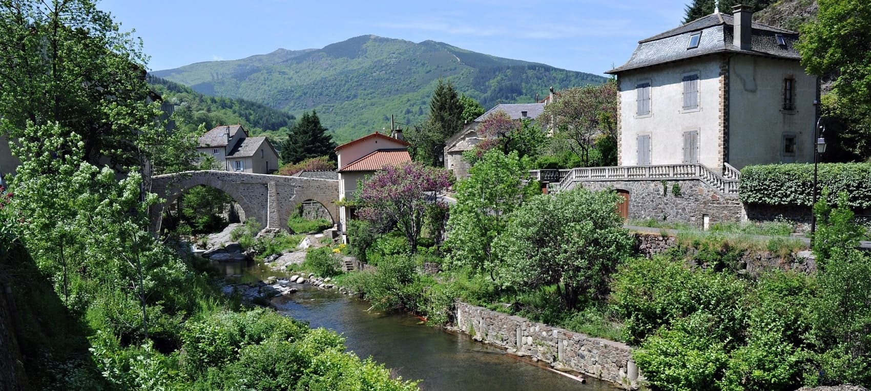
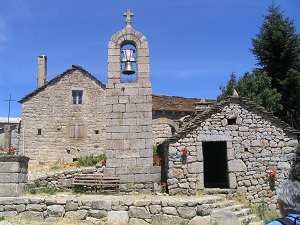
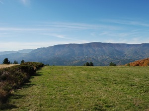
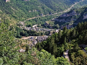
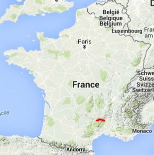
A true link between the Ardèche and Lozère regions, the GR®44 long-distance hiking trail crosses the Cévennes mountains from east to west, offering a wild immersion between Les Vans and Florac. Hikers traverse contrasting landscapes, alternating between steep-sided valleys, ancient chestnut forests and vast limestone or schist plateaux. The flora is remarkable: heaths of purple heather, golden broom and wild orchids line the trail. As for wildlife, the skies are home to griffon vultures and short-toed snake eagles, while the rivers shelter freshwater crayfish and trout.
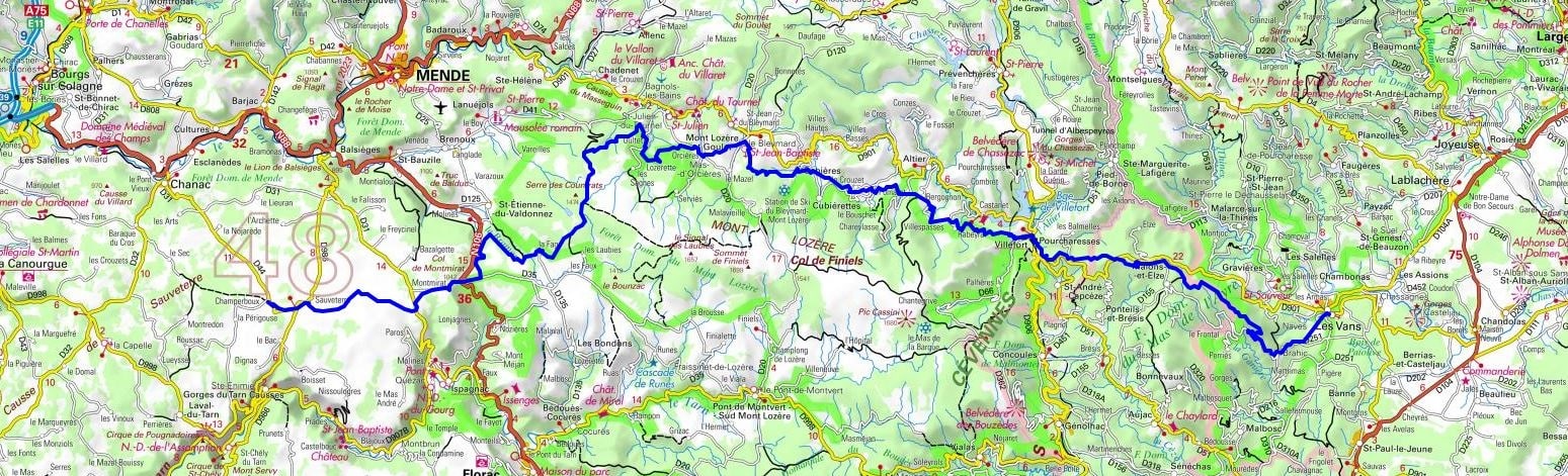
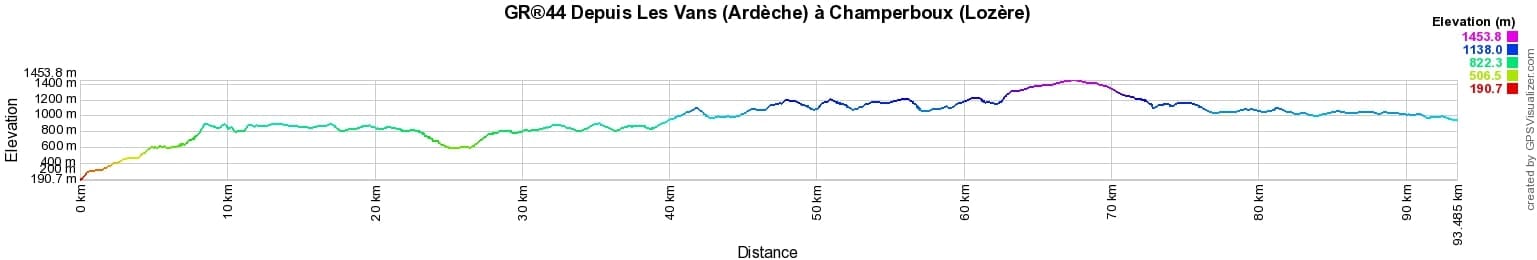
 Distance: 93km, Elevation maximum: 1453m, Elevation minimum: 191m, Elevation gain uphill: 3303m
Nearby paths:
![]() It is advisable to follow the beacons all along your hike and to bring the FFRandonnée topo-guide. You will also find information on MonGR.fr.
It is advisable to follow the beacons all along your hike and to bring the FFRandonnée topo-guide. You will also find information on MonGR.fr.
GR®, PR®, GRP®, and the corresponding signs of markings (white/red, yellow and yellow/red) are trademarks of the French Federation of Hiking. They may not be reproduced without permission. The French Federation of Hiking, state-approved, includes organizations that create and maintain hiking routes on GR®, PR® and GRP®. It publishes topo-guides for these hiking routes. With your donations, support the actions of the thousands of volunteer markers of the FFRandonnée.
GR-Infos.com is an editorial partner of MonGR.fr.
| Return |

Former holiday hotel with a garden along the Allier, L'Etoile Guest House is located in La Bastide-Puylaurent between Lozere, Ardeche, and the Cevennes in the mountains of Southern France. At the crossroads of GR®7, GR®70 Stevenson Path, GR®72, GR®700 Regordane Way, GR®470 Allier River springs and gorges, GRP® Cevenol, Ardechoise Mountains, Margeride. Numerous loop trails for hiking and one-day biking excursions. Ideal for a relaxing and hiking getaway.
Copyright©gr-infos.com (Authorization for private use only)
To help us maintain and improve GR-Infos.com, a contribution of 2€ is desired via Wero or bank transfer. Thank you!