
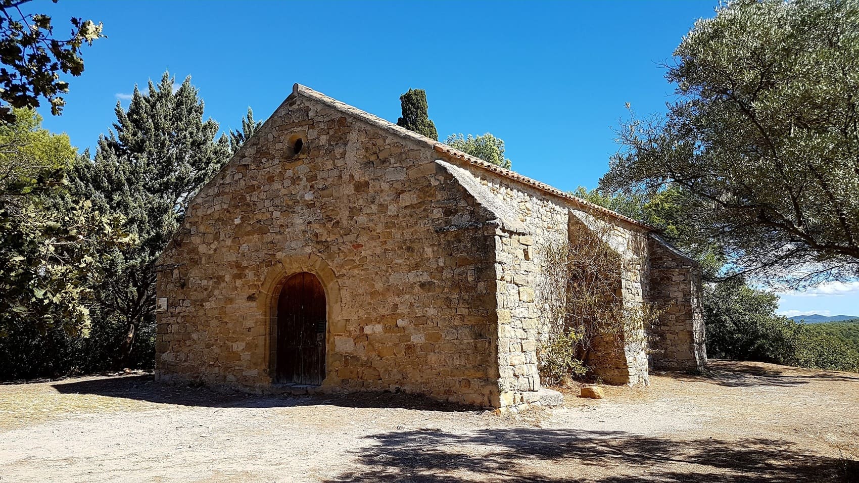
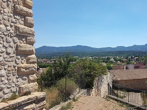
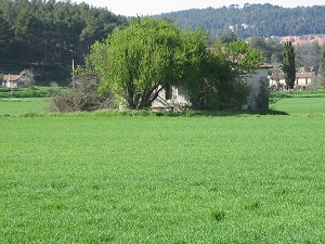
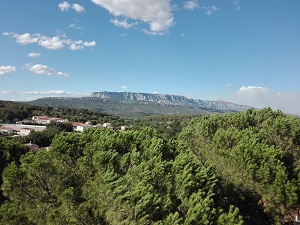
Starting in Gréasque, the trail climbs towards Mimet, the highest village in the Bouches-du-Rhône department, offering breathtaking views of the Étoile mountain range and the Sainte-Victoire massif. Descending towards Gardanne, hikers pass the remains of mine shafts, including the famous Yvon Morandat Shaft, which bear witness to centuries of lignite extraction. The route then crosses the landscapes of Meyreuil, where nature is reclaiming the former slag heaps, now covered with pine forests and fragrant garrigue. In Fuveau, the heritage takes on a more Provençal character with its steep, narrow streets and panoramic views over the Arc Valley, so beloved by the painter Paul Cézanne. Local biodiversity, characterized by kermes oak and wild thyme, flourishes on these lands once dedicated to coal mining.
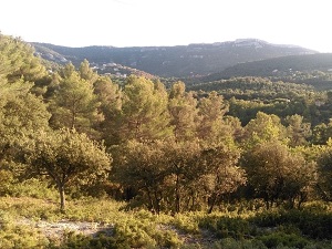
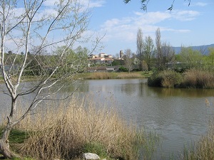
The landscape of Provence Mines d'énergies Nord, located in the Pays d'Aix region, is a mosaic of limestone hills and gently rolling plains. This area, marked by its past as a lignite mining site, juxtaposes Provençal nature with discreet vestiges of industrial activity, such as vegetated spoil heaps. The flora is typically Mediterranean: fragrant garrigue, composed of thyme and rosemary, dominates the dry slopes, while Aleppo pine forests and holm oaks cover the higher ground. Reforestation areas are also found on former mining sites, creating a recovering ecosystem. The fauna is that of the Provençal maquis, rich in insects (cicadas), small reptiles, as well as wild boar and birds that nest in the pine forests, creating the bright, dry atmosphere characteristic of inland Provence.
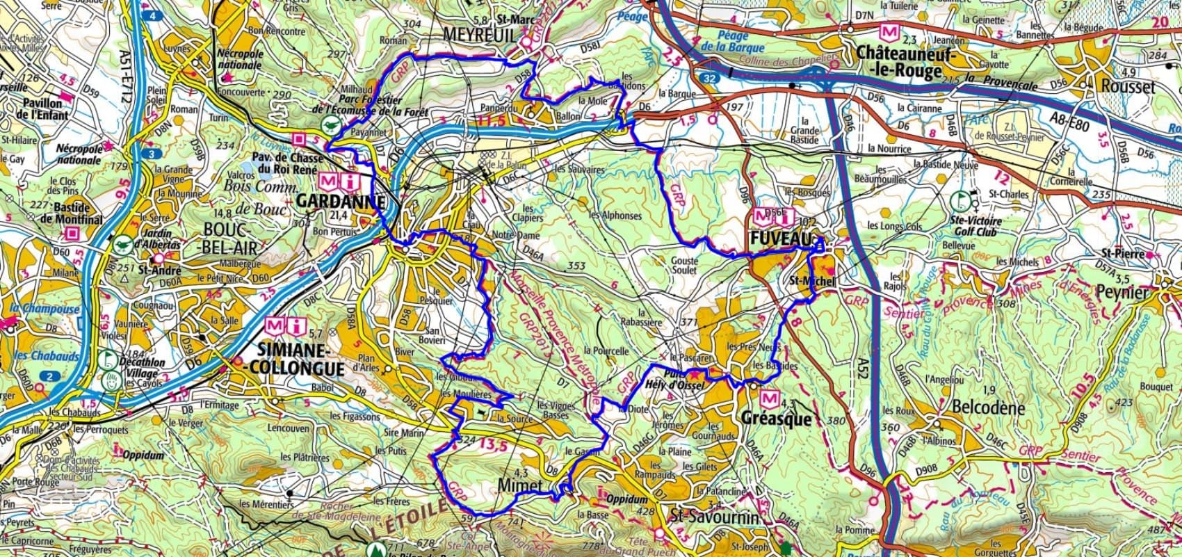
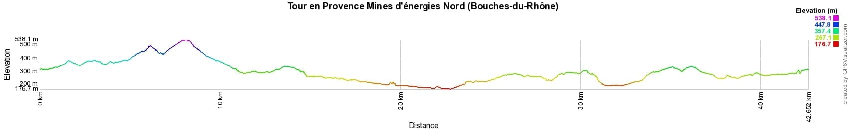
 Distance: 42km, Elevation maximum: 538m, Elevation minimum: 177m, Elevation gain uphill: 757m
IGN Maps: 3143ET - AIX-EN-PROVENCE / VITROLLES / LAMBESC. 3145ET - MARSEILLE / LES CALANQUES. 3244ET - MONTAGNE SAINTE-VICTOIRE / AIX-EN-PROVENCE / GARDANNE / TRETS. 3245ET - AUBAGNE / LA CIOTAT / MASSIF DE LA SAINTE-BAUME.
Nearby paths:
![]() It is advisable to follow the beacons all along your hike and to bring the FFRandonnée topo-guide. You will also find information on MonGR.fr.
It is advisable to follow the beacons all along your hike and to bring the FFRandonnée topo-guide. You will also find information on MonGR.fr.
GR®, PR®, GRP® and the corresponding markings are trademarks of the French Federation of Hiking. They may not be reproduced without permission. The French Federation of Hiking, state-approved, includes organizations that maintain hiking routes. It publishes guides for these routes. With your donations, support the actions of the thousands of volunteer markers of the FFRandonnée.
GR-Infos.com is an editorial partner of MonGR.fr.
| Return |

Former holiday hotel with a garden along the Allier, L'Etoile Guest House is located in La Bastide-Puylaurent between Lozere, Ardeche, and the Cevennes in the mountains of Southern France. At the crossroads of GR®7, GR®70 Stevenson Path, GR®72, GR®700 Regordane Way, GR®470 Allier River springs and gorges, GRP® Cevenol, Ardechoise Mountains, Margeride. Numerous loop trails for hiking and one-day biking excursions. Ideal for a relaxing and hiking getaway.
Copyright©gr-infos.com (Authorization for private use only)
To help us maintain and improve GR-Infos.com, a contribution of 2€ is desired via Wero or bank transfer. Thank you!