
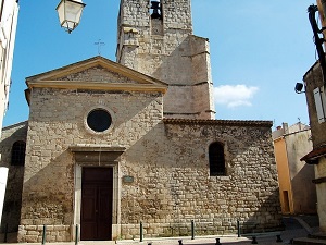
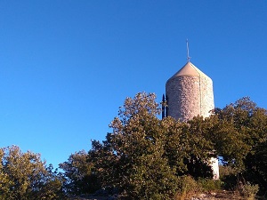
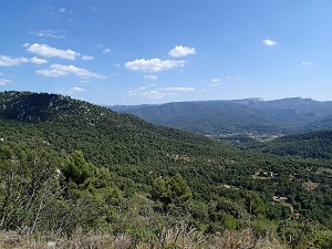
Starting in Gréasque, the trail winds through old open-air galleries and slag heaps, now reclaimed by fragrant garrigue of pines and rosemary. In Fuveau, the heritage unfolds amidst Provençal alleyways and remnants of lignite mining, before reaching Peynier, where the castle and preserved forests mark the transition to the foot of the Sainte-Victoire mountain. The trail then leads to Trets, a charming medieval town whose ramparts and the Church of Saint John the Baptist bear witness to a rich agricultural and seigniorial past. The route continues towards Belcodène, a high point offering spectacular panoramas of the Étoile and Sainte-Baume mountain ranges. Here, nature reclaims the former extraction sites, creating a unique biodiversity where local wildlife finds refuge.
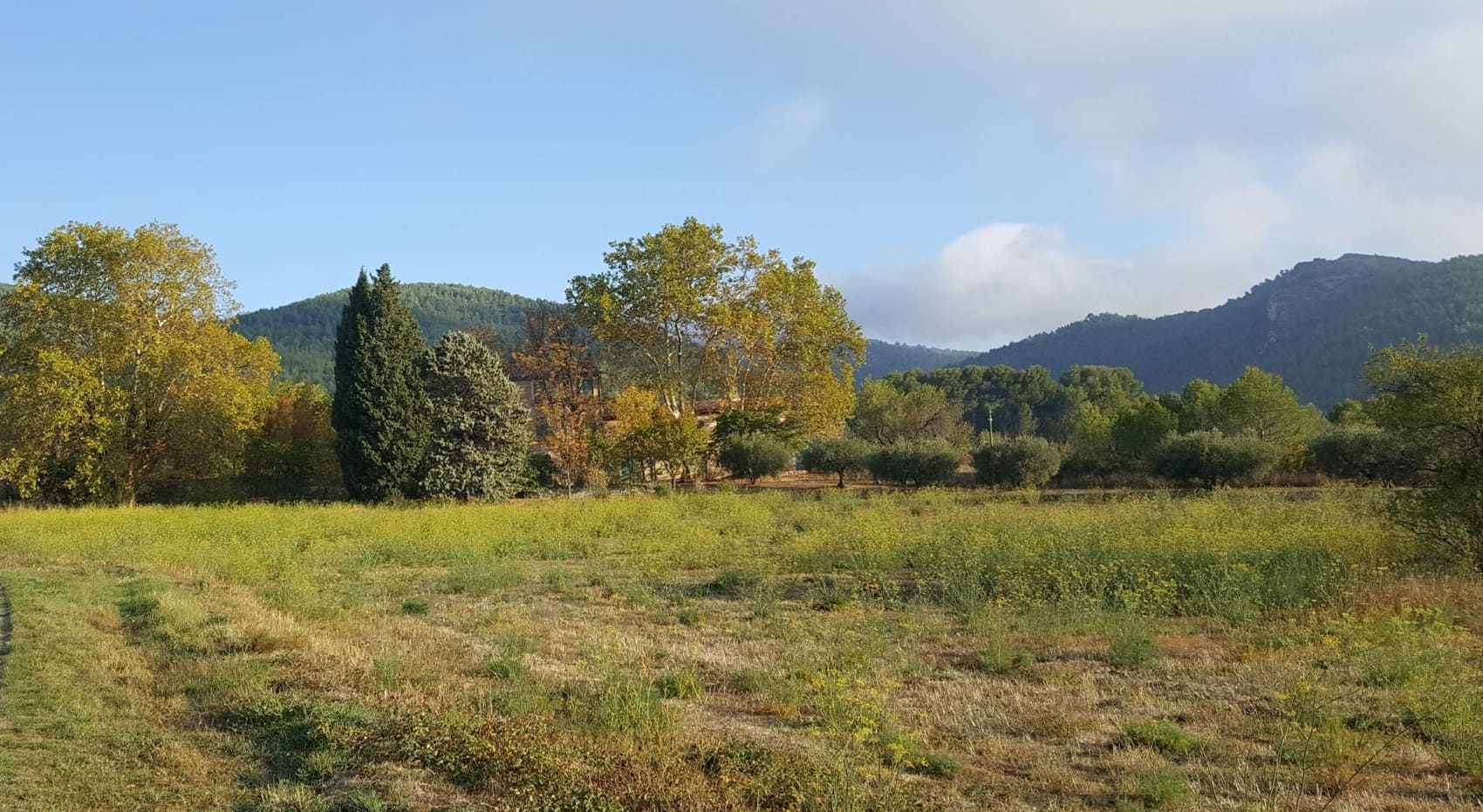
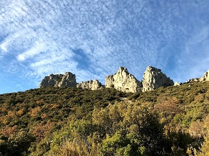
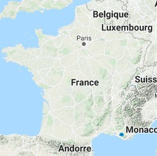
The Provence Mines d'énergies Est territory, centered on the former mining basin of Gardanne and Fuveau, presents a unique landscape in the Bouches-du-Rhône department. This landscape is a striking juxtaposition of Provençal limestone hills, pine forests, and the remnants of mining activity, notably slag heaps and industrial wastelands. Mediterranean flora is gradually adapting to this environment, with the omnipresence of Aleppo pine, kermes oak, and a garrigue rich in aromatic plants such as thyme and rosemary. The fauna is that of the classic Provençal environment, including the song of cicadas in summer, the presence of numerous reptiles, and birds specific to the garrigue that find refuge in the wooded areas and restored natural spaces. The contrast between the slag heaps and the luminosity of the surrounding hills creates a strong and constantly evolving landscape identity.
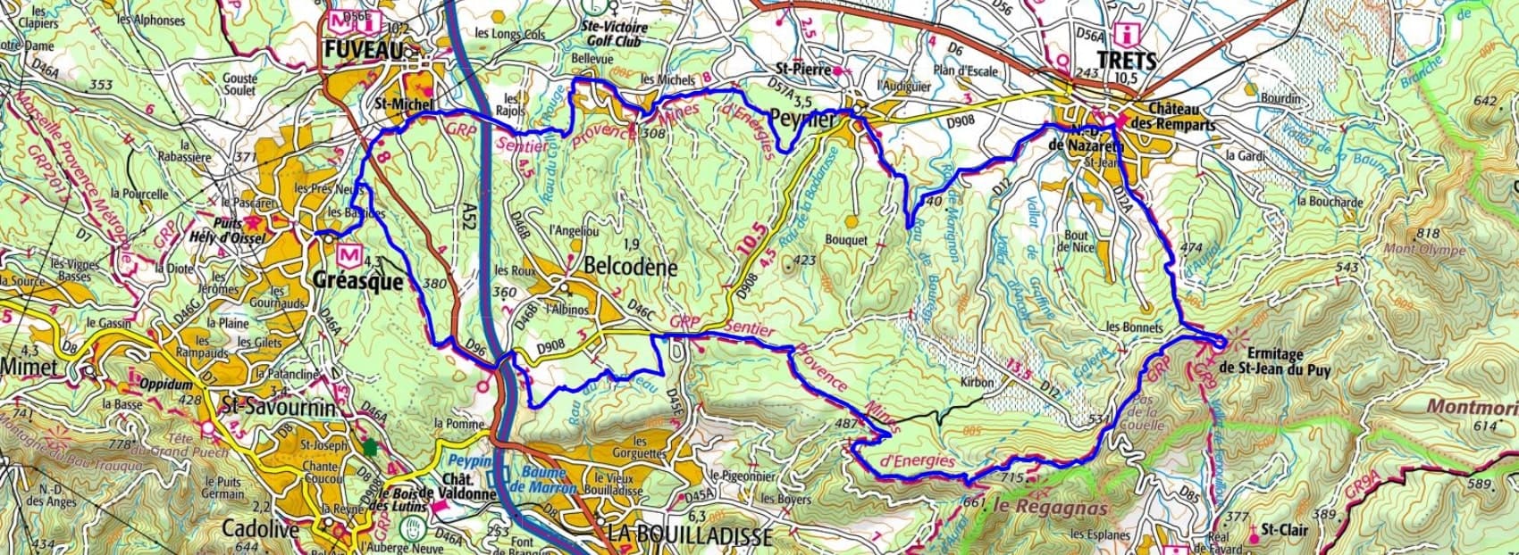
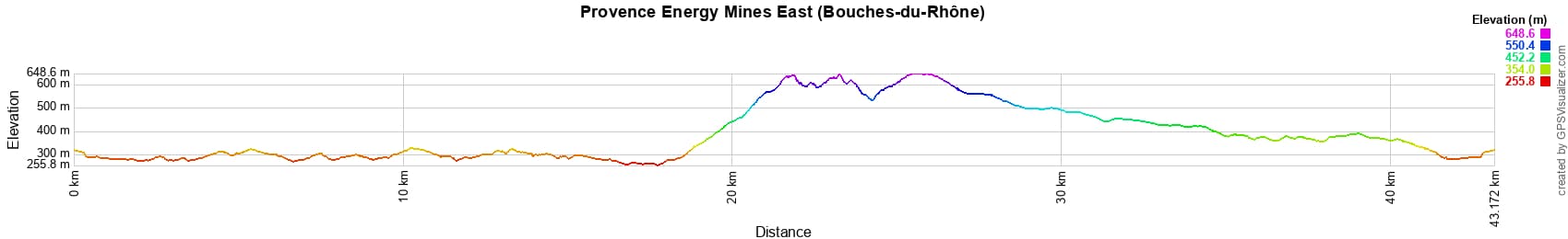
 Distance: 43km, Elevation maximum: 649m, Elevation minimum: 256m, Elevation gain uphill: 785m
IGN Maps: 3143ET - AIX-EN-PROVENCE / VITROLLES / LAMBESC. 3145ET - MARSEILLE / LES CALANQUES. 3244ET - MONTAGNE SAINTE-VICTOIRE / AIX-EN-PROVENCE / GARDANNE / TRETS. 3245ET - AUBAGNE / LA CIOTAT / MASSIF DE LA SAINTE-BAUME.
Nearby paths:
![]() It is advisable to follow the beacons all along your hike and to bring the FFRandonnée topo-guide. You will also find information on MonGR.fr.
It is advisable to follow the beacons all along your hike and to bring the FFRandonnée topo-guide. You will also find information on MonGR.fr.
GR®, PR®, GRP® and the corresponding markings are trademarks of the French Federation of Hiking. They may not be reproduced without permission. The French Federation of Hiking, state-approved, includes organizations that maintain hiking routes. It publishes guides for these routes. With your donations, support the actions of the thousands of volunteer markers of the FFRandonnée.
GR-Infos.com is an editorial partner of MonGR.fr.
| Return |

Former holiday hotel with a garden along the Allier, L'Etoile Guest House is located in La Bastide-Puylaurent between Lozere, Ardeche, and the Cevennes in the mountains of Southern France. At the crossroads of GR®7, GR®70 Stevenson Path, GR®72, GR®700 Regordane Way, GR®470 Allier River springs and gorges, GRP® Cevenol, Ardechoise Mountains, Margeride. Numerous loop trails for hiking and one-day biking excursions. Ideal for a relaxing and hiking getaway.
Copyright©gr-infos.com (Authorization for private use only)
To help us maintain and improve GR-Infos.com, a contribution of 2€ is desired via Wero or bank transfer. Thank you!