
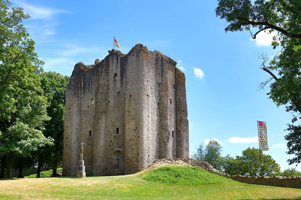
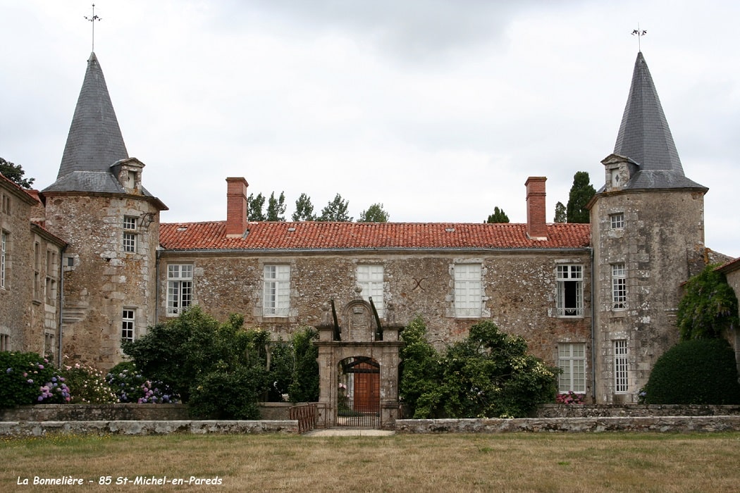
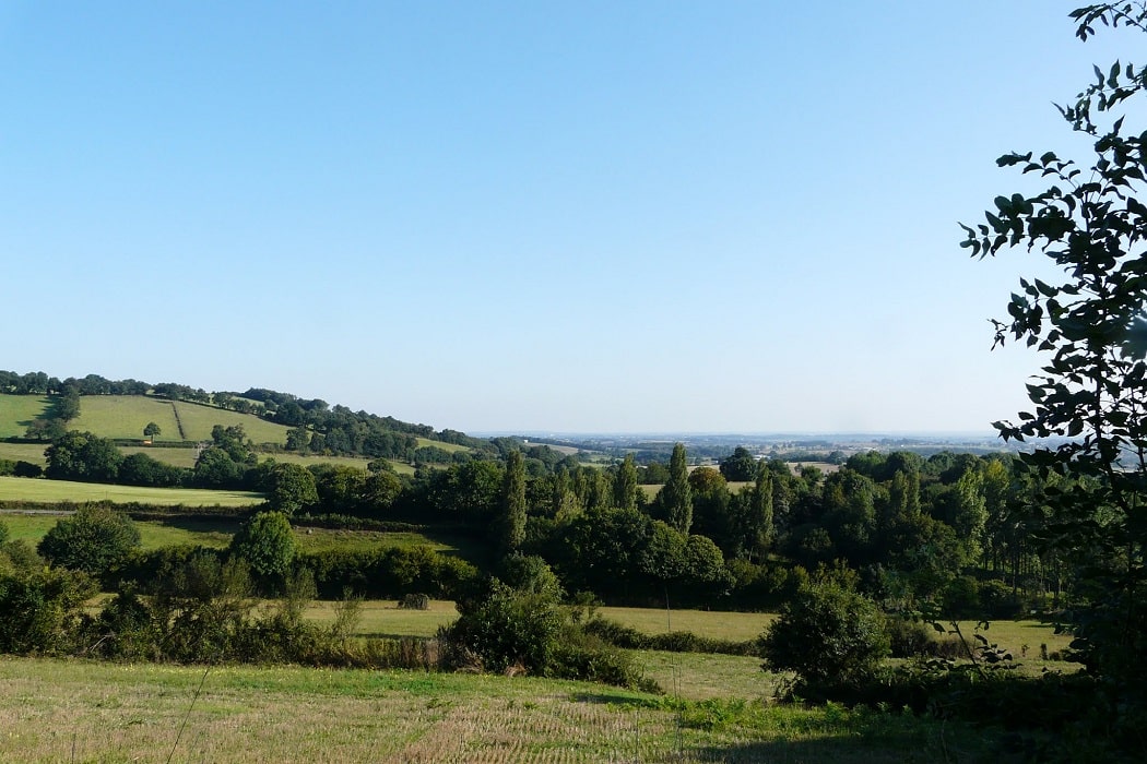
Starting from Le Boupère, the trail winds its way between hedgerows and traditional sunken lanes before tackling the challenge of Saint-Michel-Mont-Mercure, the highest point in the Vendée. Here, religious heritage reaches its peak with the archangel crowning the bell tower, offering a panoramic view of the moors and distant church steeples. Continuing towards Sèvremont, the landscape becomes wilder, a blend of deep woods and hidden valleys sculpted by time. The route then reaches Saint-Mesmin, where the medieval castle raises its imposing towers, bearing witness to a rich military history amidst a granite landscape. This trek through the "Puys" reveals a preserved biodiversity, where pollarded oaks and small streams create an atmosphere of absolute serenity.
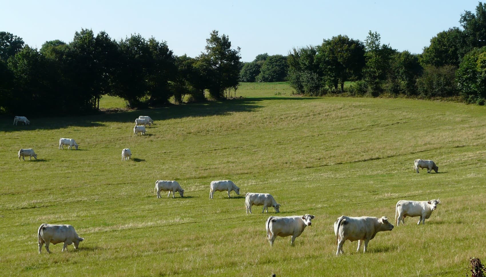
The Puys de Pouzauges are a set of granite hills located in the south of Vendée. The climate of Les Puys is temperate oceanic, with abundant precipitation averaging 1,000 millimeters and mild temperatures averaging 12 degrees Celsius. In the Middle Ages, the Puys were an important place of defense, surrounded by fortifications and many castles. In modern times, the slopes have been cultivated for agriculture and the summits used for sheep breeding.
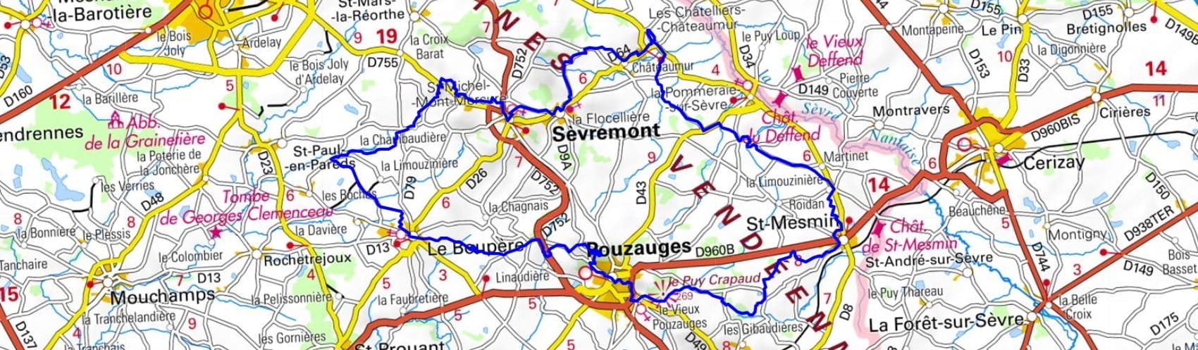
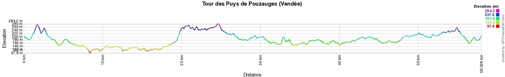

 Distance: 58km, Elevation maximum: 284m, Elevation minimum: 97m, Elevation gain uphill: 775m
IGN Maps: 1425SB - LES HERBIERS / MAULEON. 1426SB - CHANTONNAY / POUZAUGES / LA CHATAIGNERAIE. 1526SB - MONCOUTANT / LA CHAPELLE ST-LAURENT.
Nearby paths:
![]() It is advisable to follow the beacons all along your hike and to bring the FFRandonnée topo-guide. You will also find information on MonGR.fr.
It is advisable to follow the beacons all along your hike and to bring the FFRandonnée topo-guide. You will also find information on MonGR.fr.
GR®, PR®, GRP® and the corresponding markings are trademarks of the French Federation of Hiking. They may not be reproduced without permission. The French Federation of Hiking, state-approved, includes organizations that maintain hiking routes. It publishes guides for these routes. With your donations, support the actions of the thousands of volunteer markers of the FFRandonnée.
GR-Infos.com is an editorial partner of MonGR.fr.
| Return |

Former holiday hotel with a garden along the Allier, L'Etoile Guest House is located in La Bastide-Puylaurent between Lozere, Ardeche, and the Cevennes in the mountains of Southern France. At the crossroads of GR®7, GR®70 Stevenson Path, GR®72, GR®700 Regordane Way, GR®470 Allier River springs and gorges, GRP® Cevenol, Ardechoise Mountains, Margeride. Numerous loop trails for hiking and one-day biking excursions. Ideal for a relaxing and hiking getaway.
Copyright©gr-infos.com (Authorization for private use only)
To help us maintain and improve GR-Infos.com, a contribution of 2€ is desired via Wero or bank transfer. Thank you!