
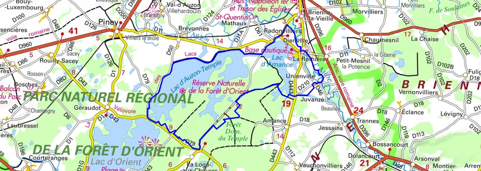
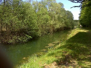
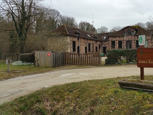
Starting from the port of Dienville, this hike in the heart of the Forêt d'Orient Regional Natural Park offers an immersive experience amidst sparkling waters and deep forests. The trail leads to Unienville and then La Loge-aux-Chèvres, whose name evokes a forestry past where people lived in harmony with the rhythm of the clearings. Crossing through Brévonnes, you'll discover a rural heritage typical of the wet Champagne region, with its half-timbered houses and picturesque churches. The route skirts the vast reservoirs of Lakes Auzon-Temple and Amance, veritable sanctuaries for thousands of migratory birds. Nature reigns supreme here: between centuries-old oak groves and wild shores, the silence is broken only by the flight of common cranes or ospreys. In Radonvilliers, local history is evident in the robust architecture of the Brie-style farmhouses before the loop completes back to the beaches of Dienville.
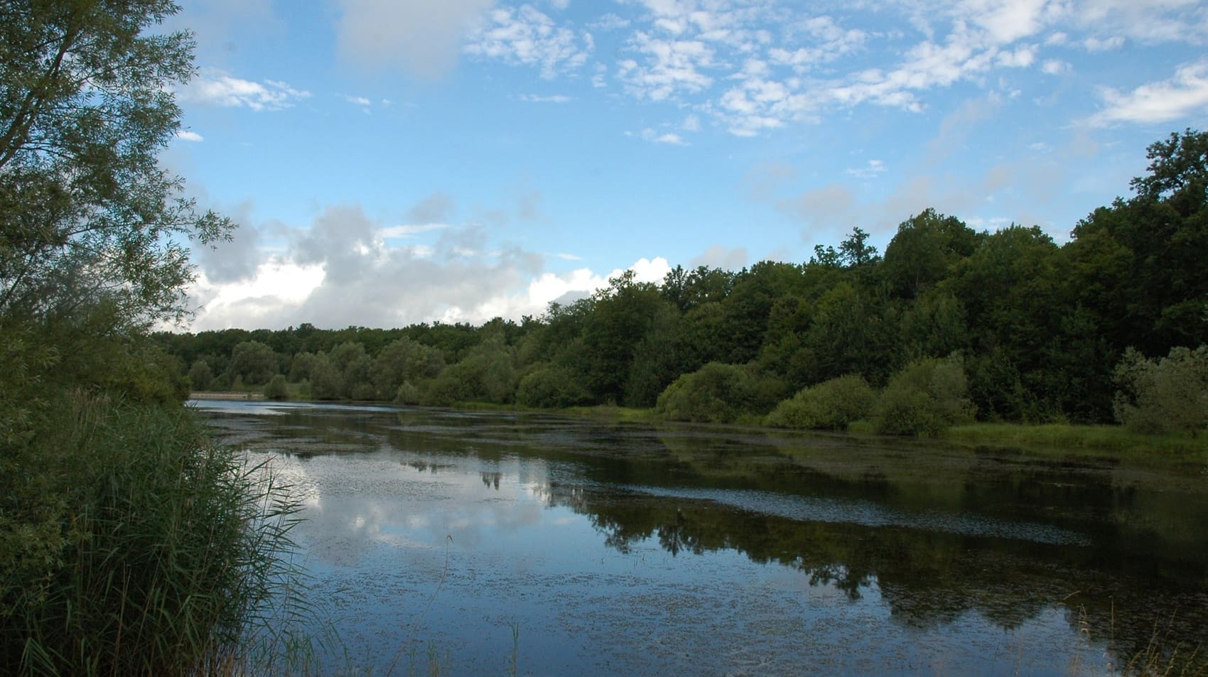
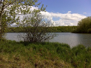
Nestled in the heart of the Forêt d'Orient Regional Natural Park in the Aube department, Lakes Amance and Temple form a fascinating hydraulic system designed to regulate the Aube River's floods. Lake Temple takes its prestigious name from the Knights Templar, who once owned important commanderies in this Champagne region. It is an exceptional biodiversity sanctuary, where thousands of migratory birds, such as common cranes, stop over in the reedbeds. The local heritage can be discovered along the way, in the half-timbered villages and medieval churches that line these artificial lakes. Between deep oak forests and shimmering waters, nature reclaims its space, offering hikers peaceful, shaded trails.
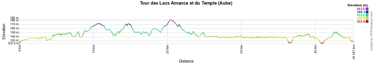
 Distance: 45km, Elevation maximum: 183m, Elevation minimum: 123m, Elevation gain uphill: 263m
IGN Maps: 2917SB - BRIENNE-LE-CHATEAU PINEY LACS DE LA FORET D'ORIENT.

Nearby paths:
![]() It is advisable to follow the trail markers all along your hike and to bring the FFRandonnée topo-guide. You will also find information on MonGR.fr.
It is advisable to follow the trail markers all along your hike and to bring the FFRandonnée topo-guide. You will also find information on MonGR.fr.
GR®, PR®, GRP® and the corresponding markings are trademarks of the French Federation of Hiking. They may not be reproduced without permission. The French Federation of Hiking, state-approved, includes organizations that maintain hiking routes. It publishes guides for these routes. With your donations, support the actions of the thousands of volunteer markers of the FFRandonnée.
GR-Infos.com is an editorial partner of MonGR.fr.
| Return |

Former holiday hotel with a garden along the Allier, L'Etoile Guest House is located in La Bastide-Puylaurent between Lozere, Ardeche, and the Cevennes in the mountains of Southern France. At the crossroads of GR®7, GR®70 Stevenson Path, GR®72, GR®700 Regordane Way, GR®470 Allier River springs and gorges, GRP® Cevenol, Ardechoise Mountains, Margeride. Numerous loop trails for hiking and one-day biking excursions. Ideal for a relaxing and hiking getaway.
Copyright©gr-infos.com (Authorization for private use only)
To help us maintain and improve GR-Infos.com, a contribution of 2€ is desired via Wero or bank transfer. Thank you!