
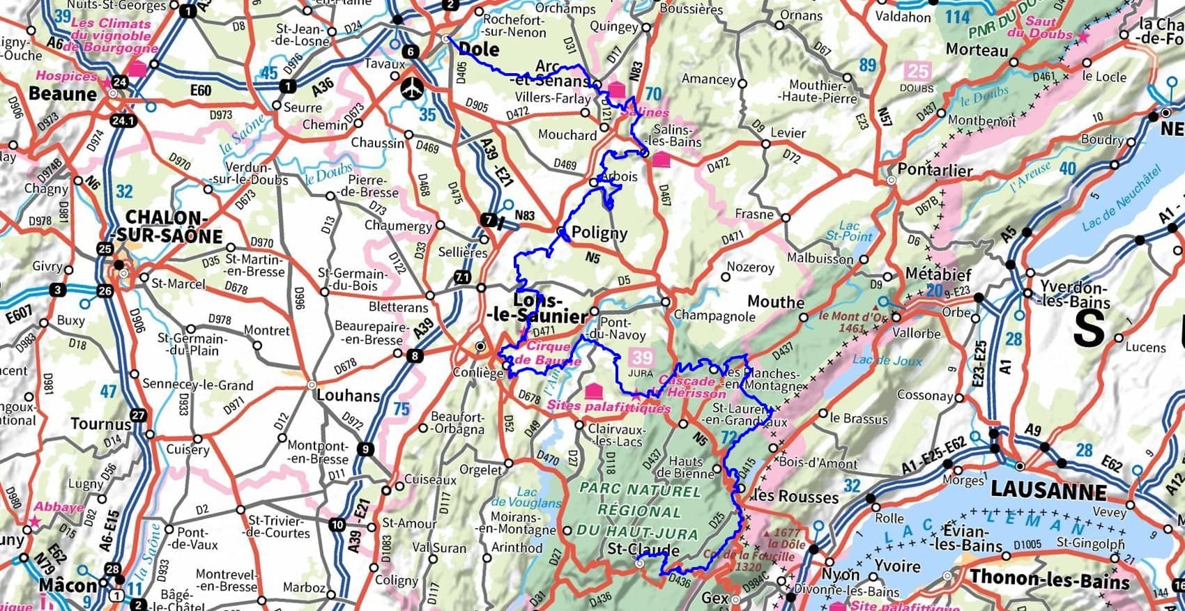
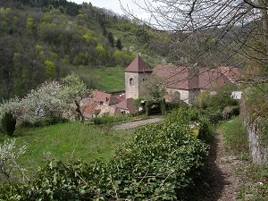
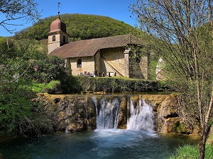
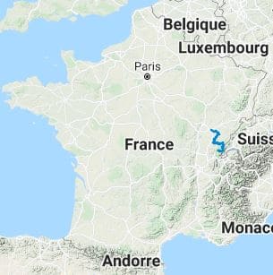
The Jura Escape is a magnificent trek that begins in Dole, a city of art and history, and plunges into the wild heart of the Jura Mountains. The trail connects listed sites, from the visionary architecture of the Royal Saltworks of Arc-et-Senans to the ancient saltworks of Salins-les-Bains, testaments to the Jura's "white gold." Crossing the vineyards of Arbois and the capital of Comté cheese, Poligny, hikers discover a gastronomic heritage inextricably linked to the local terroir. Nature reclaims its domain in the spectacular valleys of Conliège and Les Planches-en-Montagne, where waterfalls cascade from vertiginous limestone cliffs. The route then climbs towards the Hauts de Bienne and the Combes des Rousses, offering landscapes of spruce forests and high-altitude lakes reminiscent of a miniature Siberia. This journey ends in Saint-Claude, a city of pipes and diamonds, nestled in the hollow of steep mountains.
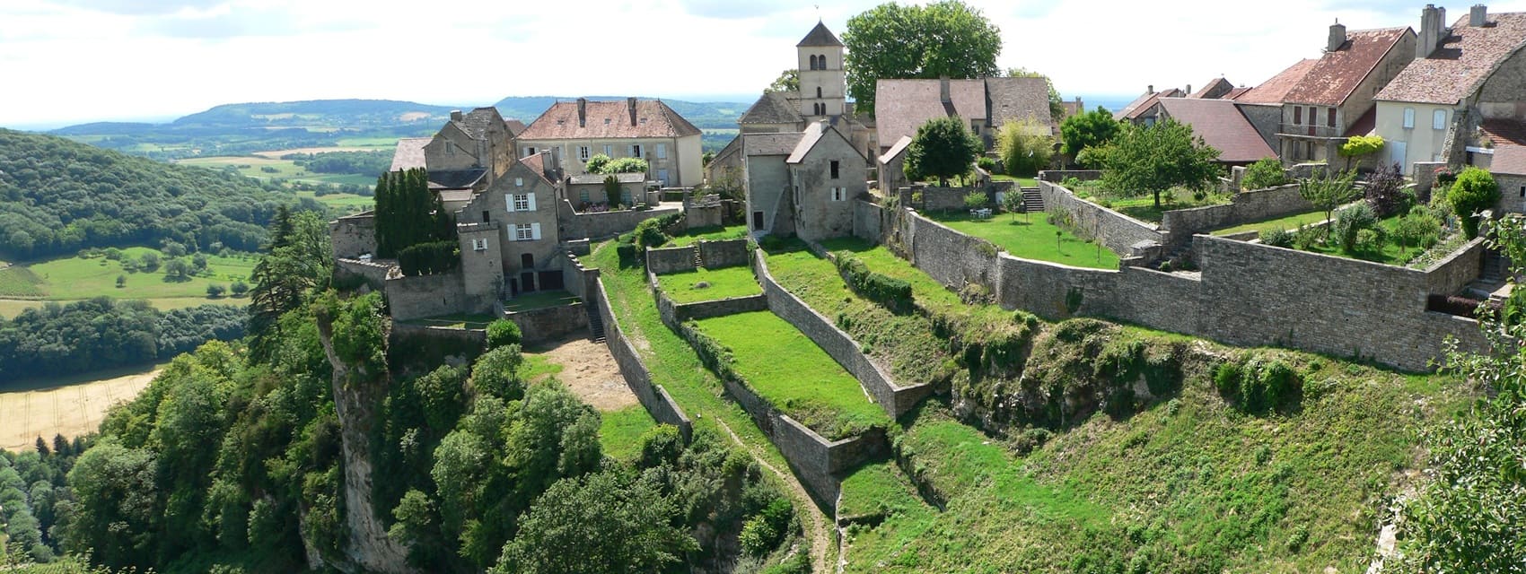
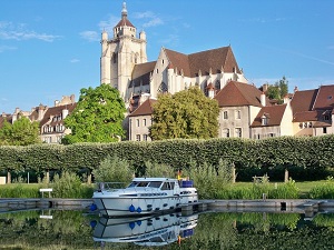
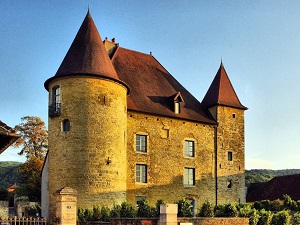
Formerly the capital of the County of Burgundy, Dole is crossed by the Doubs River and is distinguished by its cobbled streets, its fine arts museum, and the majestic collegiate church of Notre-Dame. Arc-et-Senans is famous for its saltworks. Salins-les-Bains, with its thermal baths and history linked to saltwater, is an ideal stop for relaxation. Château-Chalon, one of the most beautiful villages in France, is renowned for its Jura wines and breathtaking views of the Saine Valley. The journey ends in Saint-Claude, famous for its pipes and craftsmanship. This town, nestled in the heart of the mountains, also offers numerous hiking opportunities in the Haut-Jura Regional Natural Park, as well as the chance to discover the gorges of La Langouette or the Hérisson waterfalls.
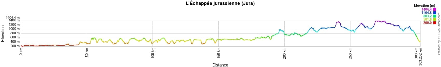

 Distance: 303km, Elevation maximum: 1405m, Elevation minimum: 200m, Elevation gain uphill: 7326m
Nearby paths:
![]() It is advisable to follow the trail markers all along your hike and to bring the FFRandonnée topo-guide. You will also find information on MonGR.fr.
It is advisable to follow the trail markers all along your hike and to bring the FFRandonnée topo-guide. You will also find information on MonGR.fr.
GR®, PR®, GRP® and the corresponding markings are trademarks of the French Federation of Hiking. They may not be reproduced without permission. The French Federation of Hiking, state-approved, includes organizations that maintain hiking routes. It publishes guides for these routes. With your donations, support the actions of the thousands of volunteer markers of the FFRandonnée.
GR-Infos.com is an editorial partner of MonGR.fr.
| Return |

Former holiday hotel with a garden along the Allier, L'Etoile Guest House is located in La Bastide-Puylaurent between Lozere, Ardeche, and the Cevennes in the mountains of Southern France. At the crossroads of GR®7, GR®70 Stevenson Path, GR®72, GR®700 Regordane Way, GR®470 Allier River springs and gorges, GRP® Cevenol, Ardechoise Mountains, Margeride. Numerous loop trails for hiking and one-day biking excursions. Ideal for a relaxing and hiking getaway.
Copyright©gr-infos.com (Authorization for private use only)
To help us maintain and improve GR-Infos.com, a contribution of 2€ is desired via Wero or bank transfer. Thank you!