
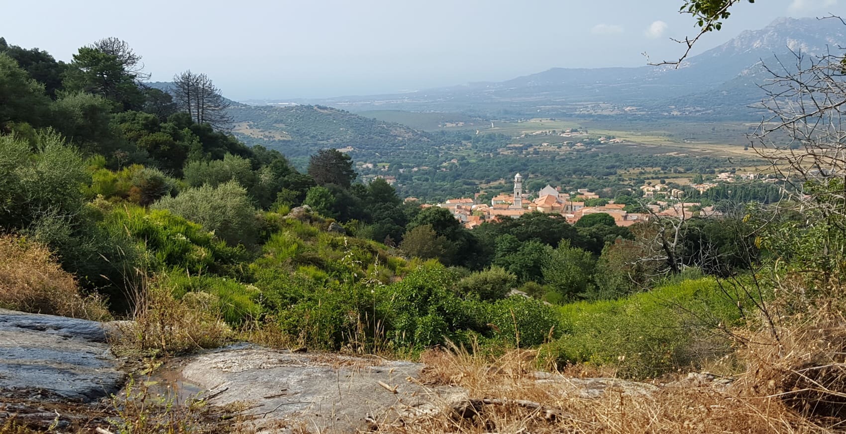
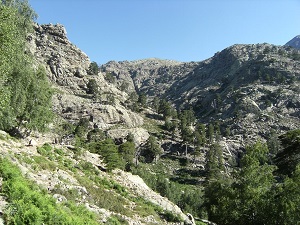
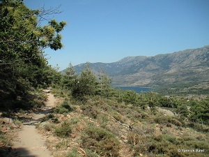
This historic route follows in the footsteps of shepherds who, for centuries, moved their flocks between the coastal plains and the summer pastures of the Niolo region to escape the harsh climate. The path climbs steeply, offering breathtaking panoramas of the Gulf of Galéria before descending into the isolated Manso Valley. The waters of the Fango River meander through a protected biosphere where centuries-old holm oaks stand alongside fragrant maquis shrubland. Genoese bridges spanning rushing torrents and ancient stone enclosures bear witness to a resilient mountain economy. Crossing the high mountain passes, the landscape becomes more rugged, revealing the jagged silhouette of the Grande Barrière mountain range and the snow-capped peaks of the Cinto massif. The Bocca di Capronale pass offers an unparalleled view of the Scandola Nature Reserve before the descent into the Niolo region and the arrival in Corscia, a charming village clinging to the rock face.
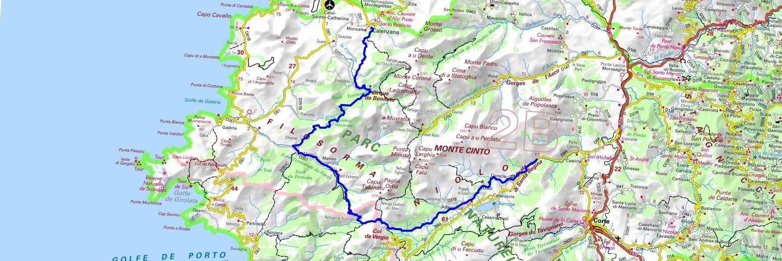
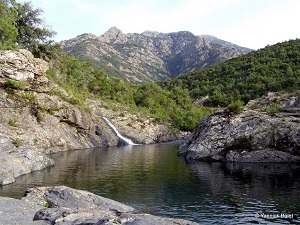
Transhumance in Corsica is an ancestral rite that still today connects the coastal plains of Filosorma to the high lands of Niolo. This seasonal movement, dictated by the cycle of herbs, sees shepherds and their flocks leave the heat of the coast for the coolness of the summer pastures of Monte Cinto. The trail crosses wild landscapes of granite and Laricio pines, crossing steep passes such as the famous Bocca di Foggiale. This living heritage is punctuated by dry stone sheepfolds and Genoese bridges, witnesses of a pastoral economy that has shaped the identity of the island. At the heart of Niolo, the cradle of mountain culture, nature preserves a rare biodiversity, between springs and vertiginous peaks.
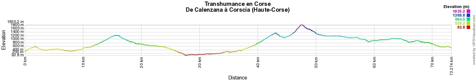

 Distance: 73km, Elevation maximum: 1835m, Elevation minimum: 94m, Elevation gain uphill: 4299m
IGN Maps: 4149OT - CALVI / CIRQUE DE BONIFATU / PNR DE LA CORSE. 4150OT - PORTO / CALANCHE DE PIANA / PNR DE LA CORSE. 4250OT - CORTE / MONTE-CINTO / PNR DE LA CORSE. 4151OT - VICO / CARGESE / GOLFE DE SAGONE.

Transhumance:
Mare e Monti:
Mare to Mare:
![]() It is advisable to follow the beacons all along your hike and to bring the FFRandonnée topo-guide. You will also find information on MonGR.fr.
It is advisable to follow the beacons all along your hike and to bring the FFRandonnée topo-guide. You will also find information on MonGR.fr.
GR®, PR®, GRP® and the corresponding markings are trademarks of the French Federation of Hiking. They may not be reproduced without permission. The French Federation of Hiking, state-approved, includes organizations that maintain hiking routes. It publishes guides for these routes. With your donations, support the actions of the thousands of volunteer markers of the FFRandonnée.
GR-Infos.com is an editorial partner of MonGR.fr.
| Return |

Former holiday hotel with a garden along the Allier, L'Etoile Guest House is located in La Bastide-Puylaurent between Lozere, Ardeche, and the Cevennes in the mountains of Southern France. At the crossroads of GR®7, GR®70 Stevenson Path, GR®72, GR®700 Regordane Way, GR®470 Allier River springs and gorges, GRP® Cevenol, Ardechoise Mountains, Margeride. Numerous loop trails for hiking and one-day biking excursions. Ideal for a relaxing and hiking getaway.
Copyright©gr-infos.com (Authorization for private use only)
To help us maintain and improve GR-Infos.com, a contribution of 2€ is desired via Wero or bank transfer. Thank you!