
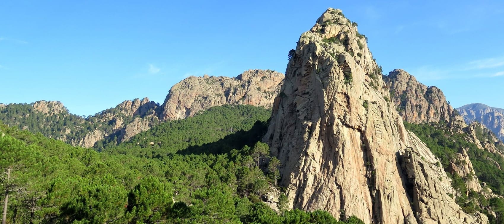
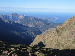
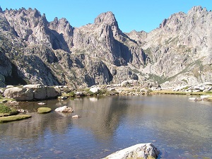
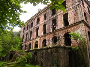
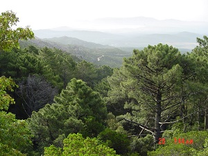
The GR®20, linking Calenzana to Conca, is a legendary Corsican trail, renowned worldwide for its challenging terrain and the raw beauty of its landscape. The trail traverses the central mountain range, offering a spectacular landscape of granite, jagged peaks and glacial cirques. The flora ranges from dense maquis in the north to majestic high-altitude Corsican pines, including alpine meadows and natural pools (pozzines). The history and heritage of the route are steeped in the past, marked by traditional pastoral life, stone sheepfolds and Corsican mountain culture. The fauna is adapted to this extreme environment, with endemic species such as the Corsican nuthatch and, more rarely, the mouflon, making the GR®20 a unique physical and cultural experience in the heart of the Regional Natural Park.
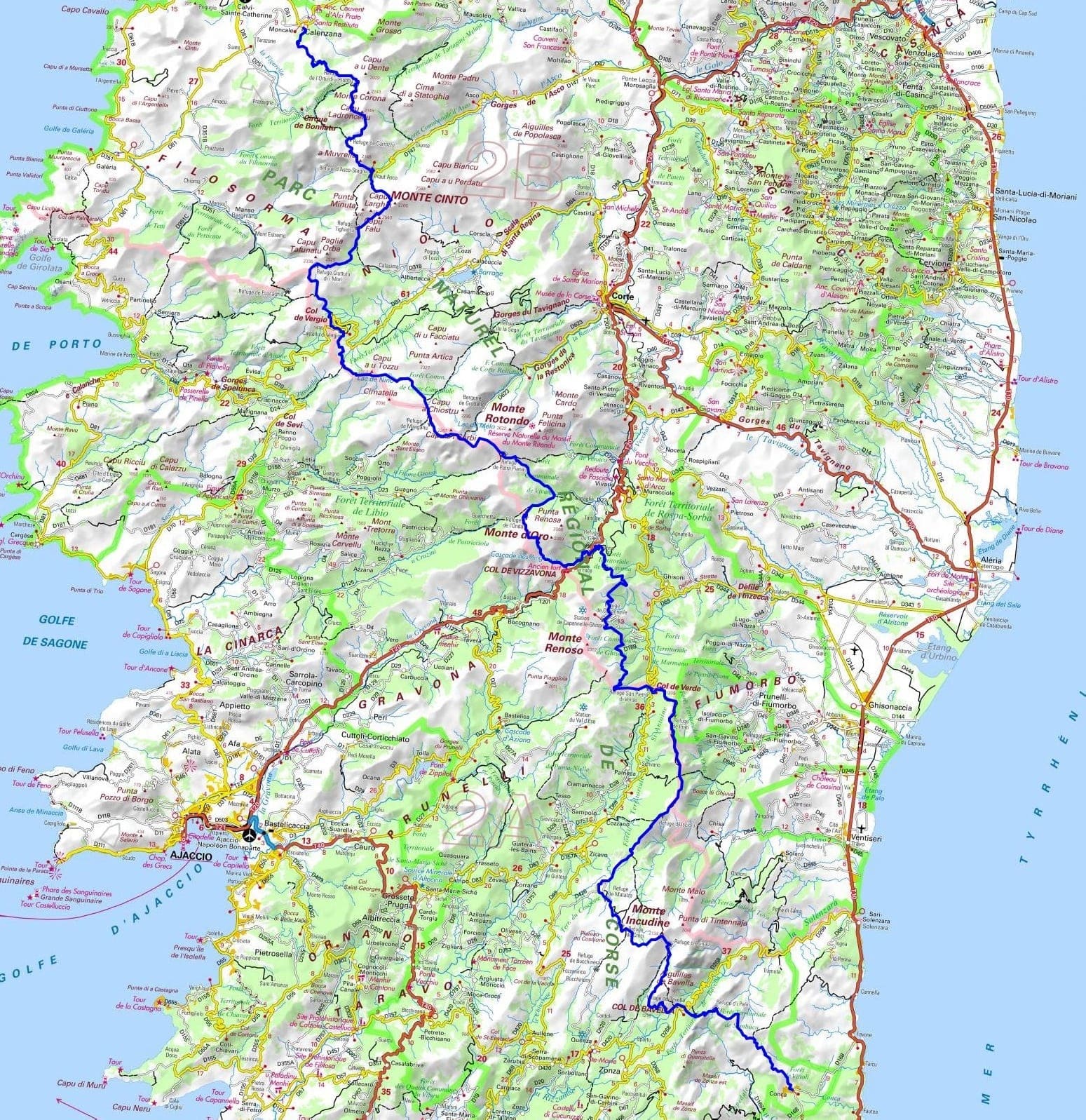
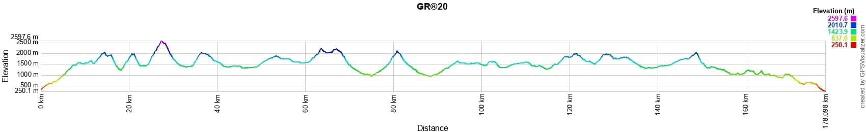
 Distance: 178km, Elevation maximum: 2598m, Elevation minimum: 250m, Elevation gain uphill: 12536m

Nearby paths:
![]() It is advisable to follow the beacons all along your hike and to bring the FFRandonnée topo-guide. You will also find information on MonGR.fr.
It is advisable to follow the beacons all along your hike and to bring the FFRandonnée topo-guide. You will also find information on MonGR.fr.
GR®, PR®, GRP®, and the corresponding signs of markings (white/red, yellow and yellow/red) are trademarks of the French Federation of Hiking. They may not be reproduced without permission. The French Federation of Hiking, state-approved, includes organizations that create and maintain hiking routes on GR®, PR® and GRP®. It publishes topo-guides for these hiking routes. With your donations, support the actions of the thousands of volunteer markers of the FFRandonnée.
GR-Infos.com is an editorial partner of MonGR.fr.
| Return |

Former holiday hotel with a garden along the Allier, L'Etoile Guest House is located in La Bastide-Puylaurent between Lozere, Ardeche, and the Cevennes in the mountains of Southern France. At the crossroads of GR®7, GR®70 Stevenson Path, GR®72, GR®700 Regordane Way, GR®470 Allier River springs and gorges, GRP® Cevenol, Ardechoise Mountains, Margeride. Numerous loop trails for hiking and one-day biking excursions. Ideal for a relaxing and hiking getaway.
Copyright©gr-infos.com (Authorization for private use only)
To help us maintain and improve GR-Infos.com, a contribution of 2€ is desired via Wero or bank transfer. Thank you!