
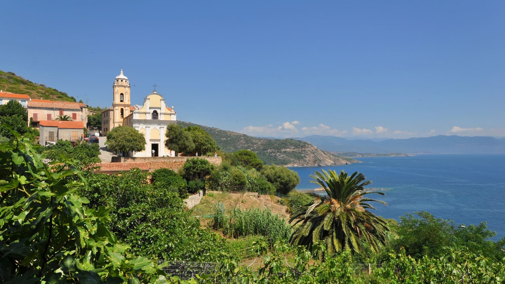
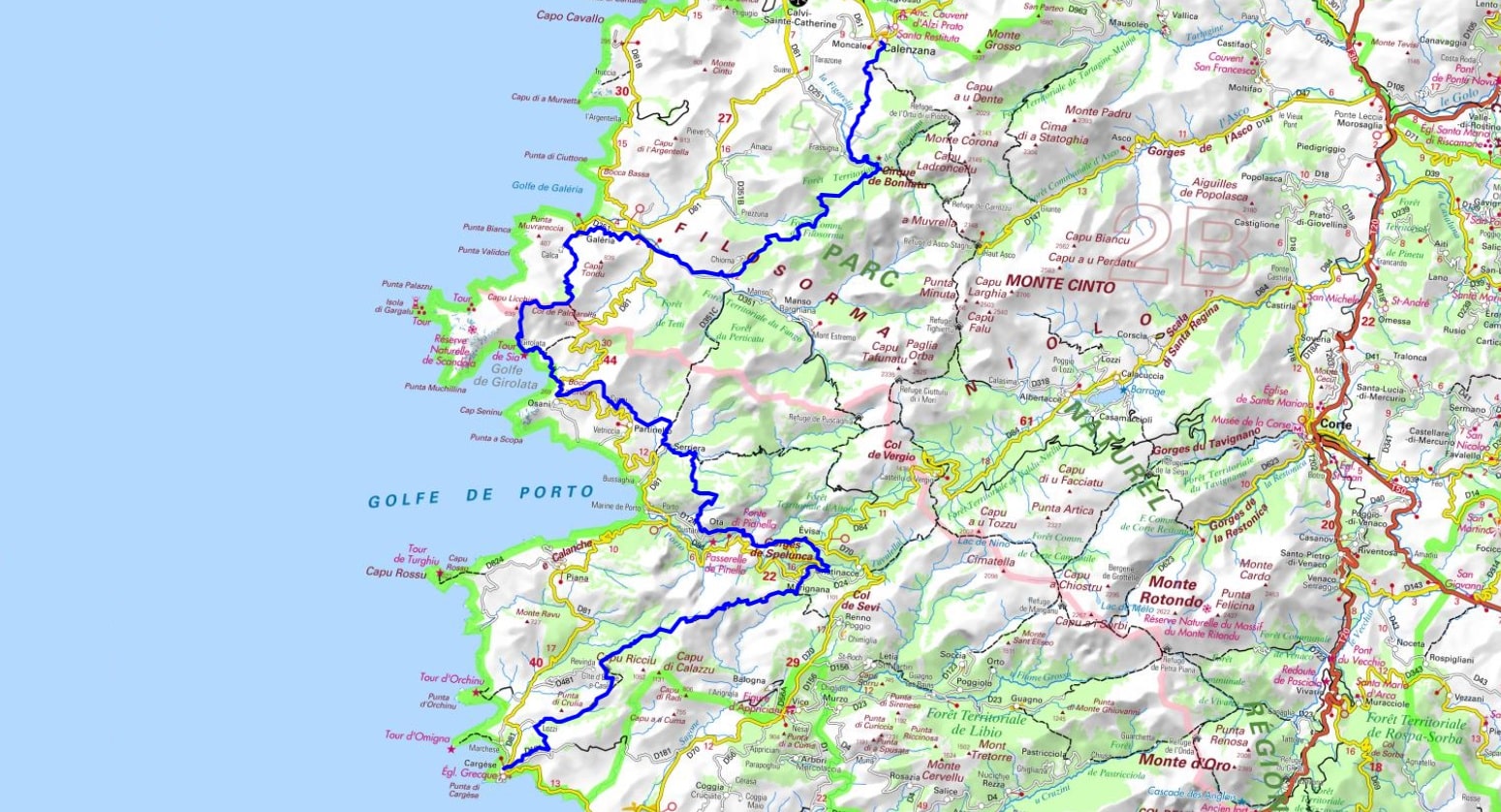
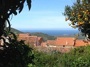
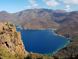
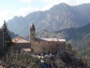
The path winds through fragrant maquis shrubland before descending into the Fango Valley, where natural pools of light granite contrast with the deep green of the holm oak forests. Upon reaching Galéria, hikers discover a wild coastline. The route then passes through villages steeped in history, such as Osani and Serriera, testaments to a rural architecture of schist and granite that defies time. The passage through Ota and Marignana reveals an authentic mountain heritage, with old Genoese bridges and centuries-old transhumance trails. The highlight is undoubtedly the breathtaking view over the Gulf of Porto and the red cliffs of Piana, before the itinerary gently concludes in Cargèse, the "Greek city," whose two churches face each other above the sea.
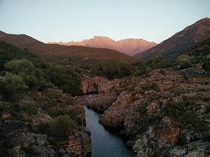
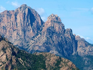
La Filosorma, a secluded region of Upper Corsica nestled between the Balagne and the Gulf of Porto, is a wild sanctuary where the mountains plunge dramatically into the sea. Traversed by the Fango River, this valley offers spectacular landscapes of natural pools bordered by red rocks. Its history is one of transhumance and resistance, marked by pastoralism and the remains of isolated sheepfolds in the maquis. The built heritage is concentrated in Galéria, a former fishing port watched over by a majestic Genoese tower that once protected against Barbary pirate raids. With one of the oldest holm oak forests in Europe, it serves as a refuge for golden eagles and ospreys. This territory, untouched by urbanization, is ideally explored via the Mare e Monti trail, which reveals breathtaking panoramas of the Cinto massif.
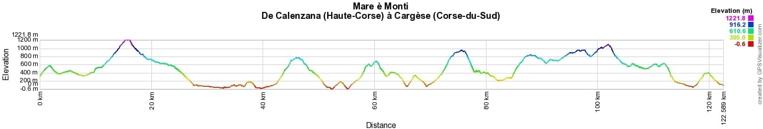
 Distance: 122km, Elevation maximum: 1234m, Elevation minimum: 0m, Elevation gain uphill: 7180m
IGN Maps: 4149OT - CALVI / CIRQUE DE BONIFATU / PNR DE LA CORSE. 4150OT - PORTO / CALANCHE DE PIANA / PNR DE LA CORSE. 4250OT - CORTE / MONTE-CINTO / PNR DE LA CORSE. 4151OT - VICO / CARGESE / GOLFE DE SAGONE.

Transhumance:
Mare e Monti:
Mare to Mare:
![]() It is advisable to follow the beacons all along your hike and to bring the FFRandonnée topo-guide. You will also find information on MonGR.fr.
It is advisable to follow the beacons all along your hike and to bring the FFRandonnée topo-guide. You will also find information on MonGR.fr.
GR®, PR®, GRP® and the corresponding markings are trademarks of the French Federation of Hiking. They may not be reproduced without permission. The French Federation of Hiking, state-approved, includes organizations that maintain hiking routes. It publishes guides for these routes. With your donations, support the actions of the thousands of volunteer markers of the FFRandonnée.
GR-Infos.com is an editorial partner of MonGR.fr.
| Return |

Former holiday hotel with a garden along the Allier, L'Etoile Guest House is located in La Bastide-Puylaurent between Lozere, Ardeche, and the Cevennes in the mountains of Southern France. At the crossroads of GR®7, GR®70 Stevenson Path, GR®72, GR®700 Regordane Way, GR®470 Allier River springs and gorges, GRP® Cevenol, Ardechoise Mountains, Margeride. Numerous loop trails for hiking and one-day biking excursions. Ideal for a relaxing and hiking getaway.
Copyright©gr-infos.com (Authorization for private use only)
To help us maintain and improve GR-Infos.com, a contribution of 2€ is desired via Wero or bank transfer. Thank you!