
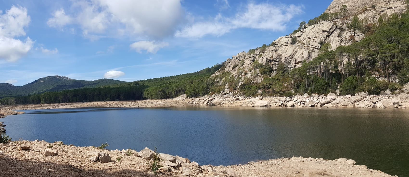
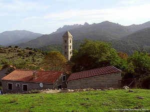
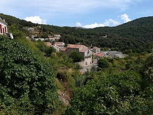
The Mare a Mare Sud trail, linking the Tyrrhenian Sea to the Mediterranean, offers an immersion into the Alta Rocca, the "Land of the Lords." The path leaves the salt flats behind and climbs towards Carbini, famous for its 12th-century Romanesque church and the mysterious history of the Giovannali family. The route then passes through Levie, Quenza, and Serra-di-Scopamène with its ancient olive oil mills. From eucalyptus forests to high-altitude pine forests, passing through dense maquis shrubland where wild boar and red kites roam. Descending via Altagène towards Fozzano, hikers enter the village of the infamous Colomba, a symbol of the Corsican vendetta, whose tower houses dominate the landscape. The trail winds between holm oaks and olive groves before concluding this journey in Propriano, in the Gulf of Valinco.
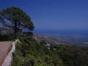
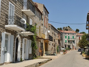
Southern Corsica is a sanctuary where the sheer verticality of granite peaks plunges dramatically into the Mediterranean. From the Genoese city of Ajaccio to the white limestone cliffs of Bonifacio, its heritage tells a story of resistance and conquest, marked by coastal towers and prehistoric sites like Filitosa. The landscapes are strikingly diverse, alternating between the famous Calanques of Piana, with their glowing red rocks, and the Bavella Needles that dominate the interior. Wild nature expresses itself in the fragrant maquis, a refuge for unique biodiversity where the red kite and the mouflon thrive. Inland villages, such as Sartène, retain an authentic soul and age-old traditions rooted in stone.
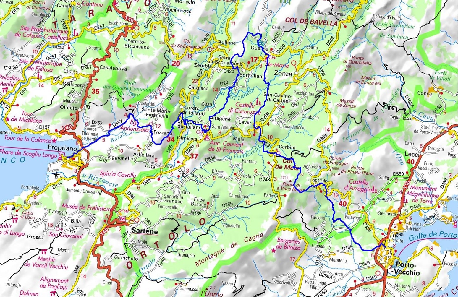
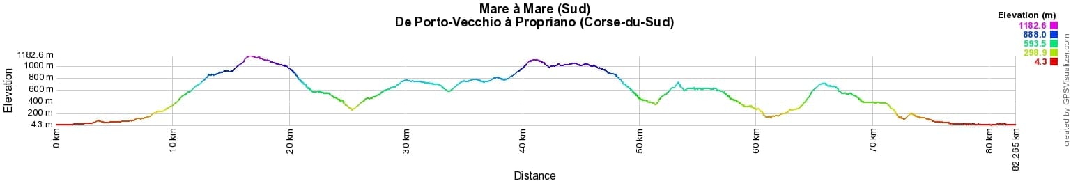
 Distance: 82km, Elevation maximum: 1183m, Elevation minimum: 4m, Elevation gain uphill: 3748m
IGN Maps: 4153OT - AJACCIO / ILES SANGUINAIRES. 4252OT - MONTE-RENOSO / BASTELICA / PNR DE LA CORSE. 4253ET - AIGUILLES-DE-BAVELLA / SOLENZARA / PNR DE LA CORSE. 4253OT - PETRETO-BICCHISANO / ZICAVO / PNR DE LA CORSE. 4352OT - ALERIA / GHISONACCIA / PNR DE LA CORSE.

Transhumance:
Mare e Monti:
Mare to Mare:
![]() It is advisable to follow the beacons all along your hike and to bring the FFRandonnée topo-guide. You will also find information on MonGR.fr.
It is advisable to follow the beacons all along your hike and to bring the FFRandonnée topo-guide. You will also find information on MonGR.fr.
GR®, PR®, GRP® and the corresponding markings are trademarks of the French Federation of Hiking. They may not be reproduced without permission. The French Federation of Hiking, state-approved, includes organizations that maintain hiking routes. It publishes guides for these routes. With your donations, support the actions of the thousands of volunteer markers of the FFRandonnée.
GR-Infos.com is an editorial partner of MonGR.fr.
| Return |

Former holiday hotel with a garden along the Allier, L'Etoile Guest House is located in La Bastide-Puylaurent between Lozere, Ardeche, and the Cevennes in the mountains of Southern France. At the crossroads of GR®7, GR®70 Stevenson Path, GR®72, GR®700 Regordane Way, GR®470 Allier River springs and gorges, GRP® Cevenol, Ardechoise Mountains, Margeride. Numerous loop trails for hiking and one-day biking excursions. Ideal for a relaxing and hiking getaway.
Copyright©gr-infos.com (Authorization for private use only)
To help us maintain and improve GR-Infos.com, a contribution of 2€ is desired via Wero or bank transfer. Thank you!