
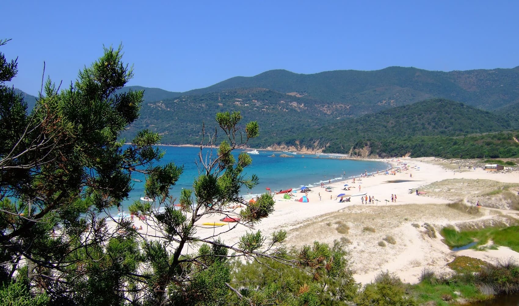
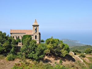
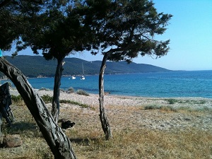
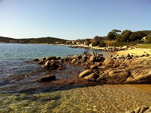
The Mare e Monti Sud trail, between the azure Mediterranean and the wild maquis of Southern Corsica, climbs towards Pietrosella, offering spectacular views of the Sanguinaires Islands. Crossing the Coti-Chiavari forest, hikers discover the remains of the old penitentiary, a testament to a complex social history, before reaching Cupabia beach, a jewel of white sand nestled in a secluded cove. Genoese towers dot the coastline, watching over the horizon from Serra-di-Ferro. The scent of myrtle and strawberry tree accompanies every step towards the port of Porto Pollo. Ascending towards Olmeto, a charming village clinging to the mountainside, one embraces the history of Corsican vendettas and the beauty of centuries-old olive groves. The journey ends in Propriano, at the bottom of the Gulf of Valinco, after crossing landscapes of pink granite and cork oaks.
The Ornano Taravo micro-region, south of Ajaccio, is a microcosm of the Corsican soul, where the Taravo River valley sculpts landscapes of rare diversity. From the granite ridges of the Upper Taravo to the golden beaches of Porto-Pollo, nature displays its raw power amidst fragrant maquis, cork oak forests, and ancient olive groves. The historical heritage here is exceptional, marked by the mysterious alignments of menhir-statues at the prehistoric site of Filitosa. The region's history is also that of the Lords of Ornano, whose fortified houses and hilltop villages like Santa-Maria-Siché bear witness to a powerful medieval past. Exploring the trails, one discovers Genoese bridges spanning rushing waters and discreet Romanesque churches nestled in the heart of the valleys.
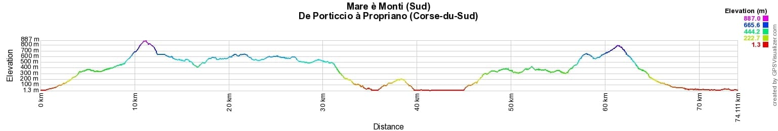
 Distance: 74km, Elevation maximum: 885m, Elevation minimum: 0m, Elevation gain uphill: 2844m
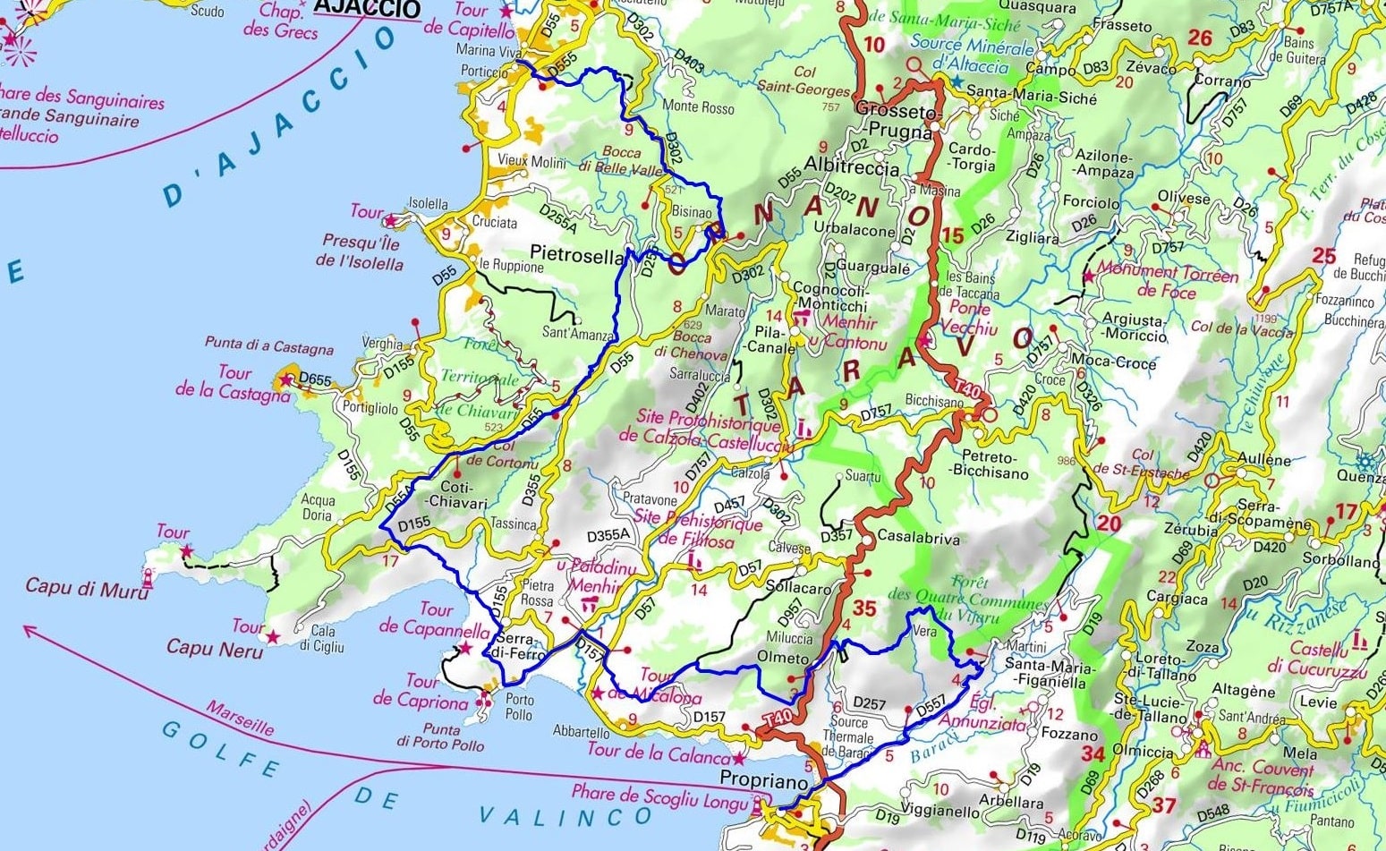
IGN Maps: 4153OT - AJACCIO / ILES SANGUINAIRES. 4253OT - PETRETO-BICCHISANO / ZICAVO / PNR DE LA CORSE. 4254OT - SARTENE / MONTAGNE DE CAGNA / PNR DE LA CORSE. 4154OT - PROPRIANO / GOLFE DE VALINCO.

Transhumance:
Mare e Monti:
Mare to Mare:
![]() It is advisable to follow the beacons all along your hike and to bring the FFRandonnée topo-guide. You will also find information on MonGR.fr.
It is advisable to follow the beacons all along your hike and to bring the FFRandonnée topo-guide. You will also find information on MonGR.fr.
GR®, PR®, GRP® and the corresponding markings are trademarks of the French Federation of Hiking. They may not be reproduced without permission. The French Federation of Hiking, state-approved, includes organizations that maintain hiking routes. It publishes guides for these routes. With your donations, support the actions of the thousands of volunteer markers of the FFRandonnée.
GR-Infos.com is an editorial partner of MonGR.fr.
| Return |

Former holiday hotel with a garden along the Allier, L'Etoile Guest House is located in La Bastide-Puylaurent between Lozere, Ardeche, and the Cevennes in the mountains of Southern France. At the crossroads of GR®7, GR®70 Stevenson Path, GR®72, GR®700 Regordane Way, GR®470 Allier River springs and gorges, GRP® Cevenol, Ardechoise Mountains, Margeride. Numerous loop trails for hiking and one-day biking excursions. Ideal for a relaxing and hiking getaway.
Copyright©gr-infos.com (Authorization for private use only)
To help us maintain and improve GR-Infos.com, a contribution of 2€ is desired via Wero or bank transfer. Thank you!