
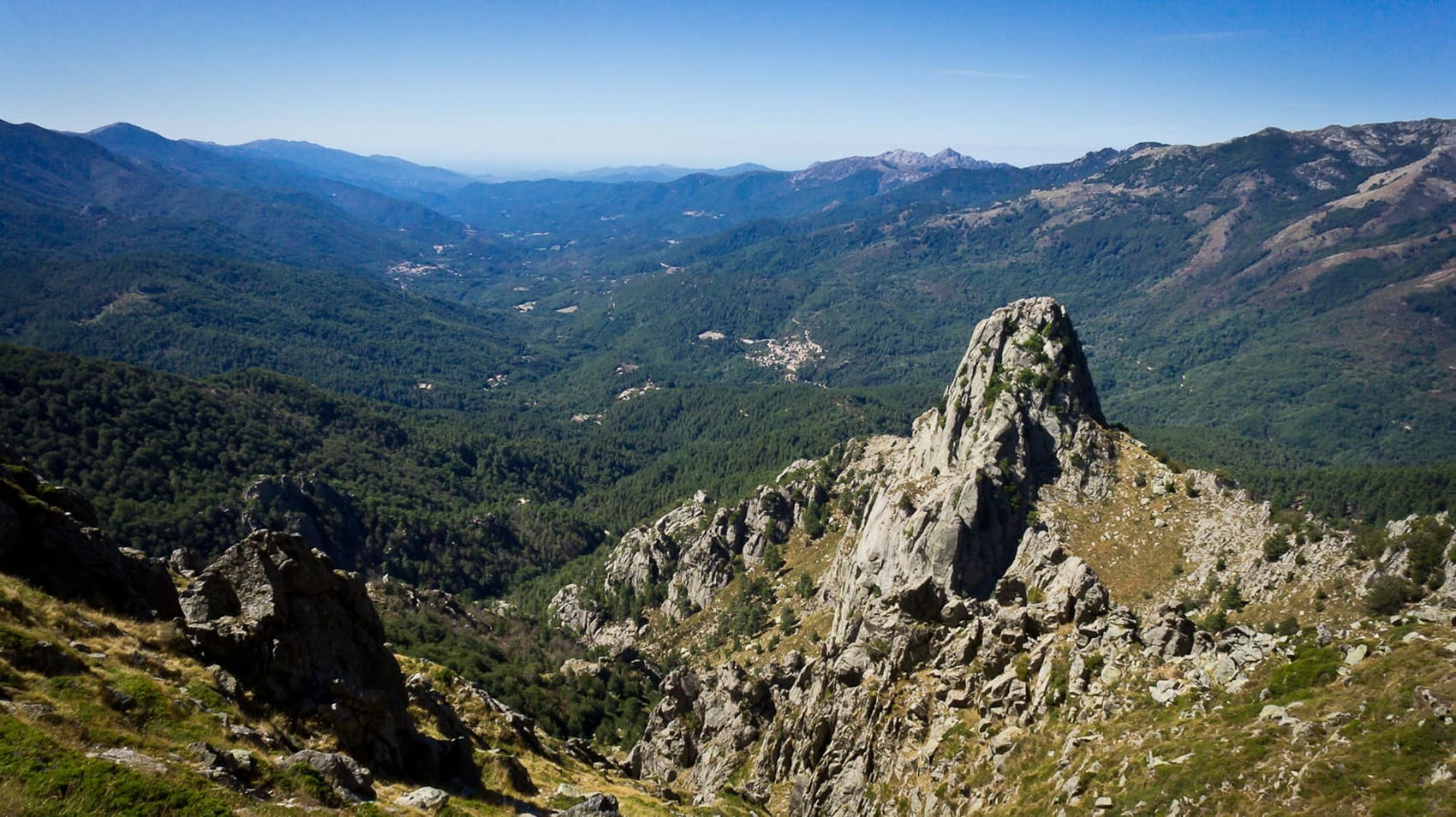
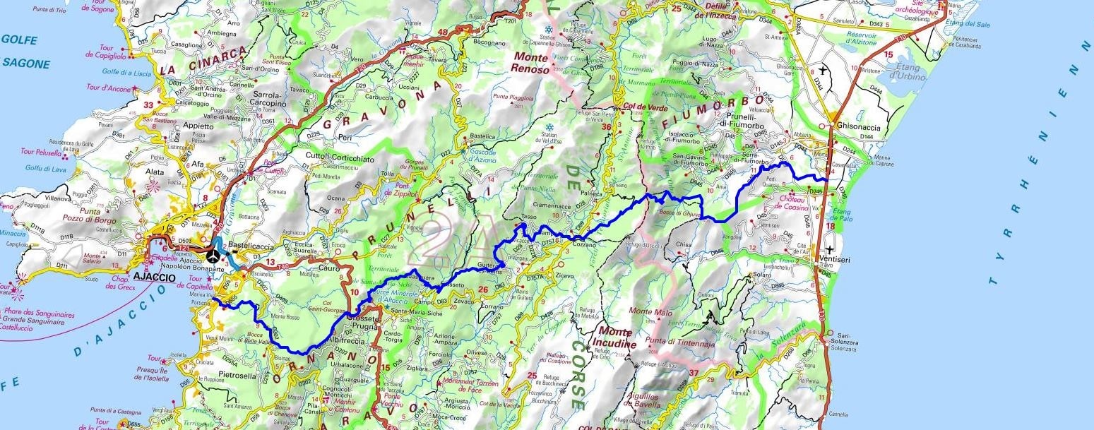
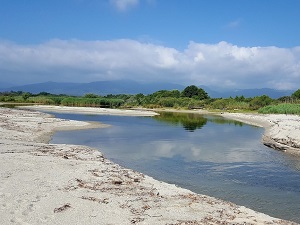
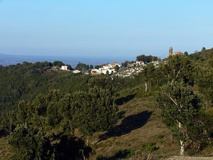
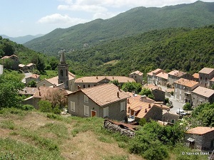
The Mare a Mare trail, linking the Tyrrhenian Sea to the Mediterranean, winds through ancient chestnut forests, the cornerstone of Corsica's historic rural economy. Crossing mountain passes, hikers discover the Upper Taravo Valley and the village of Cozzano, a bastion of a still vibrant pastoral heritage. Between Tasso and Guitera-les-Bains, thermal springs offer a welcome respite amidst dense vegetation of Corsican pine and beech trees. The route then meanders through Frasseto and Quasquara, granite villages with narrow streets steeped in history and tradition. Descending towards Buselica, the maquis reclaims its territory, releasing the scents of rockrose and heather, before the horizon opens onto the Gulf of Ajaccio. The arrival at Grosseto-Prugna and the end on the beach of Porticcio mark a striking contrast between the rigor of the central mountains and the clarity of the coastal waters.
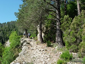
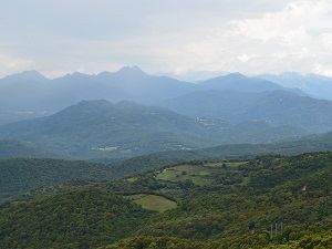
Central Corsica, a true sanctuary of the island, is dominated by the Monte Cinto massif and high-altitude glacial lakes like Capitello. In Corte, the historical and moral capital, the citadel perched atop its rocky outcrop recalls the epic story of Pascal Paoli and the independence of the Corsican nation. The built heritage is revealed in the charming villages perched on the hillsides, where Baroque churches conceal treasures of sacred art. Nature reigns supreme here, expressing itself through the pink granite cliffs of the Popolasca Needles and the Corsican pine forests, with breathtaking panoramas over the Tavignano and Restonica valleys. Between crystal-clear streams and natural pools, the mountain biodiversity shelters the bearded vulture and rare endemic flora. This central region embodies pastoral Corsica, where transhumance traditions still profoundly shape the local identity.
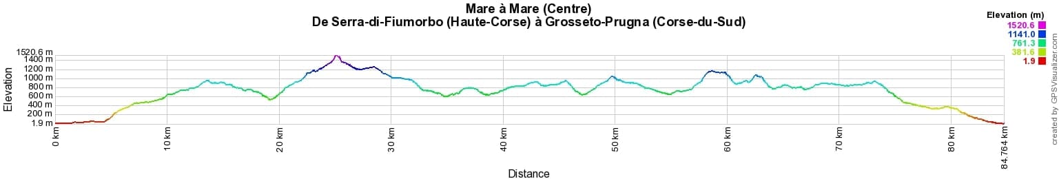
 Distance: 84km, Elevation maximum: 1521m, Elevation minimum: 2m, Elevation gain uphill: 4463m
IGN Maps: 4153OT - AJACCIO / ILES SANGUINAIRES. 4252OT - MONTE-RENOSO / BASTELICA / PNR DE LA CORSE. 4253ET - AIGUILLES-DE-BAVELLA / SOLENZARA / PNR DE LA CORSE. 4253OT - PETRETO-BICCHISANO / ZICAVO / PNR DE LA CORSE. 4352OT - ALERIA / GHISONACCIA / PNR DE LA CORSE.

Transhumance:
Mare e Monti:
Mare to Mare:
![]() It is advisable to follow the beacons all along your hike and to bring the FFRandonnée topo-guide. You will also find information on MonGR.fr.
It is advisable to follow the beacons all along your hike and to bring the FFRandonnée topo-guide. You will also find information on MonGR.fr.
GR®, PR®, GRP® and the corresponding markings are trademarks of the French Federation of Hiking. They may not be reproduced without permission. The French Federation of Hiking, state-approved, includes organizations that maintain hiking routes. It publishes guides for these routes. With your donations, support the actions of the thousands of volunteer markers of the FFRandonnée.
GR-Infos.com is an editorial partner of MonGR.fr.
| Return |

Former holiday hotel with a garden along the Allier, L'Etoile Guest House is located in La Bastide-Puylaurent between Lozere, Ardeche, and the Cevennes in the mountains of Southern France. At the crossroads of GR®7, GR®70 Stevenson Path, GR®72, GR®700 Regordane Way, GR®470 Allier River springs and gorges, GRP® Cevenol, Ardechoise Mountains, Margeride. Numerous loop trails for hiking and one-day biking excursions. Ideal for a relaxing and hiking getaway.
Copyright©gr-infos.com (Authorization for private use only)
To help us maintain and improve GR-Infos.com, a contribution of 2€ is desired via Wero or bank transfer. Thank you!