
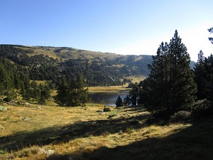
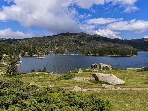
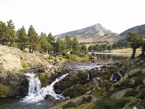
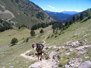
Starting directly from the lively Les Angles resort, this sweeping loop into the heart of the Capcir region offers a profound immersion into what is often affectionately called the "Little Siberia" of the Pyrenees. The trail begins purposefully with a steady climb towards Lake Aude, wonderfully surrounded by dense mountain pines, before reaching the highly protected, magnificent site of Lake Bouillouses located right at the foot of the dramatic Carlit massif. This imposing high-mountain landscape, complete with its distant glaciers, the fascinating Fontrabiouse caves, and the steadfast fortified village of Puyvalador—standing as a medieval sentinel overlooking the entire valley—is truly breathtaking. Passing quietly through the traditional, rustic hamlets of Odello and Réal, hikers will continually discover an deeply authentic pastoral heritage, powerfully marked by ancient Romanesque churches. Between these dense, silent forests and expansive high plateaus, you might even be lucky enough to spot agile mouflon or graceful chamois. The route finally becomes noticeably gentler upon reaching Lake Matemale, a vast, tranquil expanse of water beautifully bordered by a fragrant Scots pine forest.
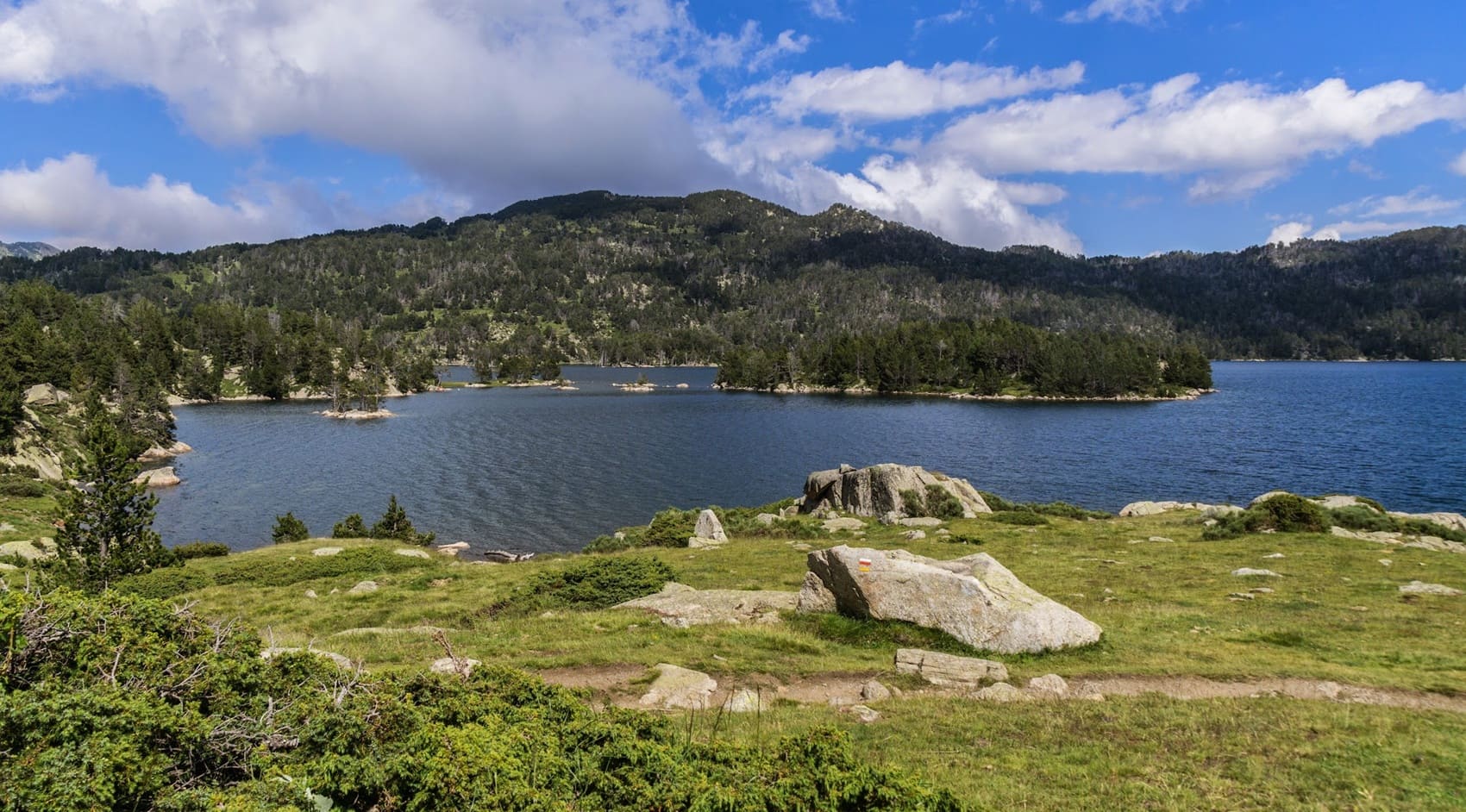
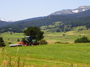
The Capcir, a sprawling high plateau positioned in the Pyrénées-Orientales and famously nicknamed the "Little French Siberia," is a remarkable high-altitude region offering entirely unique, almost Nordic landscapes. Completely encircled by majestic, soaring peaks such as Puyvalador and Péric, it proudly offers a raw, powerfully unspoiled natural environment comprised of vast mountain pine forests and sparkling, crystal-clear lakes, most notably Lake Matemale. Its history is deeply marked by long centuries of resilient forestry and pastoral traditions, where timeless villages like Formiguères—which once served as a favored summer residence for the ancient Kings of Majorca—carefully preserve an authentic, deeply rooted granite and slate heritage. The notoriously harsh climate has successfully shaped an exceptional biodiversity, actively providing a safe refuge for the elusive capercaillie and the sturdy mouflon, all highly protected within the expansive Catalan Pyrenees Regional Natural Park.
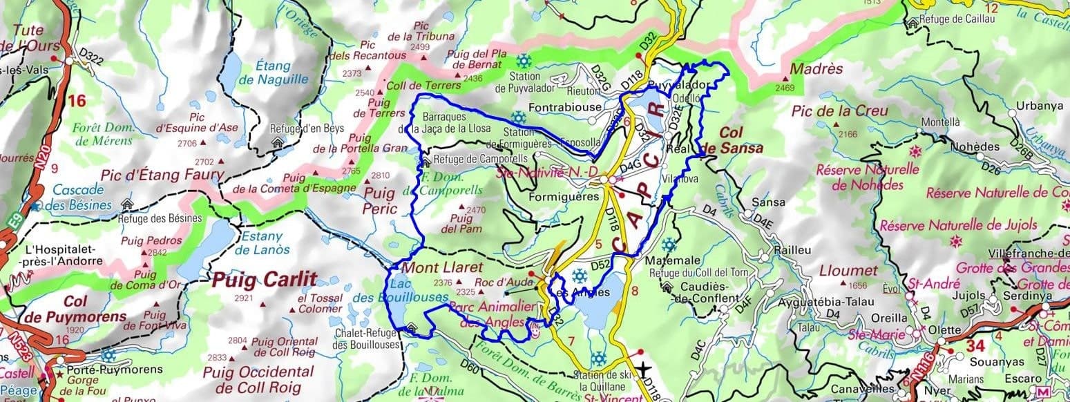
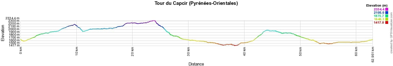
 Distance: 63km, Elevation maximum: 2331m, Elevation minimum: 1411m, Elevation gain uphill: 1828m
IGN Maps: 2248ET - AXAT / QUERIGUT / GORGES DE L'AUDE. 2249ET - FONT-ROMEU / CAPCIR.
Nearby paths:
![]() It is advisable to follow the beacons all along your hike and to bring the FFRandonnée topo-guide. You will also find information on MonGR.fr.
It is advisable to follow the beacons all along your hike and to bring the FFRandonnée topo-guide. You will also find information on MonGR.fr.
GR®, PR®, GRP® and the corresponding markings are trademarks of the French Federation of Hiking. They may not be reproduced without permission. The French Federation of Hiking, state-approved, includes organizations that maintain hiking routes. It publishes guides for these routes. With your donations, support the actions of the thousands of volunteer markers of the FFRandonnée.
GR-Infos.com is an editorial partner of MonGR.fr.
| Return |

Former holiday hotel with a garden along the Allier, L'Etoile Guest House is located in La Bastide-Puylaurent between Lozere, Ardeche, and the Cevennes in the mountains of Southern France. At the crossroads of GR®7, GR®70 Stevenson Path, GR®72, GR®700 Regordane Way, GR®470 Allier River springs and gorges, GRP® Cevenol, Ardechoise Mountains, Margeride. Numerous loop trails for hiking and one-day biking excursions. Ideal for a relaxing and hiking getaway.
Copyright©gr-infos.com (Authorization for private use only)
To help us maintain and improve GR-Infos.com, a contribution of 2€ is desired via Wero or bank transfer. Thank you!