
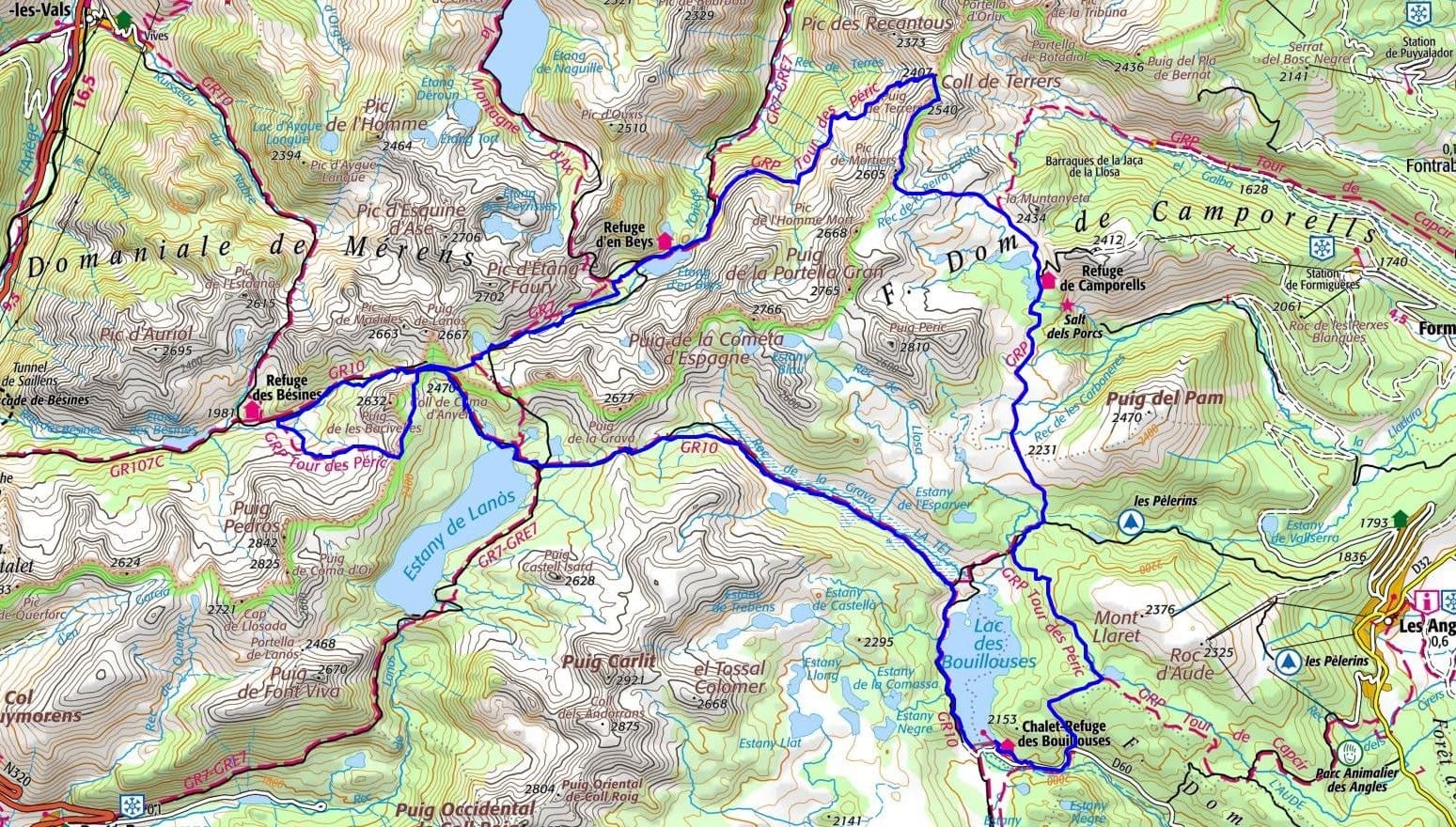
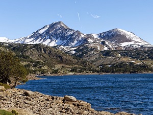
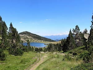
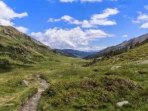
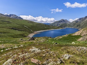
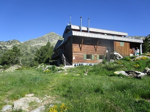
Starting from the Bouillouses dam, this high-altitude hike in the heart of the Catalan Pyrenees Regional Natural Park offers a raw immersion between Capcir and Haute-Ariège. The trail climbs towards the majestic Lac du Lanoux, the largest lake in the French Pyrenees, before descending to the Refuge des Bésines in a wild, granite landscape. Crossing mountain passes, hikers discover the Étang d'en Beys, nestled in a glacial basin where Pyrenean wildlife, including chamois and marmots, reign supreme. The route skirts the twin peaks of Grand and Petit Péric, veritable stone sentinels, to reach the Camporells site and its lakes. This area, marked by the history of pastoralism and old forges, is adorned with mountain pines and short alpine meadows. The loop then descends towards Lac d'Aude, a haven of forest peace, before returning to the shimmering shores of the Bouillouses.
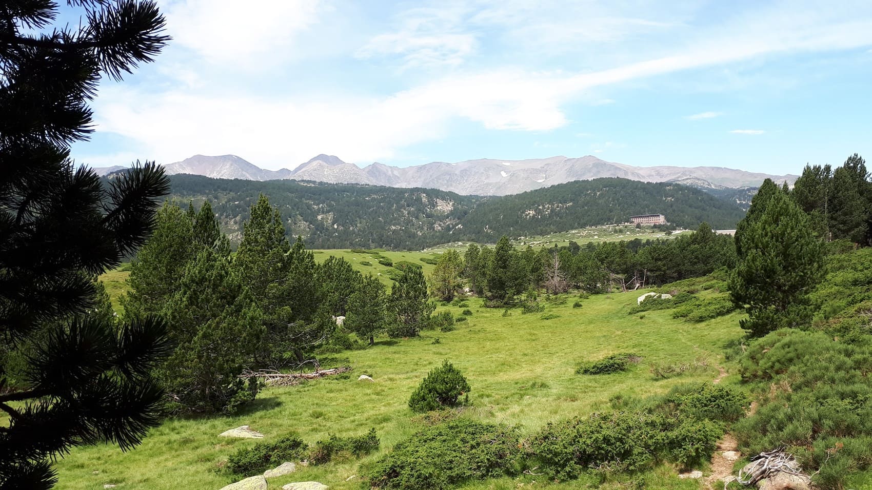
The Pérics massif is a majestic mountain range straddling the Eastern-Pyrenees and Ariège departments, in the heart of the Catalan Pyrenees and the Donezan region. The landscape is characterized by sharp, granite relief, sculpted by glaciers, giving rise to numerous high-altitude lakes with crystal-clear waters. The history of the massif is one of intense pastoral life, marked by transhumance, which forged a unique Pyrenean culture. The flora is typical of high mountains, dominated by mountain pine forests that cover the slopes, giving way to alpine meadows. The fauna is emblematic of the Pyrenees, including the Pyrenean chamois, the marmot, and various birds of prey that soar above the rocky cirques, making the Pérics massif a prime destination for hiking.
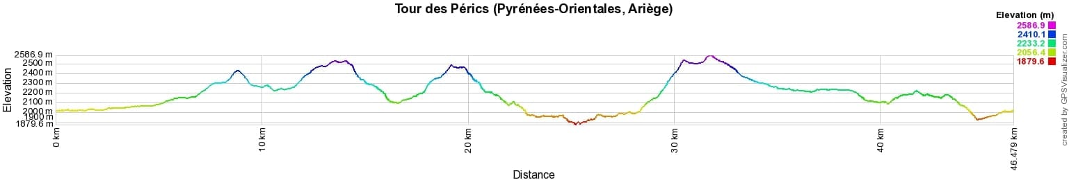
 Distance: 46km, Elevation maximum: 2587m, Elevation minimum: 1880m, Elevation gain uphill: 2289m
IGN Maps: 2248ET - AXAT / QUERIGUT / GORGES DE L'AUDE. 2249ET - FONT-ROMEU / CAPCIR. 2249OT - BOURG-MADAME / PIC CARLIT / COL DE PUYMORENS.
Nearby paths:
![]() It is advisable to follow the beacons all along your hike and to bring the FFRandonnée topo-guide. You will also find information on MonGR.fr.
It is advisable to follow the beacons all along your hike and to bring the FFRandonnée topo-guide. You will also find information on MonGR.fr.
GR®, PR®, GRP® and the corresponding markings are trademarks of the French Federation of Hiking. They may not be reproduced without permission. The French Federation of Hiking, state-approved, includes organizations that maintain hiking routes. It publishes guides for these routes. With your donations, support the actions of the thousands of volunteer markers of the FFRandonnée.
GR-Infos.com is an editorial partner of MonGR.fr.
| Return |

Former holiday hotel with a garden along the Allier, L'Etoile Guest House is located in La Bastide-Puylaurent between Lozere, Ardeche, and the Cevennes in the mountains of Southern France. At the crossroads of GR®7, GR®70 Stevenson Path, GR®72, GR®700 Regordane Way, GR®470 Allier River springs and gorges, GRP® Cevenol, Ardechoise Mountains, Margeride. Numerous loop trails for hiking and one-day biking excursions. Ideal for a relaxing and hiking getaway.
Copyright©gr-infos.com (Authorization for private use only)
To help us maintain and improve GR-Infos.com, a contribution of 2€ is desired via Wero or bank transfer. Thank you!