
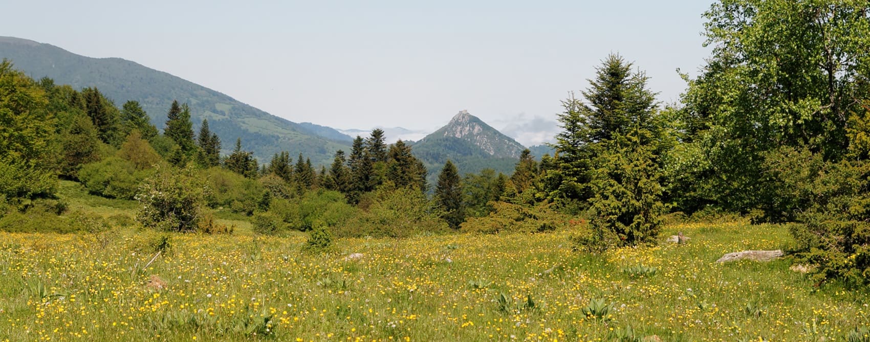
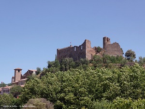
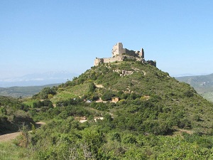
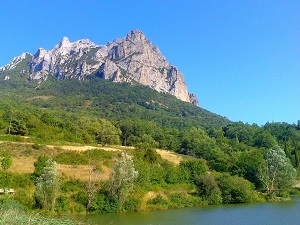
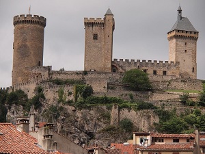
The Cathar movement, which advocated for a distinct Christian faith, flourished in this region during the 12th century. Their rejection of the Catholic Church's authority led to violent repression, culminating in the Albigensian Crusade in the early 13th century. Throughout the trail, hikers can explore the ruins of fortified castles, such as the famous Château de Peyrepertuse and Château de Quéribus, which stand as monuments to the military architecture of the era. The trail also provides an ideal habitat for numerous bird species. It is common to spot raptors like the kestrel and golden eagle, as well as songbirds such as the blackbird and warbler. The region is home to mammals including wild boar, foxes, and deer, and lucky hikers might even glimpse more elusive species like the genet or the lynx.
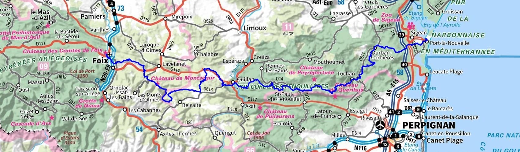
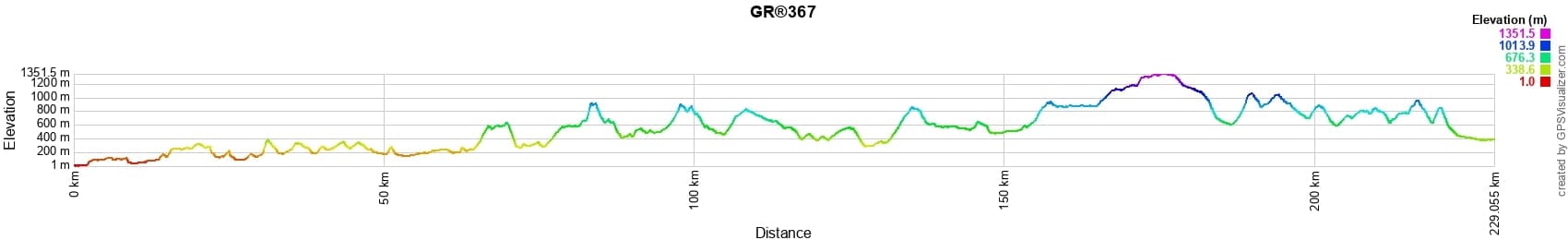
 Distance: 221.64km, Elevation maximum: 1351m, Elevation minimum: 1m, Elevation gain uphill: 7908m
IGN Maps: 2546OT - NARBONNE. 2547OT - DURBAN-CORBIERES / LEUCATE / PLAGES DU ROUSSILLON. 2447OT - TUCHAN / MASSIF DES CORBIERES. 2147ET - FOIX / TARASCON-SUR-ARIEGE. 2148ET - AX-LES-THERMES. 2247OT - LAVELANET / MONTSEGUR / LAC DE MONTBEL. 2248ET - AXAT / QUERIGUT / GORGES DE L'AUDE. 2347OT - QUILLAN / ALET-LES-BAINS.

Nearby paths:
![]() It is advisable to follow the beacons throughout your itinerary and to bring the FFRandonnée topo-guide with you. You will also find information on MonGR.fr.
It is advisable to follow the beacons throughout your itinerary and to bring the FFRandonnée topo-guide with you. You will also find information on MonGR.fr.
GR®, PR®, GRP®, and the corresponding signs of markings (white / red, yellow and yellow / red) are trademarks of the French Federation of Hiking. They may not be reproduced without permission. The French Federation of Hiking, state-approved, includes organizations that create and maintain hiking routes on GR®, PR®, and GRP®. It publishes guides for these topo hiking routes. With your donations, you support the actions of the thousands of FFRandonnée volunteer markers.
GR-Infos.com is an editorial partner of MonGR.fr.
| Return |

Former holiday hotel with a garden along the Allier, L'Etoile Guest House is located in La Bastide-Puylaurent between Lozere, Ardeche, and the Cevennes in the mountains of Southern France. At the crossroads of GR®7, GR®70 Stevenson Path, GR®72, GR®700 Regordane Way, GR®470 Allier River springs and gorges, GRP® Cevenol, Ardechoise Mountains, Margeride. Numerous loop trails for hiking and one-day biking excursions. Ideal for a relaxing and hiking getaway.
Copyright©gr-infos.com (Authorization for private use only)
To help us maintain and improve GR-Infos.com, a contribution of 2€ is desired via Wero or bank transfer. Thank you!