
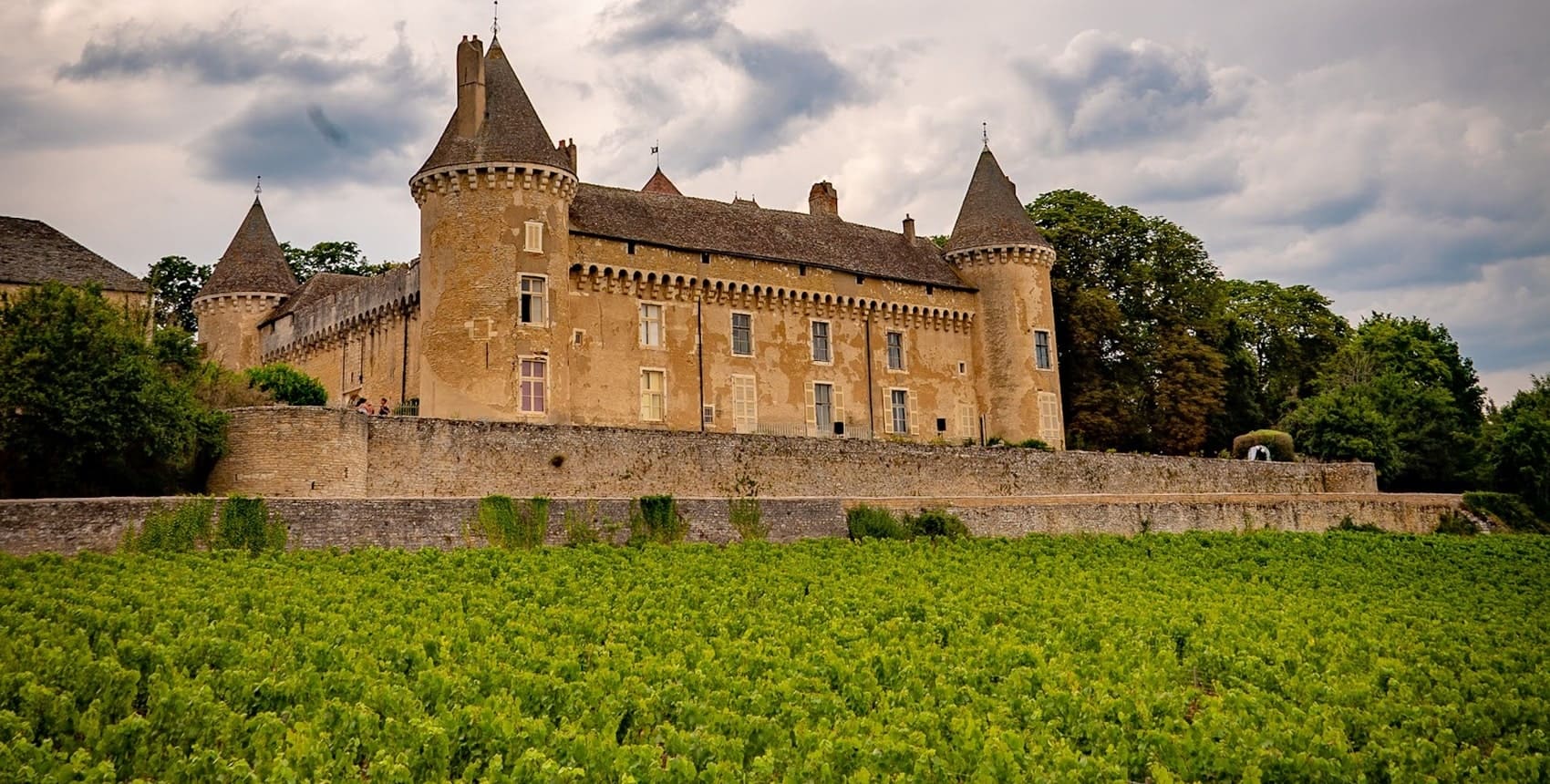
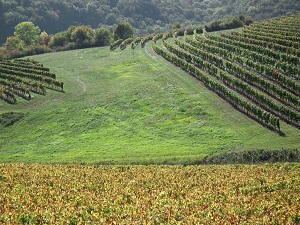
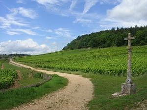
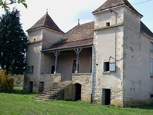
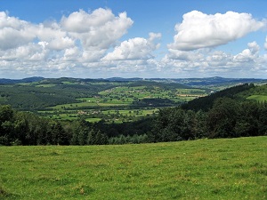
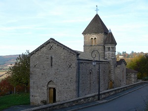
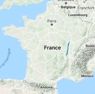
The GR®76 offers a magnificent hike from Chagny in Saône-et-Loire to Affoux in the Rhône department, crossing the renowned wine regions of Burgundy and Beaujolais. Covering approximately 183 km, the trail winds through rolling vineyards, dense forests, and charming stone villages. Along the way, hikers will discover the rich architectural heritage of the area, including Romanesque churches, traditional wine estates, and ancient castles. The flora features a mix of deciduous woodlands and sun-drenched vine slopes, while the local fauna includes diverse bird species and woodland mammals. This route provides a perfect blend of natural beauty, history, and the celebrated gastronomy of the region.
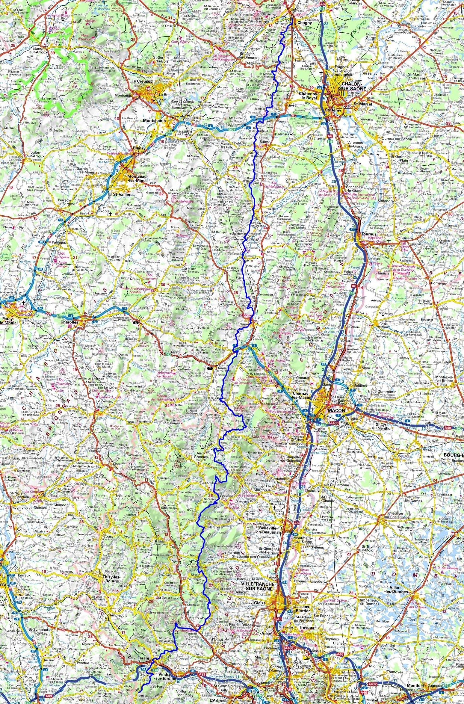
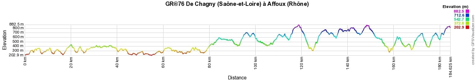
 Distance: 183km, Elevation maximum: 886m, Elevation minimum: 210m, Elevation gain uphill: 5150m
IGN Maps: Chalon-sur-Saone (2926E). Buxy (2927O). Cluny (2927E). Macon (2928O). Beaujeu (2929ET). Tarare (2930O).
Nearby paths:
![]() It is advisable to follow the beacons all along your hike and to bring the FFRandonnee topo-guide. You will also find information on MonGR.fr.
It is advisable to follow the beacons all along your hike and to bring the FFRandonnee topo-guide. You will also find information on MonGR.fr.
GR®, PR®, GRP®, and the corresponding signs of markings (white/red, yellow and yellow/red) are trademarks of the French Federation of Hiking. They may not be reproduced without permission. The French Federation of Hiking, state-approved, includes organizations that create and maintain hiking routes on GR®, PR® and GRP®. It publishes guides for these topo hiking routes. With your donations, support the actions of the thousands of volunteer markers of the FFRandonnee.
GR-Infos.com is an editorial partner of MonGR.fr.
| Return |

Former holiday hotel with a garden along the Allier, L'Etoile Guest House is located in La Bastide-Puylaurent between Lozere, Ardeche, and the Cevennes in the mountains of Southern France. At the crossroads of GR®7, GR®70 Stevenson Path, GR®72, GR®700 Regordane Way, GR®470 Allier River springs and gorges, GRP® Cevenol, Ardechoise Mountains, Margeride. Numerous loop trails for hiking and one-day biking excursions. Ideal for a relaxing and hiking getaway.
Copyright©gr-infos.com (Authorization for private use only)
To help us maintain and improve GR-Infos.com, a contribution of 2€ is desired via Wero or bank transfer. Thank you!