
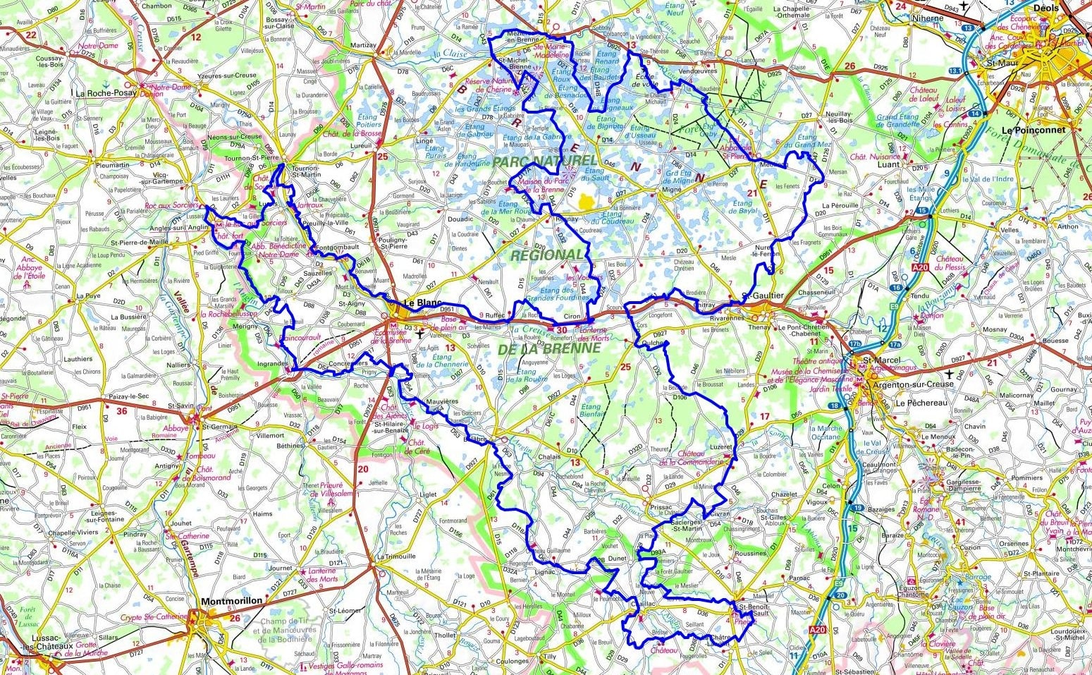
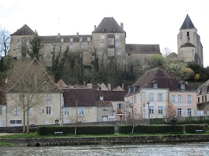
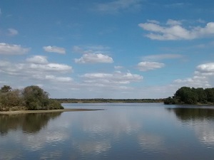
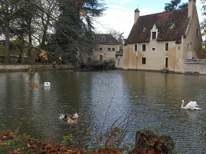
Starting from Le Blanc, situated in the renowned "land of a thousand lakes," the trail crosses directly through the heart of the Regional Natural Park via Rosnay and Saint-Michel-en-Brenne. Here, the unique landscapes of still water and dense reed beds safely shelter an exceptional level of bird biodiversity. Deep history unfolds with every step along the path, ranging from the ancient Carolingian abbey of Méobecq to the striking medieval town of Saint-Benoît-du-Sault, proudly ranked among the most beautiful villages in France. Heading further south through Chaillac and Bélâbre, the terrain steadily becomes more rolling and hilly. The region's architectural heritage reaches a magnificent peak at Angles-sur-l'Anglin, featuring a robust feudal castle that overlooks one of the area's most beautiful valleys, and at the Fontgombault Abbey, an active Romanesque jewel. Traveling gracefully between the lush banks of the Creuse and the Anglin rivers, this journey leads hikers from one charming village to the next, from Ruffec to Tournon-Saint-Martin, set amidst the ancient wetlands and weathered stones of Berry and Poitou.
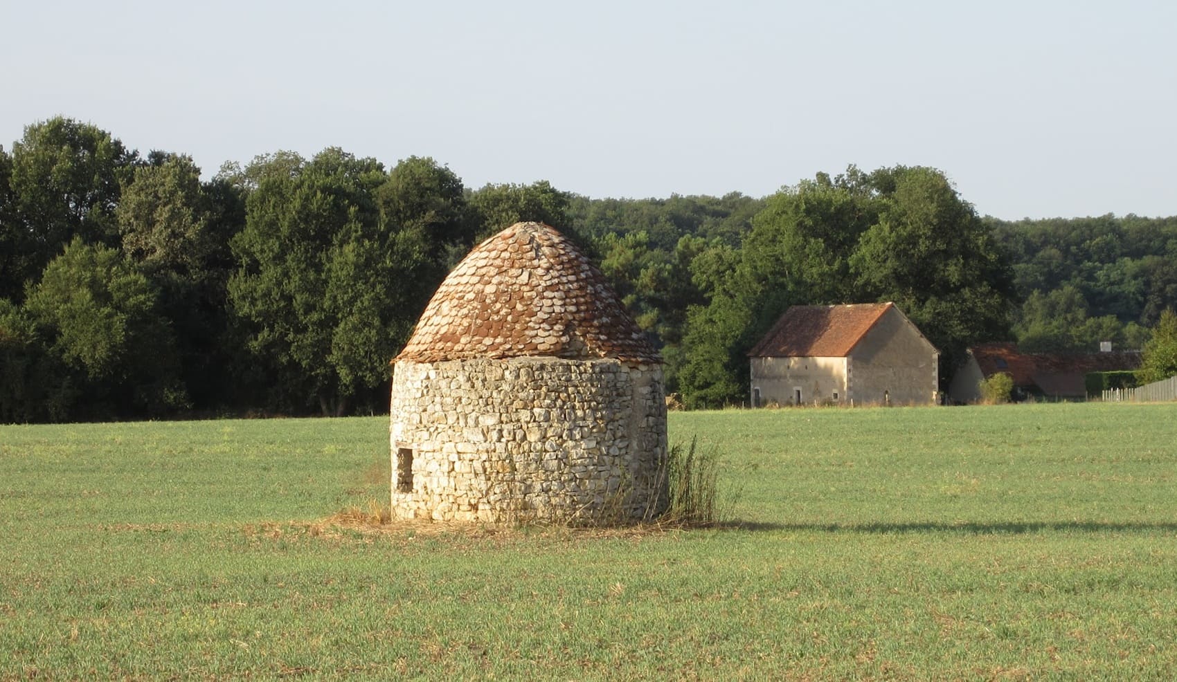
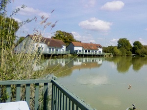
The Brenne, affectionately nicknamed the "land of a thousand ponds," is a highly unique aquatic mosaic that stretches primarily across the Indre department, while bordering the neighboring Vienne and Indre-et-Loire departments. Carefully shaped by human hands since the Middle Ages specifically for fish farming, this serene landscape of flowering heathland, open meadows, and expansive reedbeds proudly constitutes one of the most significant wetlands in all of France. It acts as a vital sanctuary for biodiversity, serving as the home to the rare European pond turtle and providing a critical resting place for thousands of migratory birds, which can be observed quietly from discreetly placed hides. The area's built heritage is equally remarkable, highlighted by architectural gems such as the historic Abbey of Saint-Savin and the imposing Château du Bouchet, which overlooks the peaceful Brenne estuary. As you walk between the rugged sandstone hillocks and the shaded, oak-lined paths, the region's history continuously unfolds through the presence of old, dormant forges and deeply charming villages like Mézières-en-Brenne.
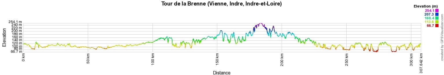
 Distance: 307km, Elevation maximum: 258m, Elevation minimum: 66m, Elevation gain uphill: 1949m
IGN Maps: Le Blanc - 1926E. Pleumartin La Roche-Posay - 1926O. La Trimouille - 1927E. Buzancais - 2025E. Mezieres-En-Brenne - 2025O. Saint-Gaultier - 2026E. Rosnay - 2026O. Saint-Benoit-Du-Sault - 2027E. Belabre - 2027O. Saint-Sulpice-Les-Feuilles - 2028E. Luant - 2126O.
|
Le Bois d'Haut (Mérigny): La Ferme du Bois d'Haut Guesthouse, 02 54 37 36 52, 06 80 45 18 11, Email. |


|
Nearby paths:
![]() It is advisable to follow the beacons all along your hike and to bring the FFRandonnée topo-guide. You will also find information on MonGR.fr.
It is advisable to follow the beacons all along your hike and to bring the FFRandonnée topo-guide. You will also find information on MonGR.fr.
GR®, PR®, GRP® and the corresponding markings are trademarks of the French Federation of Hiking. They may not be reproduced without permission. The French Federation of Hiking, state-approved, includes organizations that maintain hiking routes. It publishes guides for these routes. With your donations, support the actions of the thousands of volunteer markers of the FFRandonnée.
GR-Infos.com is an editorial partner of MonGR.fr.
| Return |

Former holiday hotel with a garden along the Allier, L'Etoile Guest House is located in La Bastide-Puylaurent between Lozere, Ardeche, and the Cevennes in the mountains of Southern France. At the crossroads of GR®7, GR®70 Stevenson Path, GR®72, GR®700 Regordane Way, GR®470 Allier River springs and gorges, GRP® Cevenol, Ardechoise Mountains, Margeride. Numerous loop trails for hiking and one-day biking excursions. Ideal for a relaxing and hiking getaway.
Copyright©gr-infos.com (Authorization for private use only)
To help us maintain and improve GR-Infos.com, a contribution of 2€ is desired via Wero or bank transfer. Thank you!