
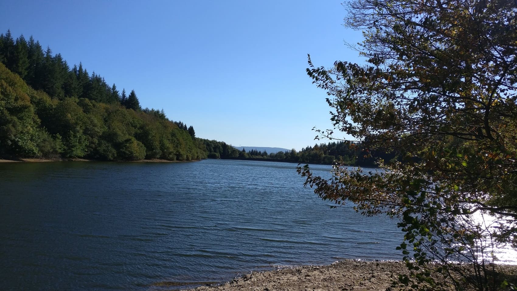
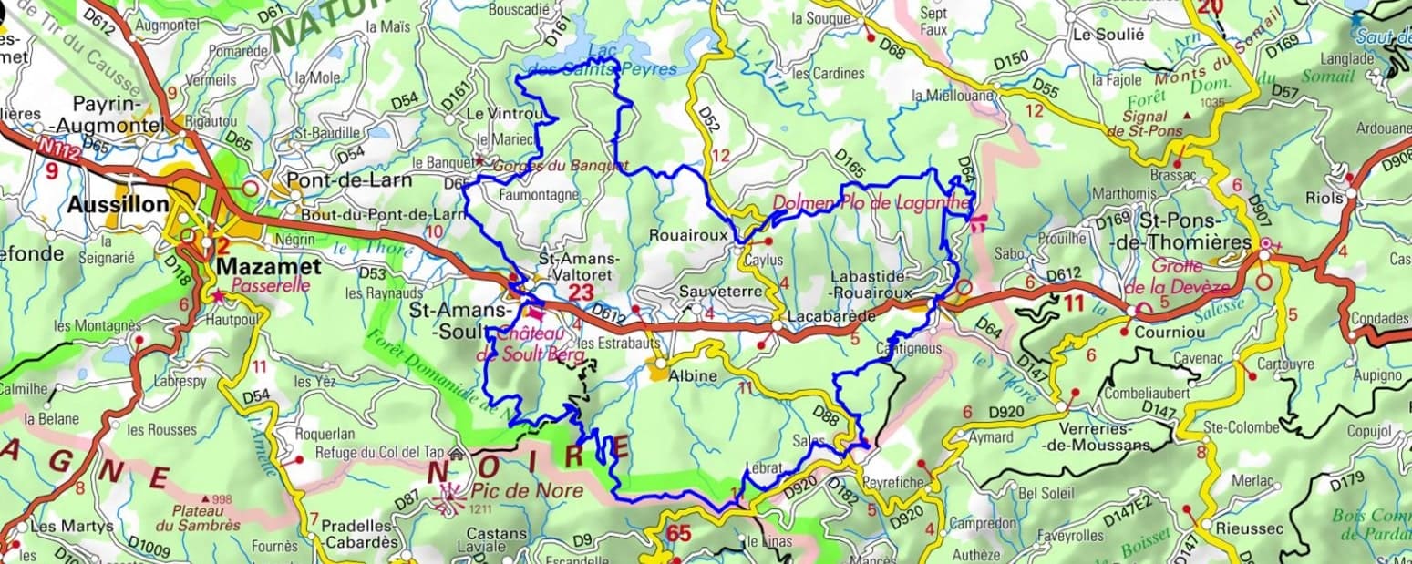
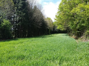
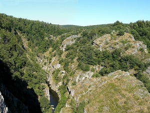
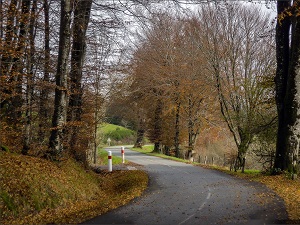
Starting in Saint-Amans-Soult, the birthplace of Marshal Soult, this hike, in the heart of the Haut-Languedoc Regional Natural Park, climbs towards Lake Saints-Peyres, nicknamed the "Canadian Lake" for its wild, wooded shores reminiscent of the vast landscapes of northern France. Passing through Saint-Amans-Valtoret, hikers discover a rich heritage linked to the textile industry of yesteryear, with its former factories and manor houses. Nature becomes lush and abundant in the upper Thoré Valley, where beech and fir forests shelter protected mountain wildlife. In Labastide-Rouairoux, the departmental textile museum bears witness to the working-class history that shaped these steep-sided valleys. The landscapes alternate between the ridges of the Montagne Noire and the hidden valleys of the neighboring Hérault region, offering spectacular views of the watershed.
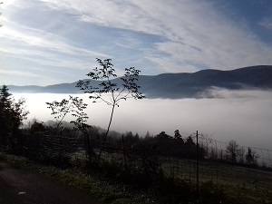
The Upper Thoré Valley, located in the heart of the Haut-Languedoc Regional Natural Park, is a wild crossroads between the Tarn, Aude, and Hérault departments. Nestled between the Lacaune Mountains and the majestic Montagne Noire, it offers landscapes of dense forests and granite ridges swept by the Autan winds. Its history is inextricably linked to the industrial saga of textiles and wool processing, whose imposing stone factories still line the banks of the rushing Thoré River. Heritage can be discovered in charming villages like Mazamet and Saint-Amans-Valtoret, testaments to a prosperous past tied to water. Nature reigns supreme here, with remarkable sites such as the Mazamet footbridge and the Anglès plateau, havens for preserved mountain biodiversity. Between high-altitude lakes and steep hiking trails, the valley marks the abrupt transition between Atlantic influence and Mediterranean mildness.
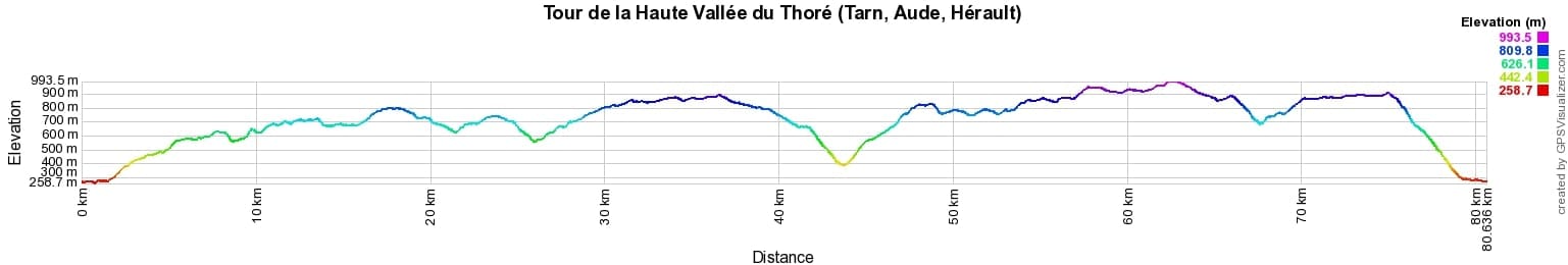
 Distance: 80km, Elevation maximum: 994m, Elevation minimum: 259m, Elevation gain uphill: 2343m
IGN Maps: 2343ET - CASTRES LE SIDOBRE PNR DU HAUT-LANGUEDOC. 2344ET - MONTAGNE NOIRE (EST) MAZAMET PNR DU HAUT-LANGUEDOC. 2344OT - MONTAGNE NOIRE (OUEST) REVEL LABRUGUIÈRE PNR DU HAUT-LANGUEDOC. 2444ET - SOMAIL MINERVOIS SAINT-PONS-DE-THOMIÈRES PNR DU HAUT-LANGUEDOC.
Nearby paths:
![]() It is advisable to follow the trail markers all along your hike and to bring the FFRandonnée topo-guide. You will also find information on MonGR.fr.
It is advisable to follow the trail markers all along your hike and to bring the FFRandonnée topo-guide. You will also find information on MonGR.fr.
GR®, PR®, GRP® and the corresponding markings are trademarks of the French Federation of Hiking. They may not be reproduced without permission. The French Federation of Hiking, state-approved, includes organizations that maintain hiking routes. It publishes guides for these routes. With your donations, support the actions of the thousands of volunteer markers of the FFRandonnée.
GR-Infos.com is an editorial partner of MonGR.fr.
| Return |

Former holiday hotel with a garden along the Allier, L'Etoile Guest House is located in La Bastide-Puylaurent between Lozere, Ardeche, and the Cevennes in the mountains of Southern France. At the crossroads of GR®7, GR®70 Stevenson Path, GR®72, GR®700 Regordane Way, GR®470 Allier River springs and gorges, GRP® Cevenol, Ardechoise Mountains, Margeride. Numerous loop trails for hiking and one-day biking excursions. Ideal for a relaxing and hiking getaway.
Copyright©gr-infos.com (Authorization for private use only)
To help us maintain and improve GR-Infos.com, a contribution of 2€ is desired via Wero or bank transfer. Thank you!